
 Live Science Plus


On Ice: Stunning Images of Canadian Arctic

Canadian Arctic Research

Canadian Arctic Research

Landsat 7 ETM+ satellite image of the south-east Devon Island Ice Cap, Devon Island, Nunavut, Canada. The darker ice is the result of accumulated impurities at the surface.
Canadian Arctic Research

An ice cave or englacial melt channel. This ice cave was formed by meltwater flowing within the glacier ice. Belcher Glacier, Devon Island, Nunavut, Canada.

Canadian Arctic Research

Canadian researcher Brad Danielson maintaining a time-lapse camera overlooking the Belcher Glacier, Devon Island, Nunavut, Canada. Monitoring the ice that breaks off from the glacier helps the researchers constrain how much ice is calving into the ocean.
Canadian Arctic Research

MODIS satellite true color image of the Canadian Arctic Archipelago.
Canadian Arctic Research

Ice channel or supraglacial melt channel. This was formed by meltwater flowing along the surface of the glacier. Belcher Glacier, Devon Island, Nunavut, Canada.
Canadian Arctic Research
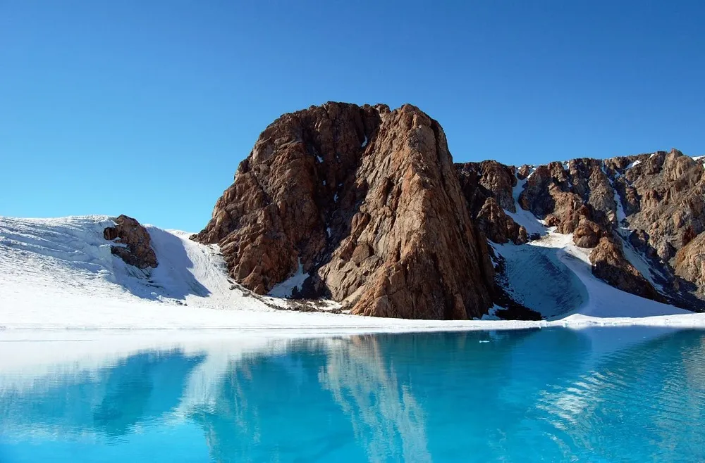
Ice lake or supraglacial lake. Surface melt water can pond on the surface of the glacier forming large lakes that can drain catastrophically. Belcher Glacier, Devon Island, Nunavut, Canada.
Canadian Arctic Research
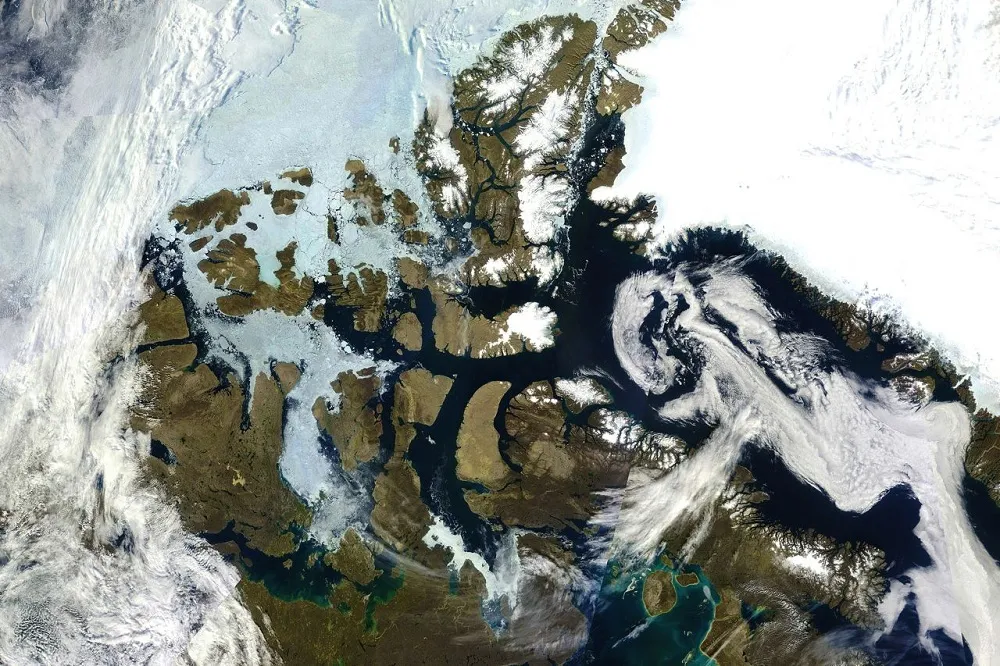
MODIS satellite true color image of the Canadian Arctic Archipelago.
Canadian Arctic Research

Canadian researcher maintaining one of several weather station on the Devon Island, Nunavut, Canada. The researchers camp can be seen in the foreground. Monitoring the meteorological conditions over the ice cap helps researchers to determine glacier responses to changes in climate.
Canadian Arctic Research

Landsat 7 ETM+ satellite image of eastern Bylot Isalnd, Nunavut, Canada.
Canadian Arctic Research

Areal view of the Sverdrup Glacier, a river of ice that flows from the interior of the Devon Island Ice Cap into the ocean. Nunavut, Canada. Flow stripes are clearly visible on the surface of the glacier.
