


Wow! Most Amazing Earth Images of 2013
North Pole lake
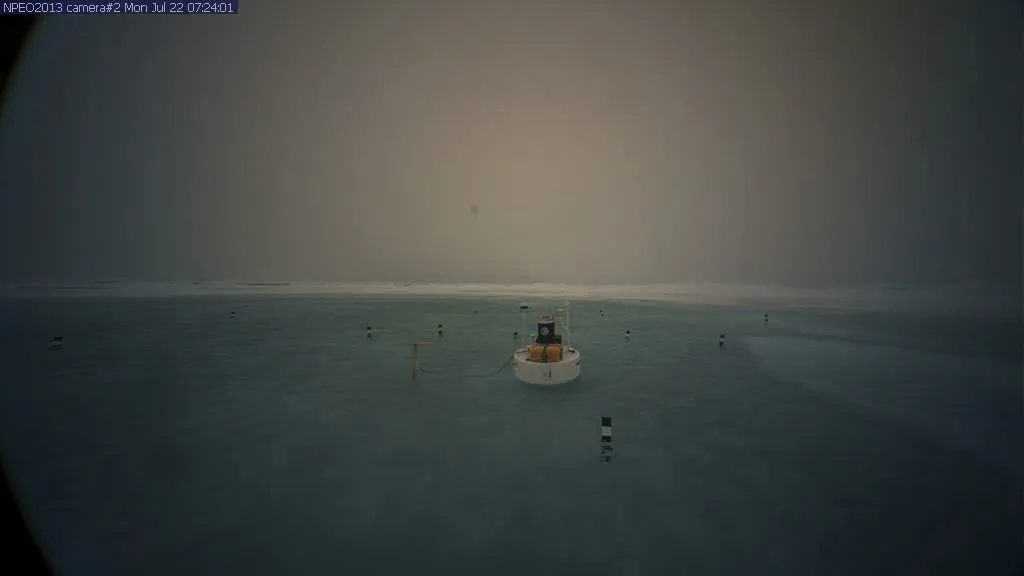
On July 22, a remote webcam on the Arctic sea ice spotted a stunning site: a meltwater lake the size of an Olympic swimming pool and 2 feet (0.6 meters) deep that had formed on the ice. While global warming has had a significant impact on Arctic sea ice, reducing its extent and thickness, such melt ponds are part of a natural summer melt cycle. By July 29, the bright blue meltwater had drained back into the Arctic Ocean through a crack in the underlying ice.
Rare eruption
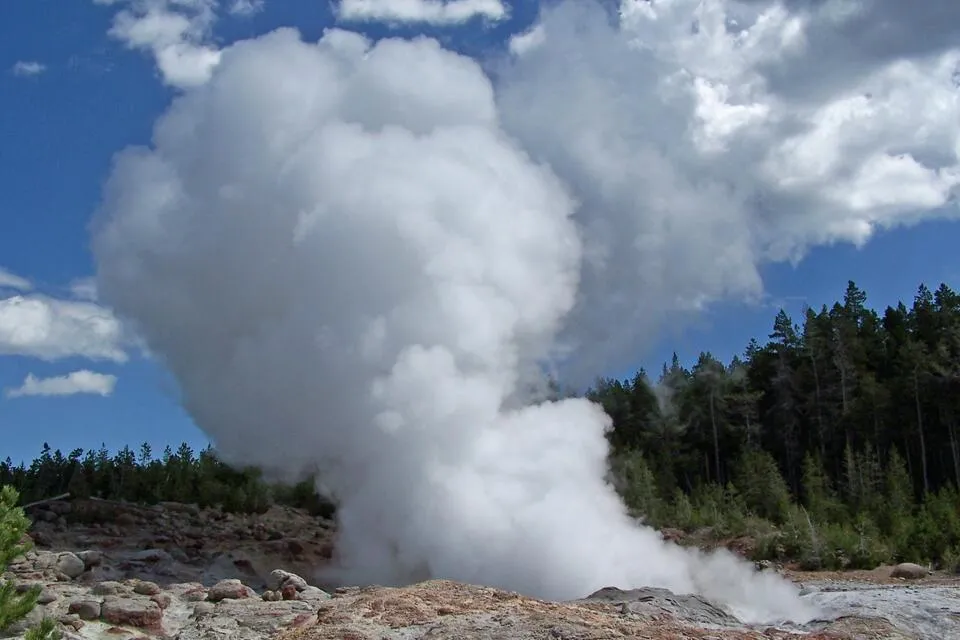
July 31 saw a rare eruption of Yellowstone's Steamboat Geyser, the first such eruption in eight years. The blast, which lasted about nine minutes, shot water and steam 200 to 300 feet (60 to 90 meters) into the air. About 30 to 40 visitors to the national park were lucky enough to catch the eruption, and reported hearing a roar and feeling the ground shake.
Elusive red sprites
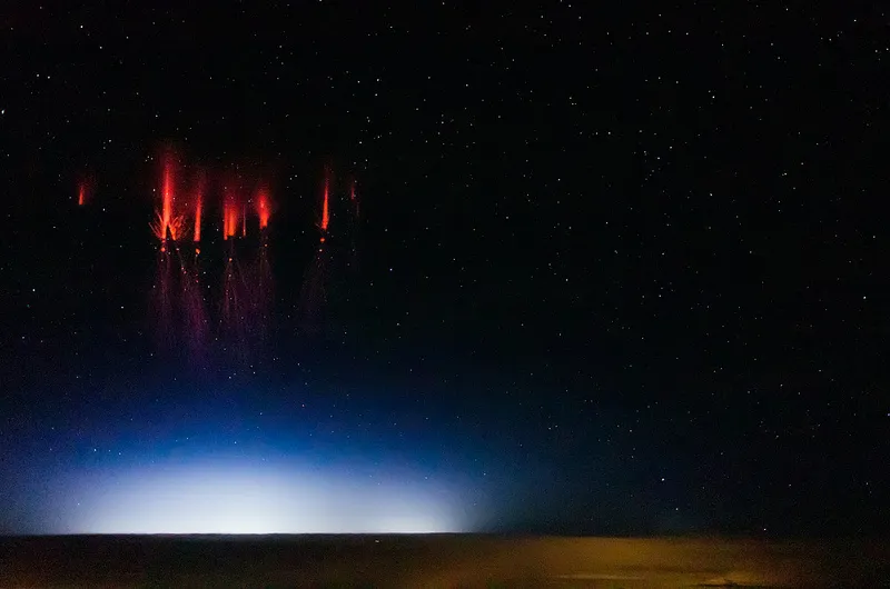
An elusive, mysterious form of lightning known as red sprites were captured in a set of amazing images and video taken aboard a Gulfstream V research plane by graduate student Jason Ahrns during several research flights this summer. Red sprites flash for less than a second on the tops of thunderstorm clouds, which means they are usually obscured from the ground, hence the need to study them from the air. This image was taken on Aug. 12.

Roll cloud, roll

This impressive panoramic photo shows an ominous-looking, but harmless, rare cloud form known as a roll cloud as it moved over northern Virginia on Sept. 16. Roll clouds are a type of broader cloud formation known as shelf clouds, which form along the leading edge of a thunderstorm when rain-cooled air slams into warm, moist air closer to the ground and forces it upward where its water condenses. With roll clouds, the winds in a storm's gust front can "roll" the cloud into it tubular shape, though unlike other shelf clouds, the roll cloud isn't attached to the rest of the storm.
Monster storm
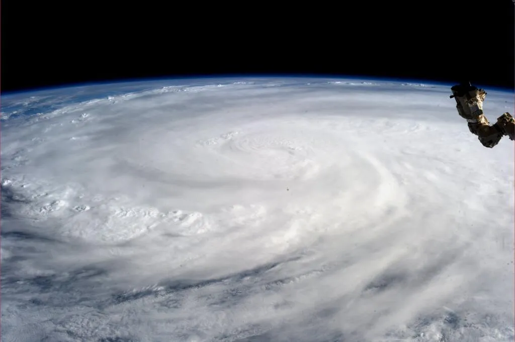
The punishing power and sheer size of Super Typhoon Haiyan could be appreciated in a unique view of the storm captured by astronaut Karen Nyberg aboard the International Space Station on Nov. 9 — one day after the storm devastated the Philippines. Haiyan (called Yolanda in the Philippines) was blamed for thousands of deaths and millions of dollars in damage.
PIG iceberg sets sail
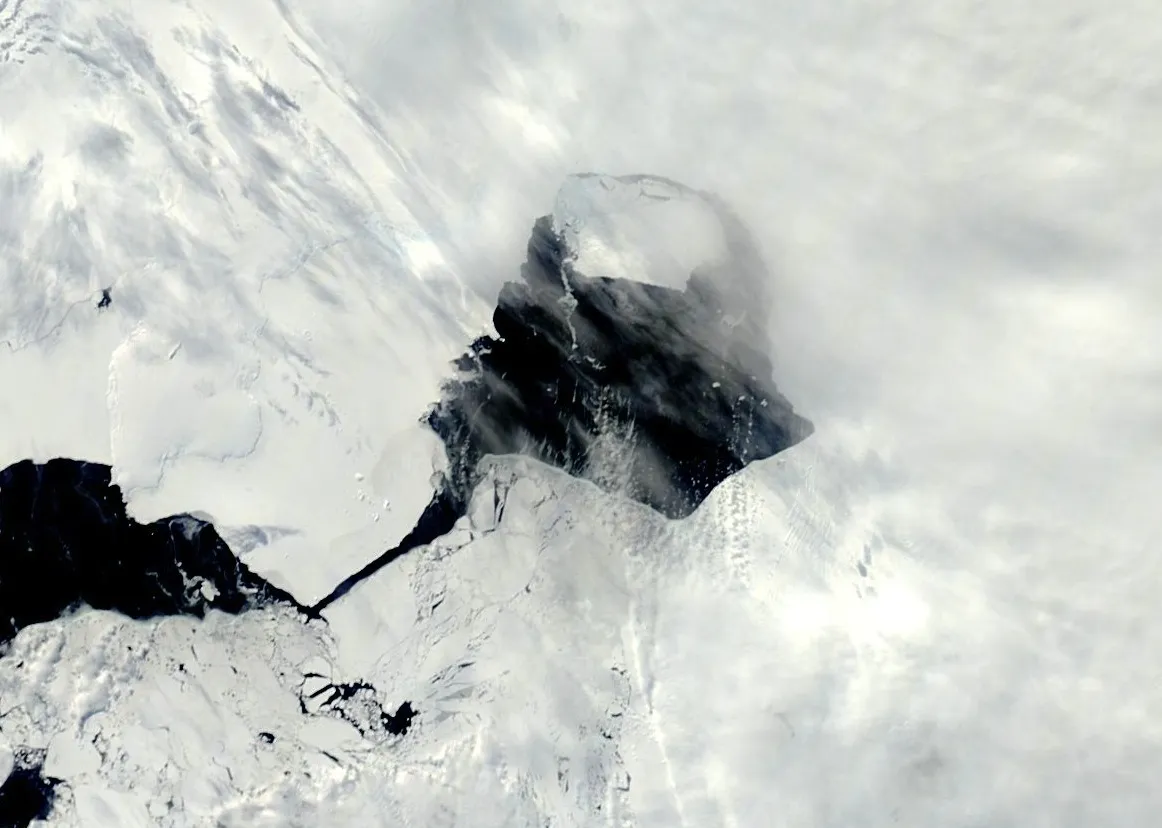
Nearly six months after first breaking off from Antarctica's Pine Island Glacier, an iceberg the size of Singapore finally set sail for the open ocean in November. The iceberg had been suck for months by sea ice that blocked its path. The iceberg's movement could be seen in a NASA satellite image snapped Nov. 13 that showed a couple of miles (several kilometers) of ocean between the iceberg and its parent glacier.
Earth's newest island

A new island rose out of the sea in the Bonin Islands, about 600 miles (1,000 kilometers) south of Tokyo, on Nov. 20, when a volcanic eruption piled up lava and shot out ash and lava fragments into the air. The Japanese Coast Guard snapped photos of the new spit of land, named Niijima, from the air. It was thought that the erosive action of the ocean would tear the newborn island apart, but so far, it has actually gotten bigger.
Get the world’s most fascinating discoveries delivered straight to your inbox.
Fog-filled canyon

The Grand Canyon is certainly picturesque and impressive enough on its own, but the American natural wonder took on an otherworldly look when a rare weather event filled the chasm with fog in December 2013. The cloud-filled canyon was the result of what is called a temperature inversion, when cool air gets trapped under a layer of warm air. Calm winds prevent the warm air from mixing upward, and if water vapor is trapped in the layer, fog can form.