


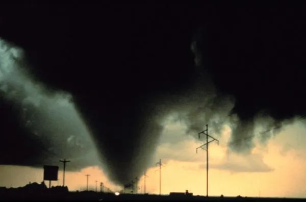
Why This Tornado Season Has Been a Mild One
Tornado season this year started off with a bang — an above-average number of twisters churned across the United States in the early months of 2012 — but lately, the storms have been more subdued.
And this spring hasn't seen the terrible twisters that devastated parts of the country last year.
So what's behind the quieter spring? Thank the jet stream, weather experts say.
Spring's stats
January and February of this year saw 70 and 55 tornadoes, respectively — more tornadoes than typically form in those months. And although solid numbers aren't yet in for March and April — forecasters are still sifting through tornado reports to winnow out repeat sightings — those months also saw more than their typical share of twisters.
"The numbers weren't staggering like last spring, but they were above average," said Jake Crouch, a climatologist with the National Climatic Data Center.
Yet after a wild start, the number of twisters has plummeted — due, in part, to some of the same conditions that fueled record-breaking high temperatures in many places around the country.
Get the world’s most fascinating discoveries delivered straight to your inbox.
The preliminary count for May, which is typically the busiest month for tornadoes, is 122. Those numbers will undoubtedly change, yet they are still uncharacteristically low. In comparison, 326 twisters hit in May 2011, and the three-year average for the month of May is 279 tornadoes.
The comparatively mild weather follows on the heels of one of the most dramatic tornado seasons in U.S. history. In 2011, the Storm Prediction Center tallied 1,691 tornadoes, making it the second-busiest season on record. It was also took a huge human toll; tornadoes killed 553 people in 2011, making it the fourth-deadliest year on record for tornadoes.
Northern jet stream
This year, the jet stream — essentially an atmospheric fence that divides northern air from southern air — is hanging out in the northern area of the country. That's the traditional territory for the jet stream in springtime.
Last year, the jet stream stayed parked above the middle of the country for months on end, allowing the key ingredients for severe weather — cold, dry air and warm, moist air — to meet.
"We tend to see the most active severe weather along those boundaries," Crouch told OurAmazingPlanet. "It led to an extremely active storm track last year." [Infographic: Tornado! How, When & Where Twisters Form]
With the jet stream over higher latitudes this year, the air on the southern side isn't as loaded with moisture from the Gulf of Mexico — a key factor for severe weather.
"As the jet stream moves farther north, it is removed from that moisture source," Crouch explained, which is why you don't see the types of tornado outbreaks that raged last year afflicting northern states when the jet stream is draped across them.
Despite a lull in overall tornado activity in recent weeks, it's important to stay vigilant when severe weather is brewing, Crouch said.
"We can still have individual storms that cause severe weather outbreaks," he said.
Reach Andrea Mustain at amustain@techmedianetwork.com. Follow her on Twitter @AndreaMustain.Follow OurAmazingPlanet for the latest in Earth science and exploration news on Twitter @OAPlanet and on Facebook.