Our amazing planet.

Rina, Denver Snowstorm Caught in Same Satellite View

rina-snow-111027-02
(Image credit: NOAA)

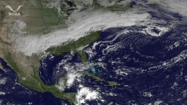
While passing over the United States today (Oct. 27), the GOES East satellite snapped this picture of North and Central America in which Tropical Storm Rina and the snow that blanketed Denver are clearly visible.

While Rina looked poised to become a major hurricane (a Category 3 or higher) earlier this week, the storm has since weakened considerably and has been reduced to tropical storm status. Forecasters still warn that the storm could bring impacts for places along the Yucatan Peninsula.

Another storm, this one of the wintry variety, rushed through Denver yesterday, dumping up to 18 inches (46 centimeters) of wet, heavy snow that knocked out power to thousands in the area. The October snowstorm came just a day after the city saw record high of 80 degrees Fahrenheit.

The continuation of that system can be seen bringing rain and cooler temperatures to the East Coast, and the possibility for some light snow in West Virginia into Friday.

Live Science Staff
For the science geek in everyone, Live Science offers a fascinating window into the natural and technological world, delivering comprehensive and compelling news and analysis on everything from dinosaur discoveries, archaeological finds and amazing animals to health, innovation and wearable technology. We aim to empower and inspire our readers with the tools needed to understand the world and appreciate its everyday awe.