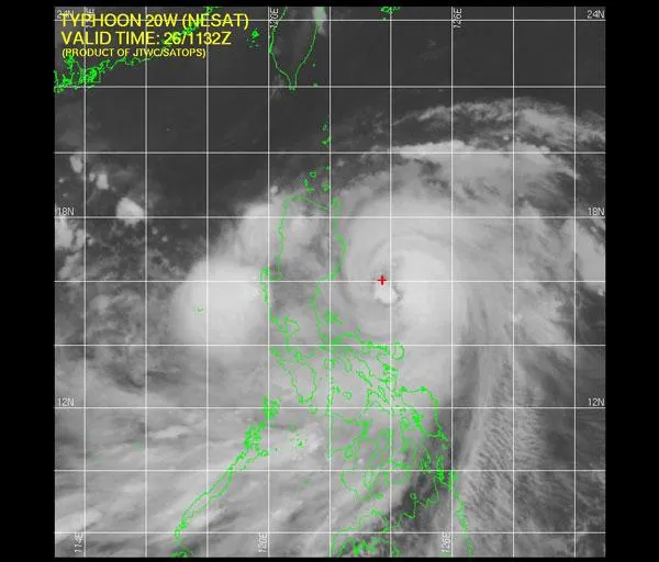
The Philippines is preparing as Typhoon Nesat swirls closer to the main island of Luzon.
The storm has maximum sustained winds of 92 mph (148 kph), equivalent to a Category 2 hurricane on the Saffir-Simpson scale used in the Atlantic basin, and is bearing down on the island nation as it tracks west-northwestward. Some satellite estimates put the strength closer to a Category 3 or 4 storm, according to the The Weather Channel.
The storm is expected to strengthen before making landfall, achieving wind speeds of 103 mph (167 kph), according to the Joint Typhoon Warning Center.
Latest Videos From
"Typhoon" is the term used for powerful, circulating storms that form in the western Pacific and southeastern Indian Ocean, while "hurricane" refers to storms that start in the Atlantic, Caribbean and northeast Pacific.
Typhoons rotate counterclockwise if they form in the Northern Hemisphere, while so-called "backward" storms, which rotate clockwise, form in the Southern Hemisphere. Clockwise-rotating storms are most common in the Indian Ocean and off the coast of Australia.
While Nesat heads for landfall in the western Pacific basin, Hurricane Hilary is churning off the west coast of Mexico in the eastern Pacific. It is not currently a threat to land, though it is creating dangerous rip currents.
In the Atlantic basin, the only storm currently swirling is Tropical Storm Phillipe, which has winds of 60 mph (95 kph). Phillipe is expected to remain a tropical storm over the next few days and is too far out in the ocean to be a threat to any land.