


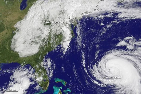
Family Portrait: Remnants of Lee & Hurricane Katia
(Image credit: NASA/NOAA)
One week after Hurricane Irene battered the East Coast of the United States with damaging winds and flooding rain, a less-touted, plodding storm system soaked the eastern half of the country with more widespread and nearly as abundant rain as its predecessor. Tropical Storm Lee had a short official life as a named storm, but its effects lasted nearly a week.
Officially declared a tropical storm late on September 2, Lee reached its peak sustained winds of 57 miles (92 kilometers) per hourwell below hurricane forceon September 3 before making landfall on the Gulf Coast. By September 5, the storm was no longer a tropical depression, yet it was only beginning its march from Louisiana to soggy New England and the Mid-Atlantic.

