Months After Disappearing, La Niña Returns


A persistent La Niña that dominated climate patterns late last year and early this year was blamed for everything from a record-breaking tornado season to spring flooding, but seemed as though it had petered out by mid-spring. Now it's back.
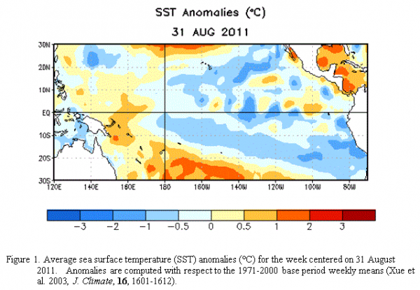
After dying down over the summer, La Niña has re-emerged in the tropical Pacific Ocean and should gradually strengthen and continue into winter, according to forecasters at the U.S. National Oceanic and Atmospheric Administration's (NOAA) Climate Prediction Center.
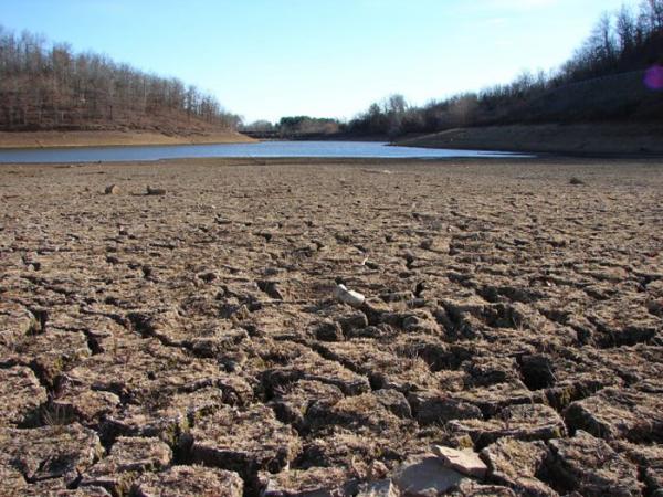
The strong 2010-11 La Niña contributed to record winter snowfall, spring flooding and drought across the United States, as well as othe extreme weather events throughout the world, such as heavy rain in Australia and an extremely dry equatorial eastern Africa.
Article continues belowLa Niña is a naturally occurring climate phenomenon located over the tropical Pacific Ocean and results from interactions between the ocean surface and the atmosphere. During La Niña, cooler-than-average Pacific Ocean temperatures influence global weather patterns. La Niña typically occurs every three to five years, and back-to-back episodes occur about 50 percent of the time. Current conditions reflect a re-development of the June 2010 to May 2011 La Niña episode.

La Niña winters often see drier-than-normal conditions across the southern tier of the United States and wetter-than-normal conditions in the Pacific Northwest and Ohio Valley.
"This means drought is likely to continue in the drought-stricken states of Texas, Oklahoma and New Mexico," said Mike Halpert of the Climate Prediction Center. "La Niña also often brings colder winters to the Pacific Northwest and the northern Plains, and warmer temperatures to the southern states."
According to climate and weather experts, 2011's record-breaking number of billion-dollar weather disasters was caused by a combination of factors, including La Niña, local atmospheric patterns and potentially climate change — though the importance of climate in any individual weather scenario is still nearly impossible to put an exact number on. One NASA scientist even called "La Nada" — the disappearance of La Niña — the real wild weather culprit.
Get the world’s most fascinating discoveries delivered straight to your inbox.
La Niña does have a strong link to hurricane season, and forecasters factored the potential return of La Niña into NOAA's updated 2011 Atlantic hurricane season outlook, issued in August, which called for an active hurricane season. With the development of tropical storm Nate this week, the number of tropical cyclones entered the predicted range for this year of 14 to 19 named storms.
