It's quick and easy to access Live Science Plus, simply enter your email below. We'll send you a confirmation and sign you up for our daily newsletter, keeping you up to date with the latest science news.
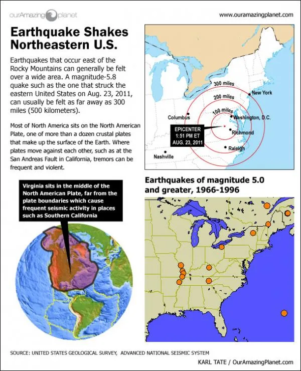
A magnitude 5.8 earthquake ruptured in Virginia today with an epicenter that was 41 miles (66 kilometers) northwest of from Richmond, Va., and 83 miles (134 km) southwest of Washington, D.C. The shaking was felt for hundreds of miles around, as far away as Toronto, New York City, Chicago and Atlanta.
Sign up for the Live Science daily newsletter now
Get the world’s most fascinating discoveries delivered straight to your inbox.
Karl has been Purch's infographics specialist across all editorial properties since 2010. Before joining Purch, Karl spent 11 years at the New York headquarters of The Associated Press, creating news graphics for use around the world in newspapers and on the web. He has a degree in graphic design from Louisiana State University.


 Live Science Plus


