 Live Science Plus


Lake-Effect Snow May Need Mountain Effects, Too
Those who live around the Great Lakes are very familiar with the snow those bodies of water can bring, a phenomenon called lake-effect snow. But a new study suggests that lakesaren'talways the only feature behind the falling flakes.
Nearby mountains can enhance or dampen a lake-effect storm, depending on where they sit in relation to the lake, and they may even be necessary to triggersome lake-effect snowfall, the study finds.
University of Utah researchers explored the role that local topography plays in driving lake-effect snow with computer simulations of a lake-effect storm around Utah's Great Salt Lake, even with the relatively gentle terrain around the lake.
Article continues below"It is going to help us with weather prediction — helping forecasters recognize that in some lake-effect events, the mountains or hills can play an important role in triggering lake-effect snow bands" over large bodies of water,study author Jim Steenburgh said in a university release.

Mountains' influence
Here's how the lake effect works: A cold air mass moves over a large body of water that is warm in comparison (because more heat has to be released to change the temperature of water than air); the air picks up moisture and heat, then rises. As it does so, the air cools, and the moisture it contains condenses out, forming snow if the air is cold enough.
It was previously known that lake-effect snow could intensify as it moved up over a mountain, which further cools the air and forces more moisture out over the highlands. But the simulations of lake-effect storms around the Great Salt Lake that Steenburgh and his colleagues ran showed that sometimes the influence of the mountains extended below the high mountain altitudes, triggering snow over lowlands and the lake itself when the mountains were downstream of the body of water. [The World's Weirdest Weather]
In other cases, mountains upstream of the lakedampened the lake-effect snow, because the cold air descending down the side of the mountain warmed and dried before it hit the lake. This resulted in less snow fall than if the mountains weren't present.
The configuration of mountains can also force together cold air masses, making them converge over the lake.
"Most people recognize that mountains get more precipitation than lowlands, because of moist air being lifted over the mountains," Steenburgh said in the release. "Everybody recognizes that it plays a role in lake-effect storms. What we're showing here is a situation where the terrain is complicated.There are multiple mountain barriers, not just one, and they affect the air flow in a way that influences the development of the lake-effect storm over the lake and lowlands, rather than just over the mountains."
Missing from models
This unrecognized abilityof the mountains to both dampen and trigger snow could help explain why forecasters have difficulty predicting the occurrence of lake-effect storms and how much snow they will drop on Utah's cities, Steenburgh said. The models currently used don't adequately include the Wasatch Range or the northern mountains along the Nevada-Idaho-Utah border.
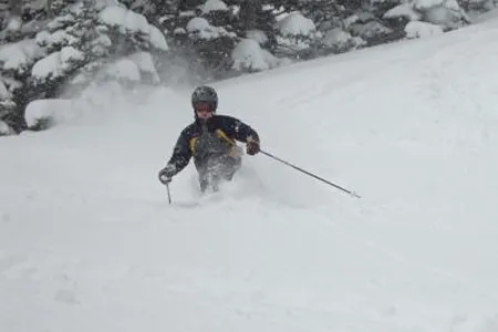
Gaininga better idea of the factorsinfluencing lake-effect snow will help forecasters better predict the traffic snarls the weathercan cause, as well as the fresh snow it can provide to ski resorts.
"These influences need to be better represented in weather forecast models," Steenburgh told OurAmazingPlanet in an email.
The new study was published Feb. 18 in the American Meteorological Society's journal, Monthly Weather Review.
Reach Andrea Thompson at athompson@techmedianetwork.com and follow her on Twitter @AndreaTOAP and on Pinterest. Follow OurAmazingPlanet on Twitter @OAPlanet. We're also on Facebook and Google+.

