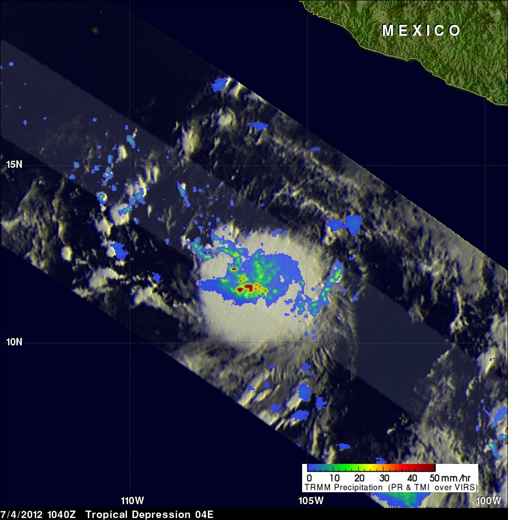
Two Hurricanes Swirling Over Eastern Pacific


Hurricane Emilia has roared to life in the eastern Pacific Ocean, joining Hurricane Daniel in swirling over the waters off North America's western coast. The storms are the fourth and third hurricanes of the East Pacific season, respectively.
A rotating gale was declared a tropical storm and christened Daniel in the early hours of July 5, when its winds crossed the required threshold of 39 mph (63 kph). The storm continued to strengthen, and was officially dubbed a hurricane — a storm packing sustained winds of at least 74 mph (119 kph) — late on Friday (July 6).
According to the latest report from the National Hurricane Center in Miami, Fla., Hurricane Daniel is packing maximum sustained winds of 90 mph (150 kph) and is weakening as it moves westward across the ocean and over cooler waters. It is currently about 1,300 miles (2,000 kilometers) west-southwest of the southern tip of Baja California.
Article continues belowEmilia first formed as a tropical storm on Saturday night, and strengthened into a hurricane early this morning (July 9). It has maximum sustained winds of 75 mph (120 kph) and is 760 miles (1,200 kilometers) south of the tip of Baja California.
Both hurricanes are a Category 1 on the Saffir-Simpson hurricane strength scale. While Daniel is expected to weakend, Emilia is expected to become a Category 2 hurricane later today and a major hurricane (those of Category 3 or higher) by Tuesday.
Both storms lie far out to sea, several hundred miles west of Mexico's mainland, and moving farther seaward, posing no threat to land.
Early in Daniel's lifecycle, satellites spotted giant "hot towers" inside the storm. The massive, heated rain clouds can soar more than 9 miles (14 kilometers) into the atmosphere, and are a telltale sign that a storm will strengthen as Daniel did.
Get the world’s most fascinating discoveries delivered straight to your inbox.
Hurricane Daniel was the fourth named storm and Emilia the fifth of the Eastern Pacific hurricane season. Storms are named only once they achieve tropical storm status. The first three storms of the season were Tropical Storm Aletta, Hurricane Bud and Hurricane Carlotta.
Although the Atlantic basin is now quiet, that ocean basin has so far seen four named storms this season — a record number of storms to appear so early in the year.
Follow OurAmazingPlanet on Twitter @OAPlanet. We're also on Facebook and Google+.
