


Dangerous Sundowner Winds Explained
A uniquely Southern California wind could blow through the region tonight (Feb. 15). It's called a sundowner wind, and it usually means that the strong Santa Ana winds are just days away.
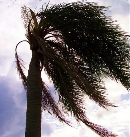
A sundowner wind is an often dangerous kind of offshore wind seen in Santa Barbara, Calif., that occurs in the late afternoon or early evening. Sundowner winds can bring tropical storm strength gusts of up to 60 mph (97 kph) at high elevations and, on rare occasions, in the city itself.
During the summer wildfire season, sundowner winds are a serious wildfire concern.
"It's a condition that brings hot gusty winds and relatively low humidity," said David Sweet, a meteorologist with the National Weather Serviceoffice in Oxnard, Calif. "We've seen instances where the temperature has gone up 20 degrees in Santa Barbara as the winds arrived."
But that kind of spike is rare, and extremely strong winds aren't expected tonight. Stronger Santa Ana winds are forecast for Friday (Feb. 17) and gusts of 60 mph are possible during that event, according to the NWS.
Sundowner winds blow when a region of high pressure is directly north of the area's east–west oriented coast. The winds are strongest when what is known as a pressure gradient forms perpendicular to the axis of the Santa Ynez Mountains, which rise directly behind Santa Barbara.
Sundowner winds can be a warning sign that the stronger Santa Ana winds will arrive in two days. If the high-pressure system that created the sundowner mixes with another high-pressure system surging through Nevada, a north-easterly pressure gradient could form, creating "perfect conditions" for Santa Ana winds, Sweet told OurAmazingPlanet.
Get the world’s most fascinating discoveries delivered straight to your inbox.
Santa Ana winds are strong down-slope winds that blow through the Santa Ana Mountain passes at speeds of 40 mph (64 kph), according to the NWS. In December 2011, a Santa Ana wind storm in Southern California was one of the strongest in decades, with widespread gusts as strong as those of Hurricane Irene.
Santa Ana winds can be of tropical storm strength (winds less than 74 mph, or 119 kph) at lower elevations and hurricane-strength (74 mph or greater) above 1,000 feet (305 meters).
Like Santa Ana winds, sundowner winds are dangerous during wildfire season because the air is hot and dry. The winds can turn a small fire into a raging wildfire before firefighters can contain the blaze.
If a fire were to get out of hand during strong winds, firefighters would not be able to use aircraft to fight the flames. Once the winds are above 35 mph (56 kph), firefighters must rely solely on boots on the ground, according to CalFire, the state's fire protection service.
You can follow OurAmazingPlanet staff writer Brett Israel on Twitter: @btisrael. Follow OurAmazingPlanet for the latest in Earth science and exploration news on Twitter @OAPlanet and on Facebook.