


Snowpocalypse Seen from Space
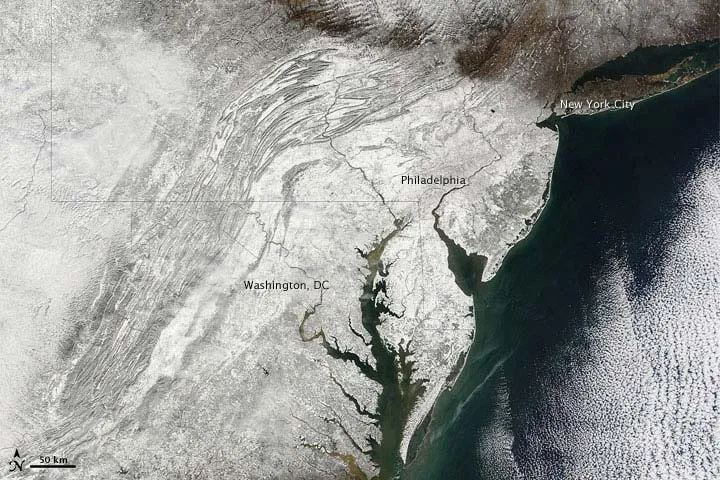
The Moderate Resolution Imaging Spectroradiometer (MODIS) on NASA's Terra satellite captured this true-color image on February 7, 2010, showing part of the region affected by heavy snowfall. Snow blankets the area hundreds of kilometers inland from the Atlantic coastline. Along the latitude of New York City, however, snow cover thins considerably.
(Image credit: NASA)
The results of the weekend storm that buried many Eastern U.S. locations in 2 feet or more of snow stands out starkly in a new satellite image.
The image from space reveals how the storm swept through Washington, D.C. and Philadelphia but largely spared New York City. The landscape is largely snow-free just north of Manhattan.

TOPICS
