Hidden Undersea Mountains Uncovered with Satellites (Photos)
Get the world’s most fascinating discoveries delivered straight to your inbox.
You are now subscribed
Your newsletter sign-up was successful
Want to add more newsletters?

Delivered Daily
Daily Newsletter
Sign up for the latest discoveries, groundbreaking research and fascinating breakthroughs that impact you and the wider world direct to your inbox.

Once a week
Life's Little Mysteries
Feed your curiosity with an exclusive mystery every week, solved with science and delivered direct to your inbox before it's seen anywhere else.

Once a week
How It Works
Sign up to our free science & technology newsletter for your weekly fix of fascinating articles, quick quizzes, amazing images, and more

Delivered daily
Space.com Newsletter
Breaking space news, the latest updates on rocket launches, skywatching events and more!

Once a month
Watch This Space
Sign up to our monthly entertainment newsletter to keep up with all our coverage of the latest sci-fi and space movies, tv shows, games and books.

Once a week
Night Sky This Week
Discover this week's must-see night sky events, moon phases, and stunning astrophotos. Sign up for our skywatching newsletter and explore the universe with us!
Join the club
Get full access to premium articles, exclusive features and a growing list of member rewards.
Scientists have created some of the most vivid maps yet of the deepest and most mysterious spots beneath the ocean. Their effort, detailed in the Oct. 3, 2014, issue of the journal Science, has uncovered thousands of undersea mountains called seamounts that rise up from the seafloor. To create the seafloor map, which covers the world's oceans, the scientists relied on measurements taken from high-resolution altimeters onboard the European Space Agency's (ESA) CryoSat-2 satellite and NASA's Jason-1 satellite, along with information resulting from new data-processing methods. The results also shed light on seafloor tectonics, or the movements of massive oceanic plates that can shape the rifts, ridges and trenches decorating the ocean bottom. Here's a look at what the researchers uncovered.
The satellite altimeters worked by bouncing a radar signal or laser off the surface of the ocean being targeted and measuring how long it took the signal to return. That time can reveal the dips and peaks, or topography, of the ocean surface to within centimeters, scientists say. The sea-surface topography roughly mirrors changes in Earth's gravity. For instance, if an underwater volcano or mountain were hidden along the seafloor, the structure would push up against the sea surface and cause it to bulge. A trench, on the other hand, would cause the surface to sag.
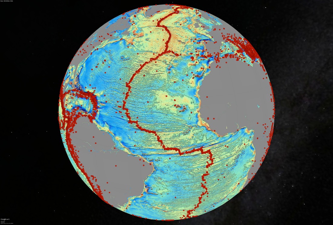
Here, the result of a gravity model in the North Atlantic Ocean, with the red dots showing locations of magnitude-5.5 or greater earthquakes. The image also reveals seafloor spreading ridges and transform faults. (Photo Credit: David Sandwell, Scripps Institution of Oceanography)
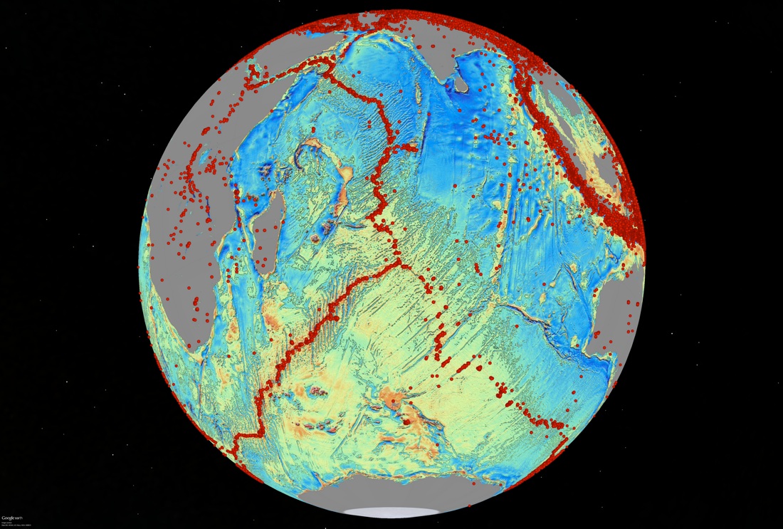
A gravity-field image centered on the Indian Ocean, particularly at the Indian Ocean Triple Junction, where three major tectonic plates meet up: the African, Australian and Antarctic plates. This region of the ocean, the location of the crash site for the Malaysian Airlines aircraft lost on March 8, 2014, is poorly charted, the researchers noted. (Photo Credit: David Sandwell, Scripps Institution of Oceanography)
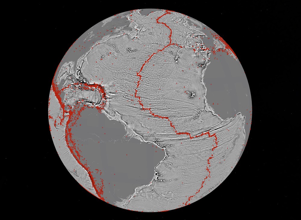
The gravity changes with depth in the North Atlantic were modeled to create this graphic that also shows seafloor-spreading ridges and faults. The gravity measurements reveal fracture zones on the ocean bottom that are currently veiled by sediment. (Photo Credit: David Sandwell, Scripps Institution of Oceanography)
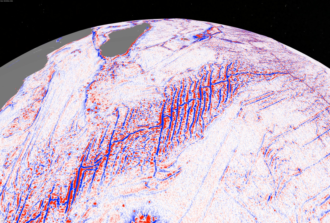
A model of the changes in gravity with depth of the Southwest Indian ridge reveals fracture zones along the world's slowest spreading ridge. The fractures record rifting and spreading between Africa and Antarctica. (Photo Credit: David Sandwell, Scripps Institution of Oceanography)
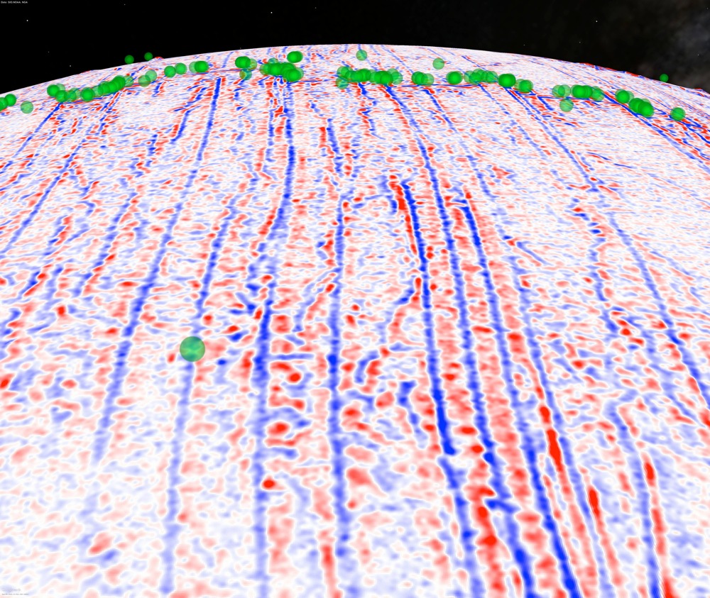
A model of the changes in gravity with depth of the Mid-Atlantic Ridge, which is a boundary in Earth's surface where the Eurasian and North American tectonic plates scoot apart under the North Atlantic Ocean. The green dots indicate the locations of earthquakes of magnitude-5.5 and greater. (Photo Credit: David Sandwell, Scripps Institution of Oceanography)
Get the world’s most fascinating discoveries delivered straight to your inbox.
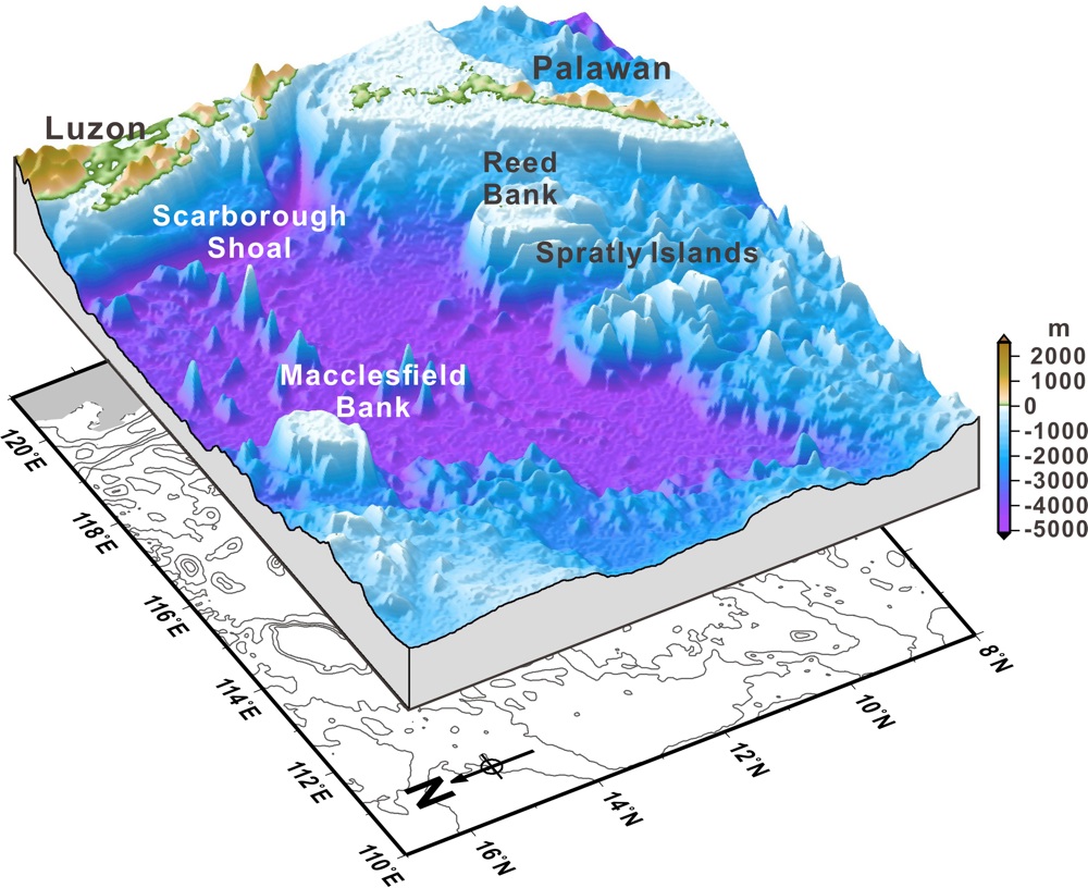
Depths over seamounts and atolls of the South China Sea, derived from satellite altimeter gravity. The depths in shallow waters are improved by satellite images. (Photo Credit: Ministry of the Interior, Taiwan)
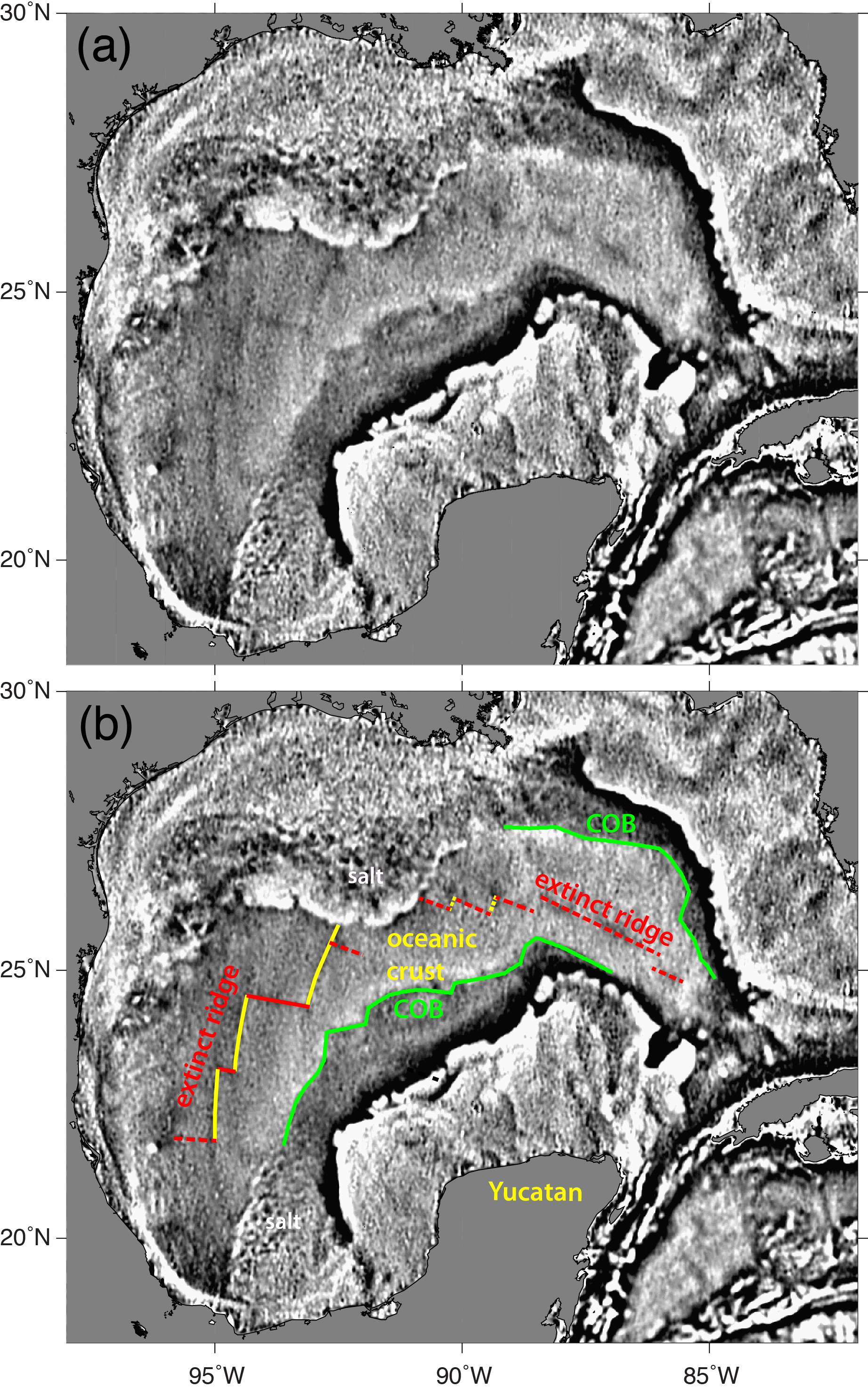
The gravity model reveals an extinct spreading ridge buried under sediment in the Gulf of Mexico, and the boundary between continental and oceanic crust (COB). (Photo Credit: David Sandwell, Scripps Institution of Oceanography)
 Live Science Plus


