
 Live Science Plus


Types of Clouds

Clouds help regulate Earth's temperature. They bring life-giving rain to different regions. All of us at one time or another have looked to the sky and watched the clouds. Clouds can be picturesque; they can also appear menacing, even threatening, suggesting a sudden, perhaps even violent turn in the weather.
How do clouds form?
Put simply, clouds develop out of the process of changing moisture from a gas to liquid.
This occurs through a process called convection. As solar radiation heats the ground and the air immediately above it, the warm air becomes lighter and the flow of air carries this warm air upward. As the air rises, the temperature decreases and so does the amount of water vapor that the air can hold. This vapor rapidly condenses and soon clouds — composed of countless billions of tiny water droplets or ice crystals — result. These droplets are exceedingly small, averaging about 10 microns in diameter (a micron is one-millionth of a meter; ice crystals are much larger but less concentrated). Virtually all types of clouds and precipitation are due to rising air.

On the other hand, as air sinks, its temperature rises and its capacity for holding vapor increases. Then any cloud droplets tend to evaporate and the cloud itself disappears; evaporation changes moisture back from liquid into gas.
Air blowing over hills or mountains is forced upward and can lead to the development of clouds. Clouds and precipitation often are found on the windward side of a mountain; clouds that form in this way can cover the tops of some mountains permanently. Conversely, air that blows down the slope of a mountain sinks, in turn causing water droplets to evaporate and preclude cloud development. That’s why it’s often clearer and drier on the lee side of a mountain.
And lastly, clouds will form where air masses collide; two different air masses can’t mix unless they are very similar in temperature and moisture content. If a cold, dry air mass pushes into an air mass that is warm and moist, the warmer air is forced upward, rapidly producing clouds that bubble up, perhaps ultimately leading to lightning, thunder and showery-type rains. If the cold air retreats, warm air pushing over it can bring a much slower process of lowering and thickening clouds and finally light precipitation in the form of light rain, mist or drizzle. [Image Gallery: Crazy Cloud Patterns]
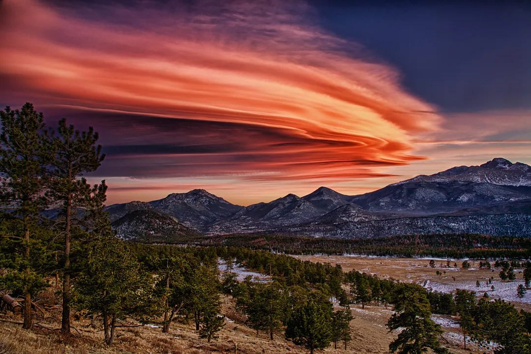
Sunset clouds
Although clouds are composed of ice and water droplets, they don't appear white or transparent as water does either in a liquid or frozen form. This is because a cloud is composed of billions of tiny water droplets or ice crystals they act like billions of reflective glass beads, which are very effective in scattering sunlight, producing a white color.
Get the world’s most fascinating discoveries delivered straight to your inbox.
And since they are excellent reflectors, clouds can appear to take on a variety of colors: yellow, orange, red or even pink around the time of sunrise or sunset. Blot out the sun and a backlit cloud can appear uniformly gray or even black.
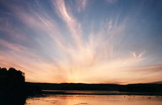
In his very popular "Weather Book," the late Eric Sloane points out that the most magnificent sunset colors often are not in the direction of the setting sun in the west, but in the east:
“When you are in the open and viewing the sun going down, do watch the deep and sullen clouds on the opposite eastern horizon as they reflect the setting western light. The changing colors are as thrilling as a symphony.” [Image Gallery: Sunrises and Sunsets]
Three types of clouds
The name of a cloud may describe its appearance. Cloud classifications were devised in the early 19th century by an Englishman named Luke Howard who classified clouds using Latin words. Clouds form in three basic patterns:
- Cirrus, from cirro, meaning curly or fibrous
- Stratus, from strato, suggesting sheets or layers
- Cumulus, from cumulo, indicating heaped or piled
By combining other terms, a number of different cloud combinations can be described. The Latin word for shower is nimbus. So the technical term for describing the cloud associated with thunderstorms is cumulonimbus. Adding to the list of Latin suffixes and prefixes, we encounter terms like fracto (referring to broken or fractured) and lenticularis (lens-shaped).
Cloud heights
Clouds are also distinguished by the heights above ground level at which they form.
High clouds: Cirrus, cirrostratus and cirrocumulus clouds are delicate wispy clouds that are located at altitudes above 20,000 feet and composed of ice crystals, because at such altitudes temperatures are perpetually below freezing. Cirrostratus is a thin cloud layer that causes a halo to appear around the sun and moon. It is often seen 12 to 18 hours in advance of an unsettled weather system. Cirrocumulus clouds look like many small tufts of cotton, rippled sand or even the scales of a fish (hence the term “mackerel sky”).
Middle clouds: Altostratus, altocumulus and nimbostratus clouds are typically found between 6,000 and 20,000 feet above the ground. Altostratus resembles a smooth gray sheet across the sky. Sometimes the sun shines through the layer as a diffuse ball as if you were looking at it through a pane of frosted glass.

Altocumulus clouds can appear in a wide variety of different shapes. When these clouds are very thin or semi-transparent, you might see a series of colored rings appearing immediately around the moon or sun, causing an atmospheric effect called a corona. Sometimes the clouds themselves take on iridescent colors; a phenomenon known as irisation. Nimbostratus clouds are smooth layers of gray, which often cannot be seen clearly because of the precipitation falling from them.
Low clouds: Stratus, cumulus and stratocumulus clouds are based at altitudes of 6,000 feet or lower. Stratus clouds appear as smooth, even sheets; light rain and drizzle often fall from them; light snow or freezing drizzle during the winter. Fog is merely a stratus cloud reaching to, or forming on the ground.
Cumulus clouds can range in size from resembling balls of cotton to big heaps of mashed potatoes in the sky. They are often referred to as “fair weather clouds,” because they usually are not associated with precipitation, but occasionally they can grow into thunderstorms (cumulonimbus). They are convective clouds and are caused by the heating of the ground by the Sun. Stratocumulus clouds are similar to altocumulus in that they can appear in a wide variety of different shapes and textures.
Clouds of great vertical development: These are the cumulonimbus clouds, often called a thunderhead because torrential rain, vivid lightning and thunder come from it. The tops of such clouds may reach up to 60,000 feet or more into the sky; ice crystals become sheared off and are carried away by strong winds aloft forming a flattened shield of cirrus that spread out in the shape of an anvil. Sometimes hail or more rarely, a tornado comes from a cumulonimbus cloud.
Related:
