 Live Science Plus


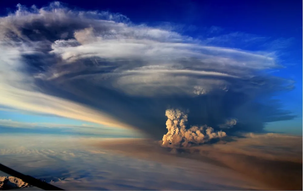
Volcano Ground-Warping Could Predict Ash Plume Height
You are now subscribed
Your newsletter sign-up was successful
Want to add more newsletters?

Delivered Daily
Daily Newsletter
Sign up for the latest discoveries, groundbreaking research and fascinating breakthroughs that impact you and the wider world direct to your inbox.

Once a week
Life's Little Mysteries
Feed your curiosity with an exclusive mystery every week, solved with science and delivered direct to your inbox before it's seen anywhere else.

Once a week
How It Works
Sign up to our free science & technology newsletter for your weekly fix of fascinating articles, quick quizzes, amazing images, and more

Delivered daily
Space.com Newsletter
Breaking space news, the latest updates on rocket launches, skywatching events and more!

Once a month
Watch This Space
Sign up to our monthly entertainment newsletter to keep up with all our coverage of the latest sci-fi and space movies, tv shows, games and books.

Once a week
Night Sky This Week
Discover this week's must-see night sky events, moon phases, and stunning astrophotos. Sign up for our skywatching newsletter and explore the universe with us!
Join the club
Get full access to premium articles, exclusive features and a growing list of member rewards.
The way a volcano warps the ground might predict how high an eruption's ash plume will get, which in turn might help scientists gauge the impact the explosion could have before it happens, researchers say in a new study.
Scientists analyzed Grímsvötn for the study,, a volcano near the middle of the Vatnajökull ice cap on the volcanically active island of Iceland.
"Grímsvötn volcano is Iceland's most frequently erupting volcano," said study lead author Sigrún Hreinsdóttir, a geophysicist at the University of Iceland in Reykjavik.
Grímsvötn's 2011 eruption was its greatest since 1873, erupting about 9.5 billion cubic feet (270 million cubic meters) of material. The resulting ash plume reached 15.5 miles (25 kilometers) high, closing air traffic over northern Europe and causing the cancellation of about 900 passenger flights.
The researchers monitored how the volcano deformed the ground using high-precision GPS sensors and tilt-meters, devices that measure changes in their own position and tilt over time. They compared this data with the height of the eruption plume over time, using radar data and photographs taken during the eruption.
"I am interested in better understanding volcanic activity using GPS and one key aspect is to improve eruption forecasting," Hreinsdóttir said. "We started monitoring the volcano with GPS measurements in 1992."
The investigators discovered the height of the ash plume varied in tandem with the GPS readings. These findings suggest both were controlled by changes in pressure within the volcano's magma chamber, which sits at a depth of about 1 mile (1.7 kilometers) .
Intriguingly, the ground began to warp an hour or so before the plume erupted. This suggests that GPS data could be used to predict the eruption and evolution of an ash cloud before it happens, providing timely warnings, the researchers say.
"Could we perhaps in the future be able to give out short-term forecasts of an imminent eruption and be able to say something about how big the eruption was going to be?" Hreinsdóttir told LiveScience's OurAmazingPlanet. "GPS is becoming more and more common in a volcanic setting for monitoring unrest, possibly giving us information on the plume height."
The next step is "to investigate available deformation signals from significant eruptions at other volcanoes," Hreinsdóttir added.
Hreinsdóttir and her colleagues detailed their findings online today (Jan. 12) in the journal Nature Geoscience.
Follow OurAmazingPlanet @OAPlanet, Facebook and Google+. Original article at LiveScience's OurAmazingPlanet.

