Hurricane Raymond Seen from Space (Satellite Photos)

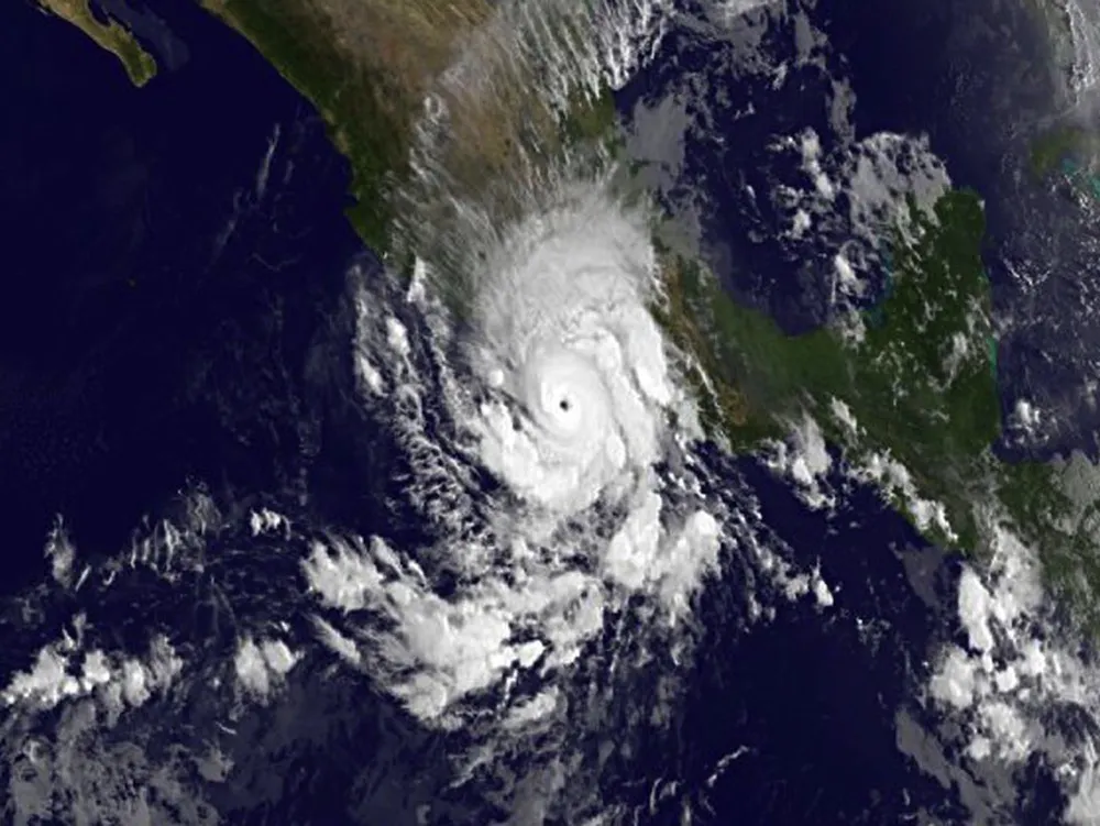
Hurricane Raymond has been menacing the Pacific coast of Mexico with heavy rains, strong winds, storm surge and rough surf. Before Raymond blew up into a major hurricane yesterday (Oct. 21), satellites snapped pictures of the nearly stationary storm.
Raymond first formed as a low-pressure system that quickly developed over the weekend and had strengthened into a hurricane by late in the day on Sunday. By early Monday morning, it had strengthened further still into a major hurricane, one that ranks a Category 3 or higher on the Saffir-Simpson scale, with winds of 120 mph (195 km/h).
Article continues below 
As of the lastest update from the U.S. National Hurricane Center (NHC), issued at 8 a.m. PDT (11 a.m. EDT), Raymond was 85 miles (135 kilometers) south-southwest of Zihuatanejo, Mexico, and was weakening, with winds 105 mph (165 km/h). Those winds make it a Category 2 hurricane.
A hurricane warning is currently in effect from Tecpan de Galeana to Lazaro Cardenas and a watch was in effect from Acapulco to Tecpan de Galeana. A warning means that, in this case, hurricane conditions are expected in the area, while a watch means they are possible.
Raymond has continued to stay fairly stationary off the Mexican coast, but could show what the NHC calls erratic slow movement today, possibly moving closer to the coast before steadily moving out to sea for the rest of the week.
The NHC warned that Raymond could bring rains of 4 to 8 inches (10 to 20 centimeters) in Guerrero and Michoacan states, with some places even seeing up to 12 inches (30 cm). Such rains could cause mudslides and flash flooding, which Mexico has already suffered from repeatedly during this year's hurricane season from both Pacific and Atlantic storms. In September, the Pacific's Hurricane Manuel and the Atlantic's Hurricane Ingrid hit Mexico's two coasts, causing extensive flooding and killing dozens.
Follow Andrea Thompson @AndreaTOAP, Pinterest and Google+. Follow us @livescience, Facebook & Google+. Original article on LiveScience.
