Significant El Niño event is almost guaranteed this year, experts warn. And it could be a big one.
NOAA researchers have predicted that an ocean-heating event known as El Niño is probably going to arrive in the next few months and persist into 2024.
Get the world’s most fascinating discoveries delivered straight to your inbox.
You are now subscribed
Your newsletter sign-up was successful
Want to add more newsletters?
Join the club
Get full access to premium articles, exclusive features and a growing list of member rewards.
The chance of the ocean-warming event known as El Niño hitting this year is now over 90%. It will likely begin in the coming months, and there is a good chance it will persist into 2024 and have a widespread impact, experts have warned.
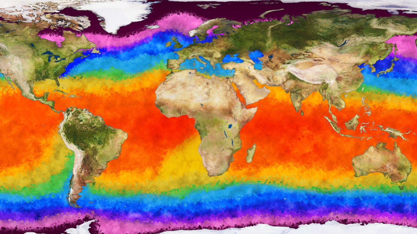
El Niño, which means "the little boy" in Spanish, is a major climatic event caused by changes to ocean currents in the Pacific Ocean. This heating event is strong enough to trigger major changes in global weather patterns and seriously impact marine ecosystems, especially combined with the effects of human-caused climate change. El Niño, along with its counterpart La Niña, or "the little girl" — a cooling event triggered by changes to the same ocean current system — make up the El Niño-Southern Oscillation (ENSO) cycle.
Experts have suspected that an El Niño event could be on the horizon for some time. And on May 3, the World Meteorological Organization (WMO) predicted there was a 60% chance that it would begin between May and July.
But on May 11, the National Atmospheric and Oceanic Administration (NOAA) released its own forecast, which suggested that it is a near certainty that El Niño will begin during the same period. The agency also said there was a 90% chance that El Niño will persist into 2024.
Related: Is climate change making the weather worse?
"Keep your eyes peeled on the tropics, and don’t blink," Nathaniel Johnson, a meteorologist at NOAA's Geophysical Fluid Dynamics Laboratory, wrote in a NOAA blog post. "Conditions are evolving quickly!"
ENSO cycle 101
The ENSO cycle is mainly linked to trade winds in the Pacific Ocean that blow westward along the equator. Normally, this blows warmer surface waters from South America toward Asia, which are in turn replaced by cooler deep ocean waters in a process known as upwelling, according to NOAA.
Get the world’s most fascinating discoveries delivered straight to your inbox.
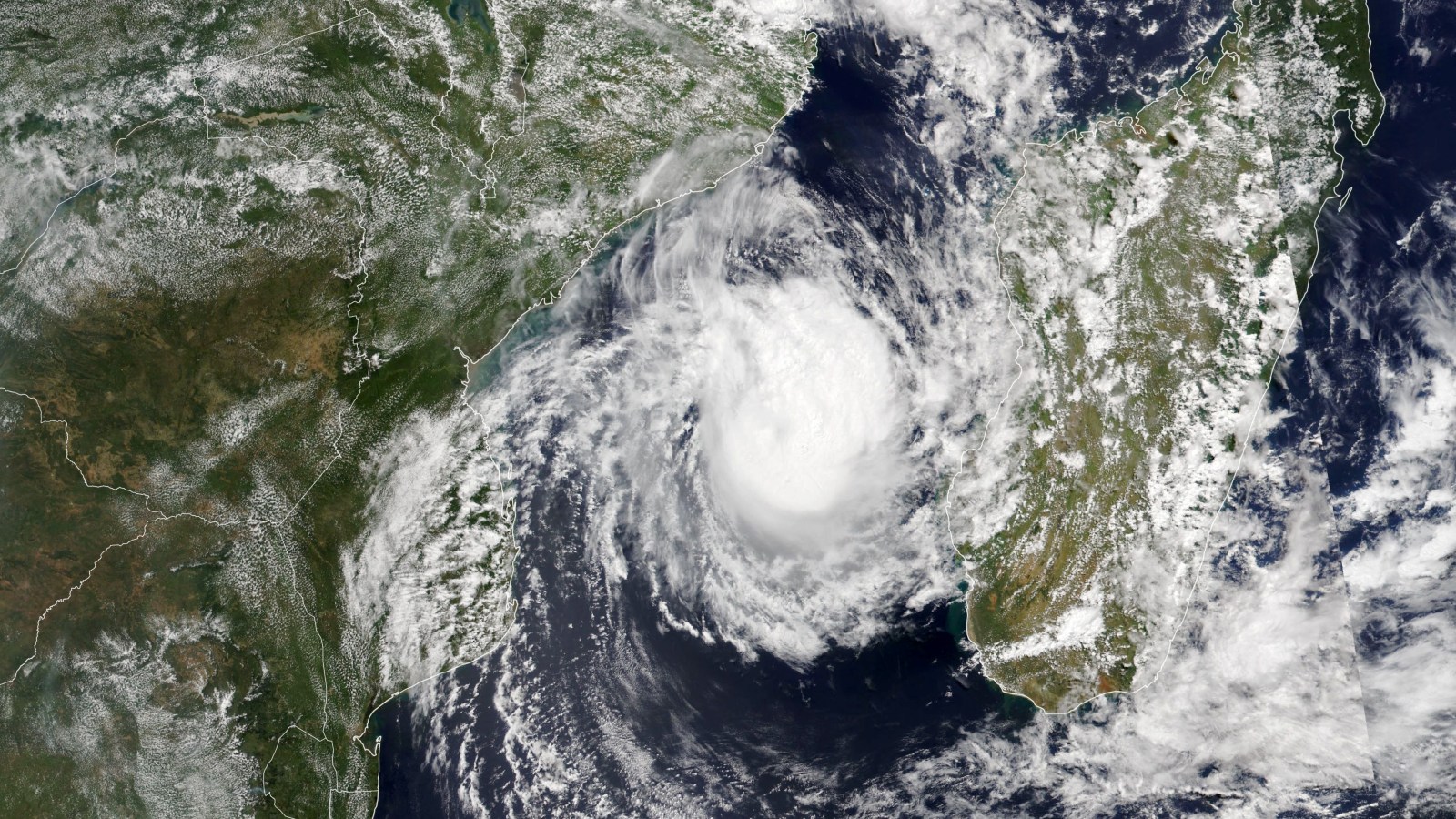
During El Niño, the trade winds weaken, which leads to reduced upwelling and in turn warmer surface waters. During La Niña, the trade winds are unusually strong, which has the opposite effect. Both events can trigger extreme weather events, such as the potentially record-breaking Cyclone Freddy that battered parts of Africa in February and March.
The periods between El Niño and La Niña events are known as ENSO neutral.
When was the last El Niño?
In the past, El Niño and La Niña events occurred roughly once every two to seven years, according to NOAA. But their appearance has recently become much more erratic due to the effects of climate change: In the last 50 years, the ocean has absorbed nearly 90% of the energy trapped by global warming, which has drastically increased sea surface temperatures, impacting the ENSO cycle.
The last El Niño event occurred between February and August 2019 and was quite weak. Between July 2020 and March 2023, a rare triple-dip La Niña suppressed rising global temperatures.
El Niño events normally last somewhere between nine months and two years but can be longer.
How strong will El Niño be?
It's unclear exactly how strong this El Niño will become, but NOAA's predictions suggest there is an 80% chance of at least a moderate El Niño, where sea surface temperatures will rise by 1.8 degrees Fahrenheit (1 degree Celsius), and a 55% chance of a strong El Niño, where temperatures will rise by 2.7 F (1.5 C).
Experts are also concerned that recent high sea surface temperatures will make the upcoming El Niño worse. In early April, the average global sea surface temperature was the highest in recorded history.
NOAA will provide more information on how El Niño is progressing in early June.
How will El Niño affect North America?
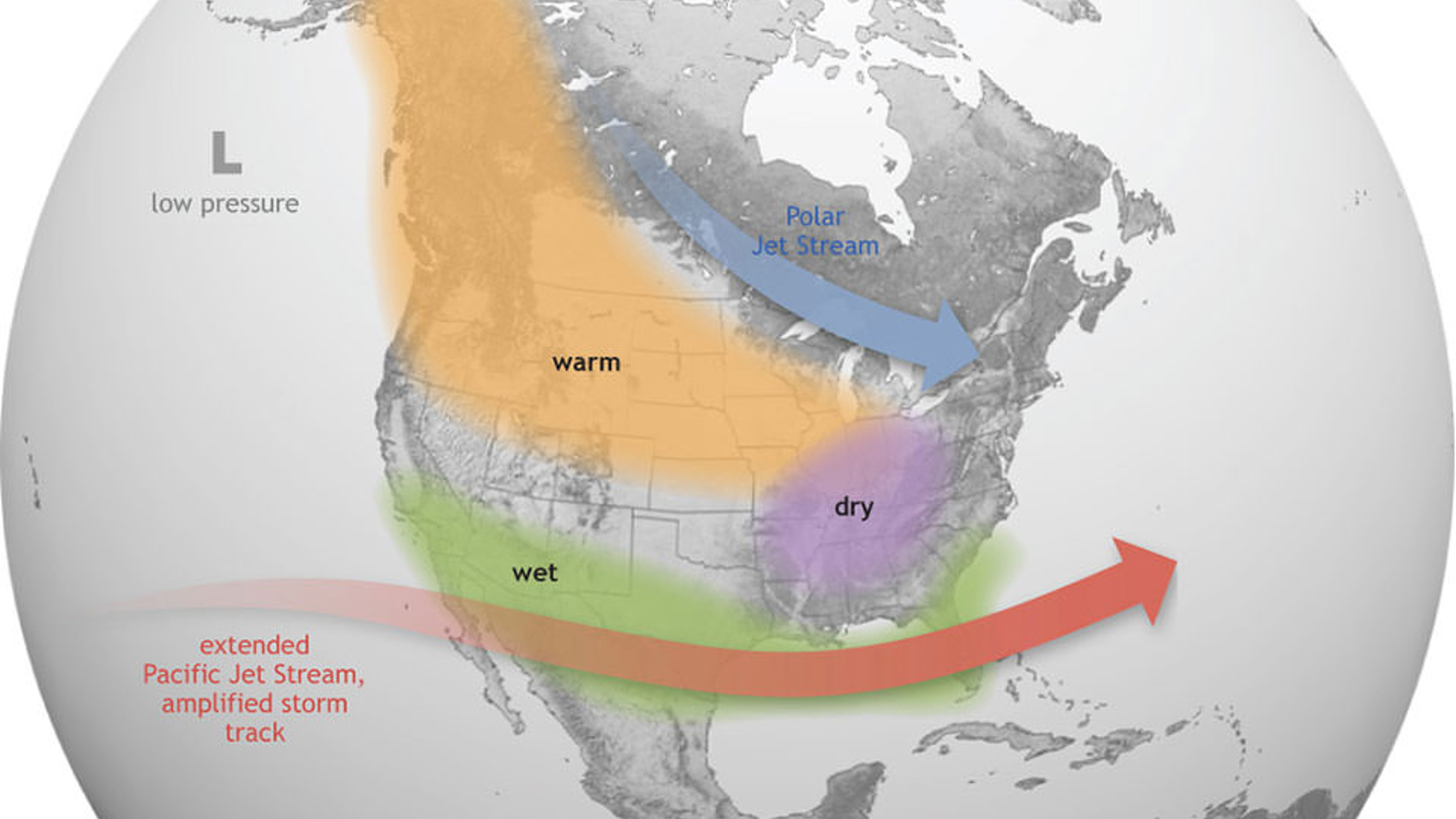
During El Niño, the weaker trade winds mean more warm water is pushed back east toward the west coast of the Americas. The warmer waters push the Pacific jet stream south of its neutral position, which impacts weather patterns in North America, according to NOAA.
For the northern U.S. and Canada, this can lead to warmer weather than usual, while eastern states often receive less rainfall. For the southern U.S. and northern Mexico, the result is often heavy rainfall, which can cause flooding and landslides.
The WMO expects global temperatures to rise to record levels during the next few years as La Niña's cooling effect ends and El Niño begins, which could severely impact the lives of millions of people.

Harry is a U.K.-based senior staff writer at Live Science. He studied marine biology at the University of Exeter before training to become a journalist. He covers a wide range of topics including space exploration, planetary science, space weather, climate change, animal behavior and paleontology. His recent work on the solar maximum won "best space submission" at the 2024 Aerospace Media Awards and was shortlisted in the "top scoop" category at the NCTJ Awards for Excellence in 2023. He also writes Live Science's weekly Earth from space series.
 Live Science Plus


