It's quick and easy to access Live Science Plus, simply enter your email below. We'll send you a confirmation and sign you up for our daily newsletter, keeping you up to date with the latest science news.
Hurricane Sally may bring "historic flooding," including "extreme life-threatening flash flooding," to the central U.S. Gulf Coast from the western Florida Panhandle to southeastern Mississippi, according to the National Hurricane Center (NHC).
As of 11 a.m. EDT, the storm is about 55 miles (85 kilometers) east of the mouth of the Mississippi River and is expected to pass near the coast of southeastern Louisiana today (Sept. 15) and make landfall later tonight or Wednesday morning (Sept. 16).
Sally is currently a Category 1 hurricane with maximum sustained winds of 85 mph (140 km/h), and it isn't expected to strengthen much before hitting land. But forecasters still expect Sally to be "a dangerous hurricane when it moves onshore along the north-central Gulf coast," according to the NHC.
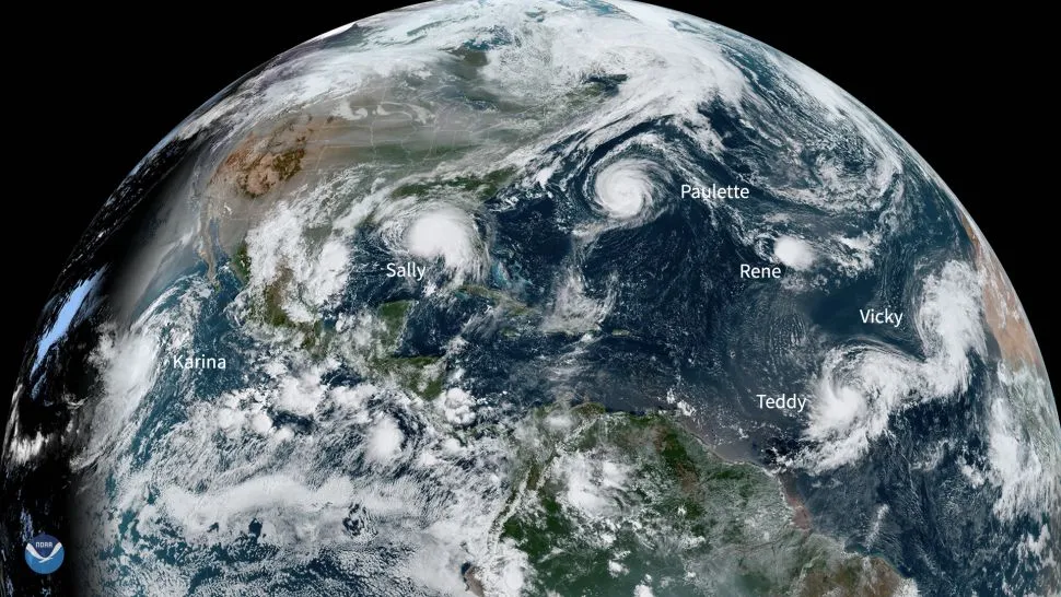
Hurricane Sally is crawling toward land and is expected to bring historic flooding.
(Image credit: National Oceanic and Atmospheric Administration/National Hurricane Center)
Hurricane warnings are in effect from the east of Bay St. Louis in Mississippi to Navarre, Florida, and tropical storm warnings are in effect for the areas east of Navarre to Indian Pass, Florida, and westward of Bay St. Louis to Grand Isle, Louisiana. Hurricane conditions are expected today in parts of the hurricane warning area, according to the NHC. Louisiana and Mississippi governors have each declared a state of emergency, according to CNN.
The storm isn't moving fast, which may prolong flooding from rainfall, storm surges and strong winds in the areas it hits, according to Weather.com. Sally is creeping toward the northwest at 2 mph (4 km/h) and is expected to head north/ north-westward in the afternoon and north/north-eastward tonight through Wednesday night. The storm is expected to drop 10 to 20 inches (25 to 51 centimeters) of rain, with some parts of the Gulf Coast getting up to 30 inches (76 cm).
A storm surge warning is in effect for the mouth of the Mississippi River to the Okaloosa/Walton County Line in Florida and for Mobile Bay, Alabama. Those areas may see "life-threatening" storm surges, according to the NHC. From Ocean Springs, Mississippi, to Dauphin Island, Alabama, storm surges could reach up to 6 to 9 feet (1.8 to 2.7 meters), according to the NHC. In other areas, including the mouth of the Mississippi River, surges could reach 4 to 7 feet (1.2 to 2 m).
Sign up for the Live Science daily newsletter now
Get the world’s most fascinating discoveries delivered straight to your inbox.
Louisiana was already hard-hit from tropical storm Marco and Hurricane Laura in August, according to a previous Live Science report. This past weekend, two weeks after Laura hit, 134,000 people were still without power, and some 23,000 people are still living in shelters, according to the report.
Yasemin is a staff writer at Live Science, covering health, neuroscience and biology. Her work has appeared in Scientific American, Science and the San Jose Mercury News. She has a bachelor's degree in biomedical engineering from the University of Connecticut and a graduate certificate in science communication from the University of California, Santa Cruz.