Antarctica: The Ice-Covered Bottom of the World (Photos)
Beautiful places
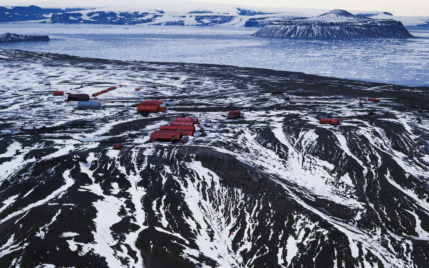
Marambio Base is a permanent Argentinian research station on the Antarctic Peninsula, which juts out from the continent toward South America and is considered by many visitors to be "one of the most beautiful places on Earth," according to CoolAntarctica, a site run by Paul Ward, who has a zoology degree and has worked in Antarctica.
Blood Falls
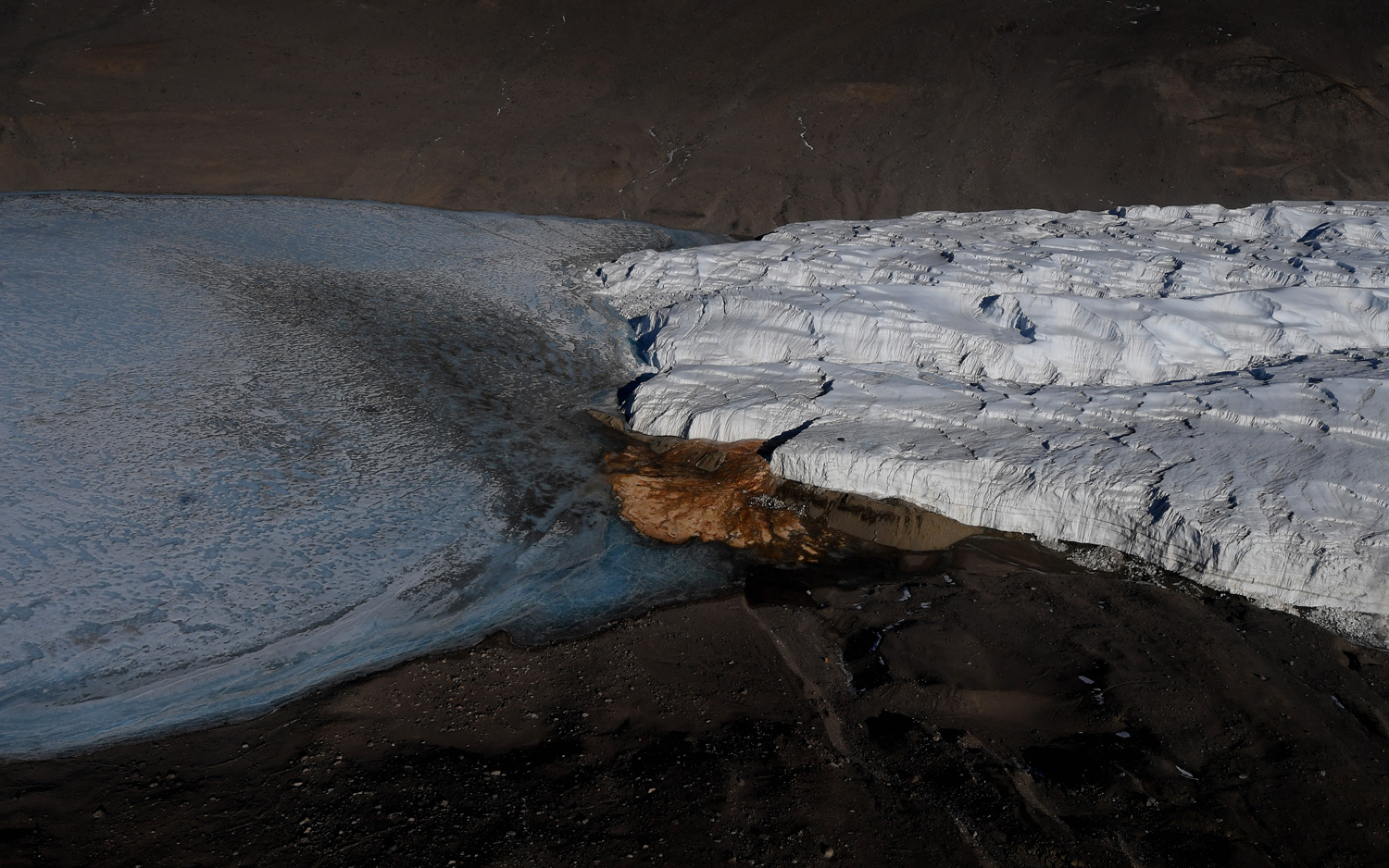
Even reds sometimes show up on this mostly white continent. Here, blood-red meltwater spills from Taylor Glacier Taylor Glacier in the McMurdo Dry Valleys, located along the southern coast of Antarctica. Blood Falls, as the waterfall-like stream is called, has a not-so-macabre source: Researchers reported April 24, 2017, in the Journal of Glaciology that a stream of brine beneatt the ice feeds the falls. That briny water is chockful of iron, which oxidizes and turns red when exposed to the air. As such, the outflow looks "bloody" as it flows into Lake Bonney, Live Science previously reported. The image was captured on Nov. 11, 2016.
Collapse
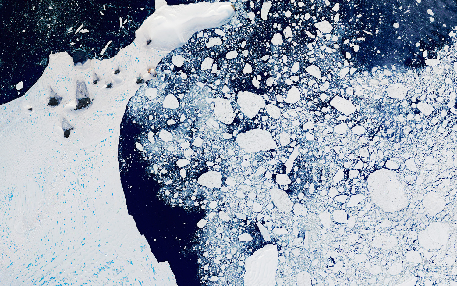
In addition to its reputation for gorgeous and awe-inspiring scapes, Antarctica is also a poster child for global warming. For instance, since 1995, the Larsen Ice Shelf, on the northeast coast of the Antarctic Peninsula along the Weddell Sea, has lost 75 percent of its mass, Live Science previously reported. And over about a month in 2002, part of the Larsen ice shelf, called Larsen B, collapsed, something that amazed scientists who had never seen so much ice (3,250 square kilometers, or 1,250 square miles) splinter off that quickly, according to NASA's Earth Observatory. Here, the gorgeous Larsen B Ice Shelf is shown on Feb. 21, 2000, about two years before its fateful collapse.
Scoured ice
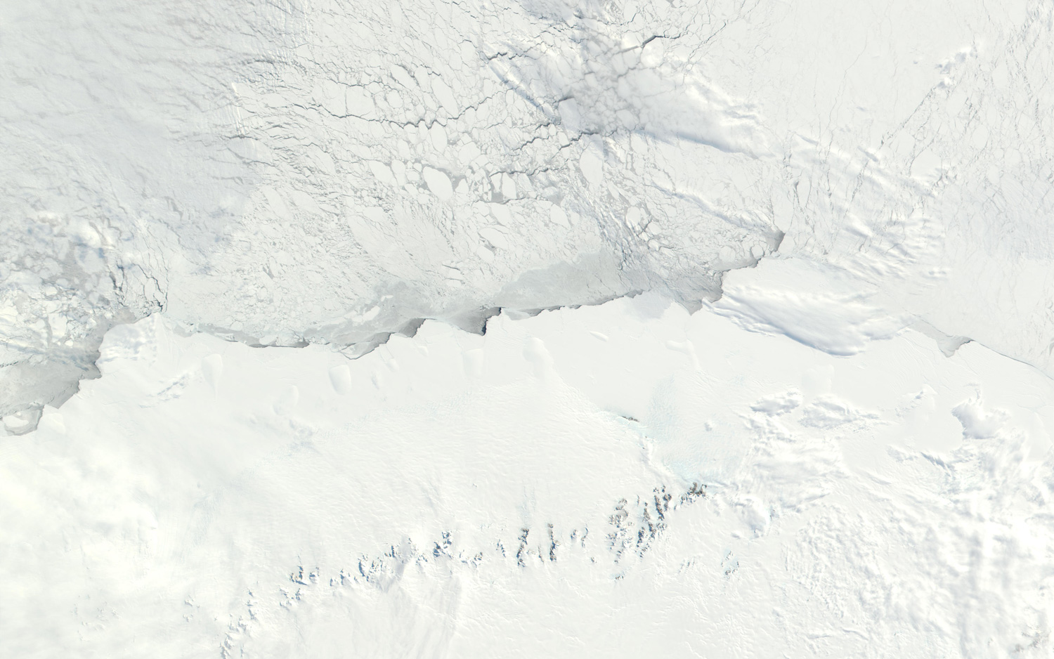
Antarctica is nearly completely blanketed in thick ice. Here, in this NASA image snapped on Sept. 26, 2001, you can get an idea of the various types of ice found on the continent. For instance, ice of continental glacier is up to 13,000 feet (4,000 meters) thick at the interior (shown at the bottom of the image). The thick glaciers are fastened in place by coastal mountain ranges, blue patches of bare ice are the result of strong "katabatic" winds that scour the snow from its surfaces, according to NASA. The much smoother ice shelf can be seen above the coastline, where the ice floats on the sea surface. "Beyond that is the chaotic surface of the sea ice, which has been solidifying all winter long," NASA said.
Volcanoes!
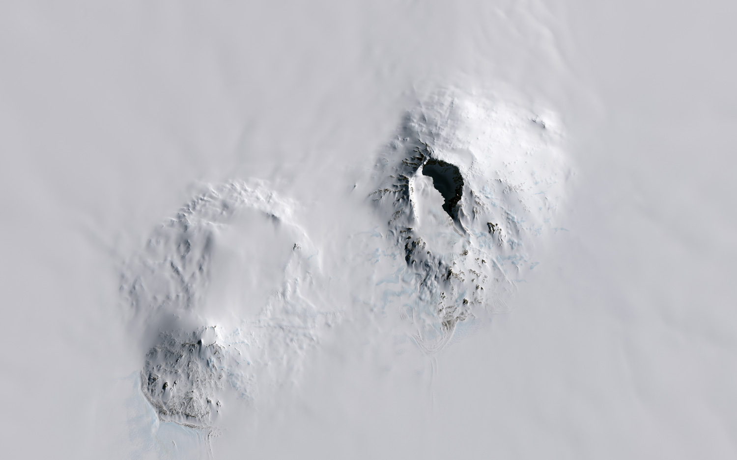
The Operational Land Imager on the Landsat-8 satellite captured this image showing a 560-mile (900 kilometers) stretch along Antarctica's Pacific coast, where 18 major volcanoes — yes, volcanoes, in Antarctica! — pop up from the ice sheet. Mount Sidley, Antarctica's tallest volcano, stands tall: It reaches 13,800 feet (4,200 meters) above sea level and 7,200 feet (2,200 m) above the ice surface. Rear Adm. Richard Byrd discovered Mount Sidley in 1934, later naming it after Mabelle Sidley, the daughter of a member of the Byrd Antarctic Expedition, according to NASA.
Get the world’s most fascinating discoveries delivered straight to your inbox.
Jeanna Bryner is managing editor of Scientific American. Previously she was editor in chief of Live Science and, prior to that, an editor at Scholastic's Science World magazine. Bryner has an English degree from Salisbury University, a master's degree in biogeochemistry and environmental sciences from the University of Maryland and a graduate science journalism degree from New York University. She has worked as a biologist in Florida, where she monitored wetlands and did field surveys for endangered species, including the gorgeous Florida Scrub Jay. She also received an ocean sciences journalism fellowship from the Woods Hole Oceanographic Institution. She is a firm believer that science is for everyone and that just about everything can be viewed through the lens of science.
 Live Science Plus


