It's quick and easy to access Live Science Plus, simply enter your email below. We'll send you a confirmation and sign you up for our daily newsletter, keeping you up to date with the latest science news.
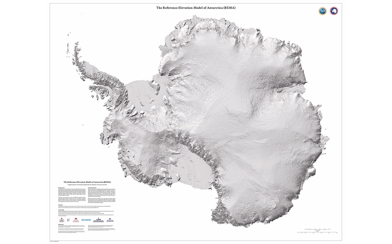
A new map of Antarctica's surface is so detailed, it almost seems as though if you put your hand on it you could trace the bumps in the ice ridges curving up the Antarctic Peninsula.
Researchers compiled the stunning topographic map — called the Reference Elevation Model of Antarctica (REMA) — from high-resolution photos that were collected over six years by a group of satellites orbiting hundreds of miles above Earth. To create the map, millions of images were processed by one of the world's largest supercomputers, according to a statement released by the University of Minnesota.
Earlier maps of the icy continent were produced at a resolution of more than 3,000 feet (1,000 meters), but the new map delivers an astonishing resolution of about 26 feet (8 m) and covering 5.4 million square miles (14 million square kilometers), making it the most accurate map of Antarctica to date. [Images of Melt: Earth's Vanishing Ice]
"Up until now, we've had a better map of Mars than we've had of Antarctica," Ian Howat, one of the researchers with the project and director of the Byrd Polar and Climate Research Center at The Ohio State University, said in the statement.
"Now it is the best-mapped continent on Earth," Howat said.
Researchers used one of the world's fastest supercomputers to process millions of images and create the new map.
(Image credit: National Geospatial-Intelligence Agency)
The height of every icy bluff and rocky outcrop on Antarctica is now easily within scientists' reach, and is accurate to within just a few feet, according to the statement.
"At this resolution, you can see almost everything," Howat said. "We will see changes in snow cover, changes in the motion of ice, we will be able to monitor river discharge, flooding and volcanoes. We will be able to see the thinning of glaciers."
Sign up for the Live Science daily newsletter now
Get the world’s most fascinating discoveries delivered straight to your inbox.
With the data in hand — and there's quite a lot of it, as the map file is 150 terabytes — scientists will now be able to better visualize the impact of a warming world on Antarctica's landscape, Morin said in the statement.
"Now, we'll be able to see changes in melting and deposition of ice better than ever before," he said. "That will help us understand the impact of climate change and sea level rise. We'll be able to see it right before our eyes."
The map was published online Sept. 4 by the Polar Geospatial Center at the University of Minnesota.
Mindy Weisberger is a science journalist and author of "Rise of the Zombie Bugs: The Surprising Science of Parasitic Mind-Control" (Hopkins Press). She formerly edited for Scholastic and was a channel editor and senior writer for Live Science. She has reported on general science, covering climate change, paleontology, biology and space. Mindy studied film at Columbia University; prior to LS, she produced, wrote and directed media for the American Museum of Natural History in NYC. Her videos about dinosaurs, astrophysics, biodiversity and evolution appear in museums and science centers worldwide, earning awards such as the CINE Golden Eagle and the Communicator Award of Excellence. Her writing has also appeared in Scientific American, The Washington Post, How It Works Magazine and CNN.