


Another Monster Storm Is Brewing in the Eastern Atlantic
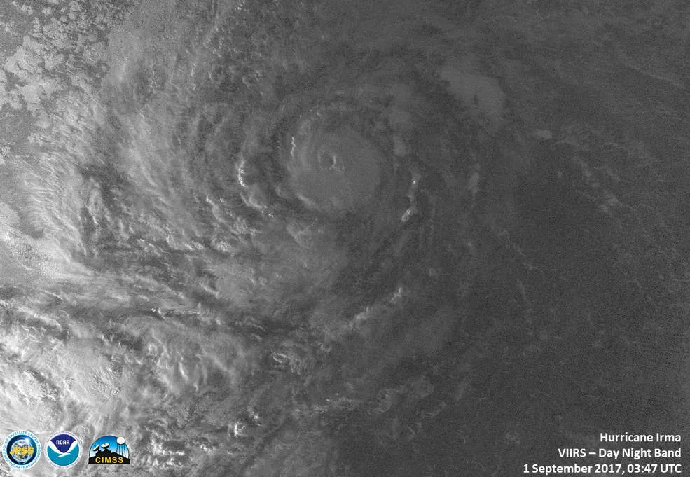
The VIIRS instrument aboard NASA-NOAA's Suomi NPP satellite captured a night-time image of Hurricane Irma in the Atlantic Ocean that showed a tight circulation on Sept. 1, 2017.
(Image credit: NASA/NOAA/UWM-CIMSS, William Straka III)
With Houston just beginning to contemplate its long recovery from the onslaught of Hurricane Harvey, which made landfall in Texas as a hurricane before dumping record amounts of rain over the region as a tropical storm, another monster storm is brewing in the Atlantic.
Hurricane Irma — which, as of 11 a.m. ET (1500 GMT) on Friday (Sept. 1), was far to the east of the Dominican Republic — rapidly intensified to nearly a Category 3 hurricane over the past 24 hours, according to the National Hurricane Center (NHC). Category 3 hurricanes have sustained wind speeds of at least 111 mph (178 km/h); Hurricane Irma has registered maximum wind speeds of 110 mph (175 km/h).

