Get the world’s most fascinating discoveries delivered straight to your inbox.
You are now subscribed
Your newsletter sign-up was successful
Want to add more newsletters?
Join the club
Get full access to premium articles, exclusive features and a growing list of member rewards.
Editor's Note: This story was updated on Sept. 10, 2017 at 9:30 a.m. E.T.
For those on the East Coast, today is statistically the most likely day to get the rain boots out, check the emergency food stash and make sure the candles are well-stocked.
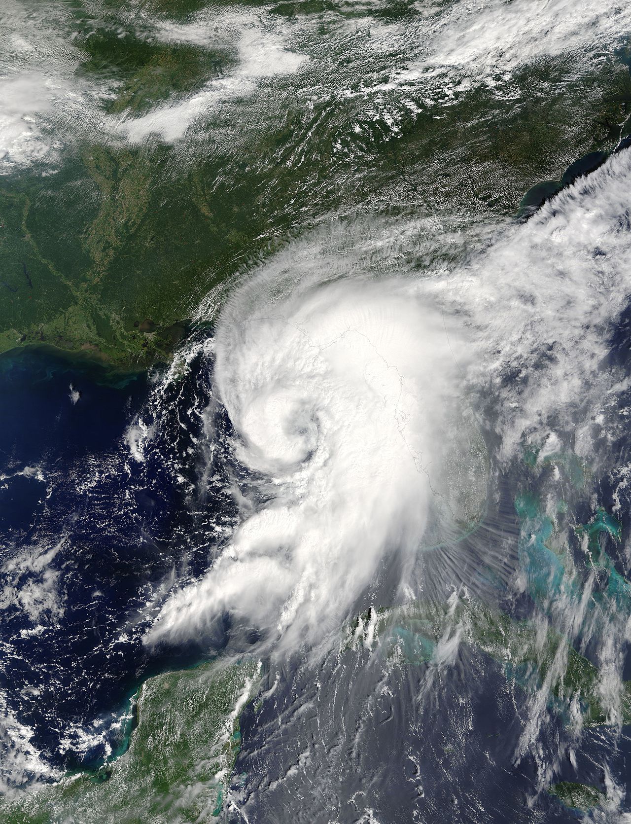
Sept. 10 is the peak day for hurricane activity along the U.S. Atlantic coast, as a result of a confluence of factors, from winds, to atmospheric pressure to ocean water temperature, according to the National Atmospheric and Oceanic Administration. And this year at least, peak hurricane day is living up to its hype: Two Category 4 hurricanes, Hurricane Irma and Hurricane Jose, are currently roiling the Atlantic. Hurricane Irma is currently battering parts of the Florida Keys and is set to make landfall in Florida soon.
Article continues belowThe reason for this year's busy Sept. 10 is a combination of light winds off the Atlantic, high moisture in the atmosphere, bathtub-warm waters in the Atlantic Ocean, experts say.
While Sept. 10 is statistically the most likely day to have active hurricanes, that doesn't mean a nasty storm is always in store for the Atlantic coast on this day every year. [Hurricanes from Above: Images of Nature's Biggest Storms]
"The tropical activity is usually greatest on average on that day," said Neal Dorst, a researcher with the NOAA Atlantic Oceanographic and Meteorological Laboratory Hurricane Research Division. "But your mileage may vary. From one year to the next, there is no guarantee that there will be a hurricane on Sept. 10, only that it is the most likely on that day."
Mixture of factors
Multiple factors affect the risk of a hurricane forming. For instance, around this time of the year, the subtropical ridge, a belt of high atmospheric pressure that usually sits above the mid-latitudes, has migrated northward. It has migrated far enough north that it allows tropical disturbances, or slight air circulation regions that center around the trade winds, to move across the deep tropical Atlantic Ocean, Dorst told Live Science in an email.
Get the world’s most fascinating discoveries delivered straight to your inbox.
At the same time, there is little vertical wind shear, Dorst said. Vertical wind shear, or the change in wind speed with height in the atmosphere, takes the oomph out of a building hurricane by transporting heat and moisture from its center and by tilting its vortex, which makes it less efficient at generating heat, according to Weather Underground. With low shear, there is little to blunt the buildup of heat and moisture needed to fuel a hurricane.
The sun's rays have also warmed the deep tropical waters off the Atlantic during this period, while air temperatures rise as well. At the same time, the middle levels of the atmosphere are chock-full of moisture, the perfect fuel for wet, gusty hurricanes, Dorst said. All these factors are likeliest to line up today, according to NOAA's weather models.
Storm season
Tropical storms occur during a narrow, eight-week window between mid-August and late October, according to NOAA. This peak season includes 78 percent of the tropical storm days, 87 percent of Category 1 and 2 hurricanes and a whopping 96 percent of the Category 3, 4 and 5 storms on the Saffir-Simpson scale.
By the end of fall, storm chasers can put away their instruments, binoculars and galoshes. Wind shear picks up, breaking up would-be hurricanes before they can form, while ocean water and air temperatures are not conducive to hurricane formation in the first place.
"After the peak of the season, these conditions become less favorable for tropical cyclone development until late fall when they become inimical to any storm formation," Dorst said.
Original article on Live Science.
Editor's Note: This story was updated to reflect hurricane conditions in 2017.

Tia is the editor-in-chief (premium) and was formerly managing editor and senior writer for Live Science. Her work has appeared in Scientific American, Wired.com, Science News and other outlets. She holds a master's degree in bioengineering from the University of Washington, a graduate certificate in science writing from UC Santa Cruz and a bachelor's degree in mechanical engineering from the University of Texas at Austin. Tia was part of a team at the Milwaukee Journal Sentinel that published the Empty Cradles series on preterm births, which won multiple awards, including the 2012 Casey Medal for Meritorious Journalism.
 Live Science Plus


