 Live Science Plus


The waiting and watching continues in Iceland, where Barðarbunga volcano still shows no signs of erupting.
Barðarbunga volcano is at orange alert, which signifies a possible eruption and is the fourth level on a five-grade scale. The volcano is in a remote region of southwest Iceland, and an eruption poses no immediate threat to local communities.
Nor do airlines expect another disaster similar to the airport shutdown following the the 2010 Eyjafjallajökull volcano eruption. Because of policy changes, planes can fly through limited levels of volcanic ash, instead of a complete grounding of flights, and models of atmospheric ash plumes have improved. [Fire and Ice: Images of Volcano-Ice Encounters]
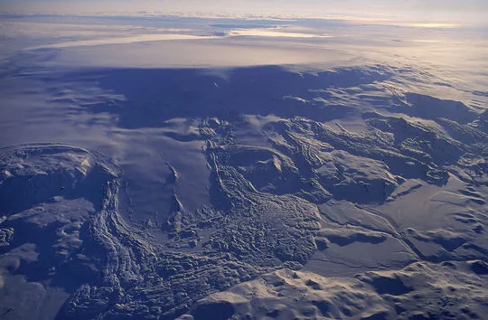
Article continues belowA more immediate risk comes from flooding, if Barðarbunga melts its cap of glacial ice. Barðarbunga is buried beneath the Vatnajökull ice cap. An outburst called a jökulhlaup could wipe out roads, without enough time to evacuate people in the area. Popular tourist sites, such as waterfalls, lie downstream. For that reason, yesterday (Aug. 19) officials sent a signal to all cellphones in the area at risk of flooding, notifying people of the possible hazard, and the country's Civil Protection Authority is evacuating the area.
Iceland was first alerted to magma rising beneath Barðarbunga volcano by an intense earthquake swarm that started Saturday (Aug. 16). About 1,000 earthquakes, most smaller than magnitude 3, struck yesterday, according to the Icelandic Met Office (IMO).

The earthquakes signal that magma, or molten rock, is pushing through rocks underground. Since Saturday, the earthquake activity has moved to the northeast at about 1 km (0.6 miles) each day. However, the magma is not rising closer to the surface, according to an IMO statement. While there is more than one possible explanation for the quake pattern, many scientists think the magma might be forming a dyke, a long, thin sheet of rock. GPS measurements also match this interpretation.
No one knows whether or not the magma will break through and trigger an eruption. The rock could solidify underground, never reaching the surface. It could also pour out in a voluminous flow that threatens Iceland's power plants, which is considered the worst-case scenario. Barðarbunga is part of a long set of fissures, topped by active volcanoes, that are responsible for some of the biggest lava flows on Earth in the last 10,000 years.
Icelandic officials and scientists are conducting regular flights over the volcano to check for signs of an eruption, such as melting ice. There are also webcams monitoring the volcano. You can watch them here and here.
Bar-da-what?
Volcanologist Dave McGarvie of the Open University in Scotland suggests b-OW-r-tha-boon-ga, while seismologist Ian Stimpson of Keele University in the U.K. counters with Bau-thar-bunga. Watch a pronunciation video here.
Email Becky Oskin or follow her @beckyoskin. Follow us @livescience, Facebook & Google+. Original article on Live Science.

