


In Photos: Crazy Cloud Patterns
Cloud Shapes Over Ocean
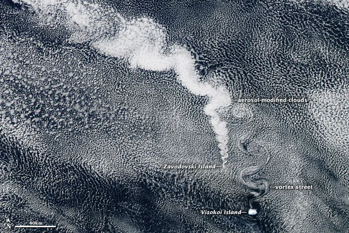
A volcano in the South Sandwich islands creates a pattern in the clouds over the Southern Ocean in this photo taken by NASA's Aqua satellite on April 27, 2012.
Australian cloud hole

A high pressure system created this enormous cloud hole photographed off Australia on June 5, 2012.
Wave Clouds
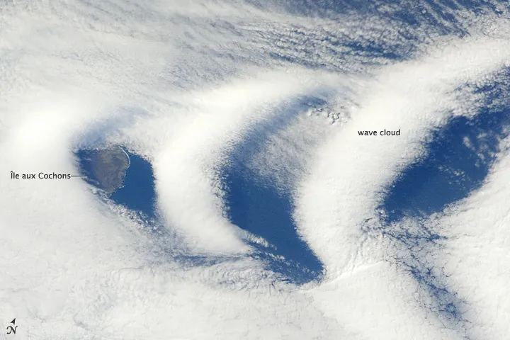
Wave clouds were photographed over the southern Indian Ocean island of

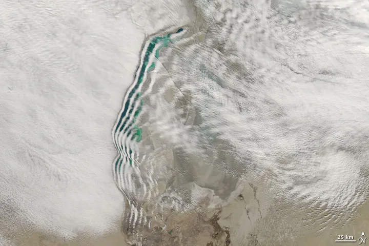
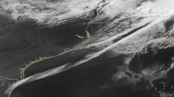
clouds-streets-greenland

NASA's Aqua satellite snapped this stunning image of cloud streetsaround Greenland's southern tip on March 6. Cloud streets are bands of cumulus clouds that form parallel to the low-level wind direction when conditions are right.
Lenticular Cloud

Richard H. Hahn snapped this stunning picture of a lenticular cloud over Rocky Mountain National Park just after sunset on Jan. 5, 2012.
Wave Clouds
Distinctive lines of clouds stretch out from the shore of the Aral Sea in this photo-like image captured by the Moderate Resolution Imaging Spectroradiometer (MODIS) on NASA's Aqua satellite on March 12, 2009. While wave clouds like this are not unusual, this particular pattern over the Aral Sea is highly unusual. The clouds conform exactly to the shape of the western shore.
Swirling clouds
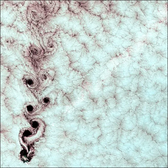
Each of the swirling clouds in this image acquired by Landsat 7's Enhanced Thematic Mapper plus (ETM+) sensor on Sept. 15, 1999, is the result of a meteorological phenomenon known as a von Karman vortex. As wind-driven clouds encounter the peak of an island, they flow around it to form large, spinning eddies.
Get the world’s most fascinating discoveries delivered straight to your inbox.
Roll Clouds
This formation, photographed by a NASA satellite on Aug. 27, 2011, is called an undular bore, or gravity wave train, and it appears as rarely as once a month. An undular bore is a disturbance in the Earth's atmosphere that can be seen as clouds move in waves. They normally occur within an area of the atmosphere that is stable in the low levels after a cold front moves through.
Honeycomb Cloud

Marine stratocumulus clouds have open cells (sky in the middle) and closed cells (cloudy in the middle).
Cloud Hole

An example of a hole-punch cloud created as a jet airplane or turboprop plane flew through a cloudy layer and caused precipitation to fall out.
Mammatus Clouds

Mammatus clouds seen over Tulsa, Okla. These clouds are formed by sinking air and are sometimes seen after a potent thunderstorm; they signal that a storm is retreating.
