


Dust Storm in Northern Mexico
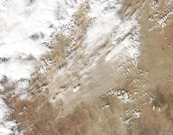
Dust storm in Northern Mexico.
(Image credit: Jeff Schmaltz, NASA.)
On Dec. 30, 2010, a dust storm blew from northern Mexico across the borders of Texas and New Mexico, skirting the cities of El Paso and Juarez. The Moderate Resolution Imaging Spectroradiometer (MODIS) on NASA's Aqua satellite took this picture the same day.
Dry salt lakes and small sand seas occupy this part of northern Mexico, providing ample material for dust storms when winds are sufficiently strong.

TOPICS
