It's quick and easy to access Live Science Plus, simply enter your email below. We'll send you a confirmation and sign you up for our daily newsletter, keeping you up to date with the latest science news.
Over the northern Indian Ocean, Jal strengthened to a tropical storm on November 4, and turned into a cyclone two days later. At its peak, the storm had winds of 70 knots (130 kilometers per hour), according to Unisys Weather. Jal weakened to a tropical storm on November 7 and withered to tropical depression the following day.
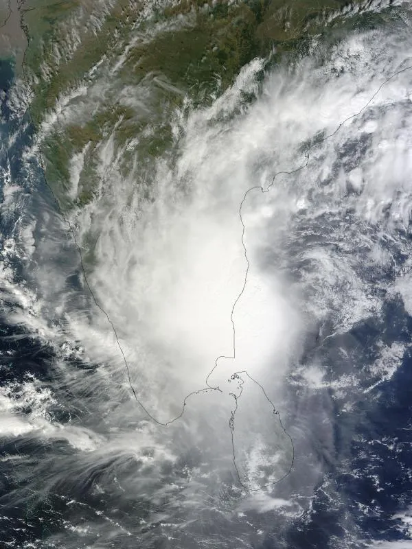
(Image credit: Jeff Schmaltz / MODIS Land Rapid Response Team / NASA GSFC.)
The leftovers of what was Tropical Cyclone Jal may not be ready to die just yet.
The low pressure area formerly known as Topical Cyclone Jal (tropical cyclone is the generic name for tropical storms, typhoons and hurricanes) has emerged into the warm waters of the Arabian Sea after crossing India this past weekend, as seen by infrared and visible imagery from NASA's Aqua satellite today (Nov. 9) at 1:30 p.m. local time in India.
Today's imagery hints that Jal's remnants are still circulating. The circulation was particularly apparent in the visible image and the infrared satellite image showed that the strongest convection and thunderstorms are now occurring to the west of the center of circulation and over the open waters of the Arabian Sea.
NASA's Aqua satellite captured this visible image of Cyclone Jal's remnants off the coast of Mumbai, India on Nov. 9. It appears that there is circulation occurring in this image.
(Image credit: NASA JPL, Ed Olsen.)
At 900 GMT (4 a.m. EST) on Nov. 9, the remnants of Tropical Cyclone Jal were over the waters of the eastern Arabian Sea. The Arabian Sea is located in the northwestern part of the Indian Ocean and covers a total area of about 1,491,000 square miles (3,862,000 square kilometers).
Relative to land and the nearest city in India, Jal's remnant low was about 70 miles (113 kilometers) east-southeast of Mumbai. Mumbai is the capital of the Indian state of Maharashtra and is located on India's west coast. It is the most populous city in India with 14 million residents.
This infrared image of Cyclone Jal's remnants on Nov. 9 at 1:30 p.m. local time (India) showed that the strongest convection (purple) and thunderstorms are now occurring to the west of the center of circulation over the open waters of the Arabian Sea.
(Image credit: NASA JPL, Ed Olsen.)
The forecasters at the Joint Typhoon Warning Center at the Naval Maritime Forecast Center in Pearl Harbor, Hawaii are monitoring Jal's remnants for possible regeneration later today.
For the science geek in everyone, Live Science offers a fascinating window into the natural and technological world, delivering comprehensive and compelling news and analysis on everything from dinosaur discoveries, archaeological finds and amazing animals to health, innovation and wearable technology. We aim to empower and inspire our readers with the tools needed to understand the world and appreciate its everyday awe.

 Live Science Plus