 Live Science Plus


Hurricane Sandy Could Outdo 'Perfect Storm'
A frightening collision of weather systems is brewing and could create a tempest even worse than 1991's "Perfect Storm." This "Frankenstorm," as some are calling it, is set to strike the Northeast on or near the 21st anniversary of that historic squall.
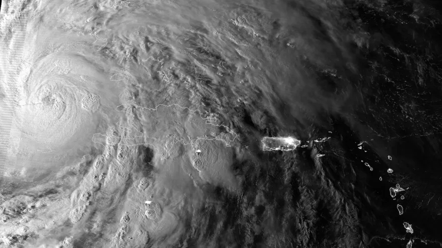
On the one hand you have Hurricane Sandy barreling north, expected to hit somewhere on the U.S. East Coast in the middle of next week. At the same time, a cold front is moving across the middle of the country, bringing cold temperatures and snow.
The two will probably meet about the time the hurricane makes landfall and, together, could form an even bigger nor'easter (snor'eastercane, some have said). And that's bad news.
Article continues below"In all likelihood, it will be worse than the Perfect Storm," said William Komaromi, a hurricane expert at the University of Miami. [How To Prepare for Hurricane Sandy]
The Perfect Storm
The Perfect Storm hit the Northeast on Nov. 1, 1991. It formed when the remnants of Hurricane Grace were absorbed by a low-pressure storm system, or nor'easter, at the edge of a cold front. That created a new storm near Newfoundland that swirled to the southwest and lashed New England with high winds, rain and waves. This new storm was an extra-tropical cyclone, meaning a cyclone that forms outside of the tropics, and it briefly reached hurricane strength, or winds of 74 mph (119 kph) or greater.
But the Perfect Storm differs from this Frankenstorm in important ways. For one, Hurricane Grace had dissipated significantly before the low-pressure system absorbed it. The storm then strengthened and moved south and west, pushed by a high-pressure system from the north and east.
In this case, however, the damage will likely come from the hurricane itself, which is predicted to make landfall in the mid-Atlantic or Northeast, unlike Grace.
Komaromi said his models suggest that the hurricane will likely "phase," or become absorbed by a developing storm on the edge of the cold front. Storms often naturally develop on the edge of cold fronts, and can form extratropical cyclones. These systems are driven by a difference in temperatures — cold to the west, warm to the east — which then swirl together, creating strong winds. The extreme low pressures created by a hurricane could help start this swirling process, giving the storm renewed strength. (By contrast, tropical cyclones, including tropical storms and hurricanes, are fueled by warm water, warm moist air and the convection these phenomena can create.)
Storm of the Century
But Jeff Weber, a scientist with the University Corporation for Atmospheric Research in Boulder, Colo., said he doesn't think a new storm will absorb the hurricane. He likens this hurricane more to the "Storm of the Century," a cyclone that hit the eastern United States in early March 1993. (Since it hit before the hurricane season began, it didn't receive an official name.) Weber said he thinks the damage will come from the hurricane itself, and he said the storm won’t likely link with another developing storm.
What both Komaromi and Weber can agree upon, however, is that the storm is likely to be extremely bad, creating very high winds. Several models suggest that Sandy could produce the lowest barometric pressure in the history of the United States, he said. The high-pressure cold front moving toward the Northeast could help create especially strong gales, since wind is created by differences in pressure, as air wants to flow from high to low pressure. Weber predicts Sandy’s winds could reach 100 mph (160 kph).
"We're talking winds in the 100-mph range as it's making landfall in the Northeast," he said.
What's in a name?
The name "Perfect Storm" refers specifically to the 1991 cyclone. But the term has been adopted to refer to other storms formed when conditions are just right to produce a large tempest.
What are those conditions? They are pretty much all in place right now. For one, the waters of the Gulf Stream, which ferry warm seawater from the northeast Caribbean into the Atlantic, are warmer than usual, providing fuel for Sandy. Secondly, the North Atlantic is "blocked" by a low-pressure system over Greenland. That has backed up the jet stream, the current of air that runs eastward over North America and into the ocean; it looks like this will allow Sandy to curve to the west and hit the East Coast, Komaromi said.
The storm will also hit around the time of the full moon, meaning the tides will be higher than usual and setting the stage for a damaging storm surge. [Video - Storm Surge: The Deadliest Part Of A Hurricane]
Then there is the advancing hurricane and high-pressure system, creating strong differences in pressure and high winds, likely stronger than those during the Perfect Storm.
"It's a little early to say it'll definitely be worse, but it probably will be," Komaromi said.
Reach Douglas Main at dmain@techmedianetwork.com. Follow him on Twitter @Douglas_Main. Follow OurAmazingPlanet on Twitter @OAPlanet. We're also on Facebook and Google+.

