Freshwater in Oceans Lets Hurricanes Strengthen Faster

Get the world’s most fascinating discoveries delivered straight to your inbox.
You are now subscribed
Your newsletter sign-up was successful
Want to add more newsletters?
Join the club
Get full access to premium articles, exclusive features and a growing list of member rewards.
Layers of freshwater on the ocean's surface, created by river runoff or heavy rains, can help hurricanes quickly get stronger, a new study finds. Hurricanes are fed by heat in the ocean's warm surface. Normally, cyclones' strong winds mix the ocean and bring up cold water from below, cooling the surface and preventing the storm from further strengthening. But freshwater, which is lighter than saltwater, prevents the normal mixing, which speeds the hurricanes' growth.
The study, published today (Aug. 13) in the journal Proceedings of the National Academy of Sciences, suggests that measurements of ocean salinity should be taken into account in hurricane forecasts, which isn't currently the case, said co-author Karthik Balaguru at the Pacific Northwest National Laboratory in Washington.
Predicting the future
Article continues belowThe likelihood that hurricanes will hit such a freshwater patch is small, between 10 to 23 percent. But the effect can be large: Hurricanes over freshwater patches intensify 50 percent faster than over the open ocean, Balaguru told OurAmazingPlanet.
"A 50 percent increase in intensity can result in a much larger amount of destruction and death," he said. [History of Destruction: 8 Great Hurricanes]
Factoring in freshwater patches could help improve predictions of a hurricane's intensity. Intensity forecasts haven't improved much in the last 20 years as many of the mechanisms that govern intensity changes aren't well-understood.
"We can predict the paths cyclones take, but we need to predict their intensity better to protect people susceptible to their destructive power," Balaguru said.
Get the world’s most fascinating discoveries delivered straight to your inbox.
Patches of freshwater like these are present in areas where there is heavy rainfall, like the western Pacific Ocean, or where large river systems pour into the sea, including the Amazon and Ganges River systems, said co-author Ping Chang at Texas A&M University. The study could help predict the power of future cyclones in these areas, he said.
Fresh fuel for hurricanes
When enough freshwater pours into the ocean, it forms a so-called "barrier layer," typically about 160 feet (50 meters) below the surface.
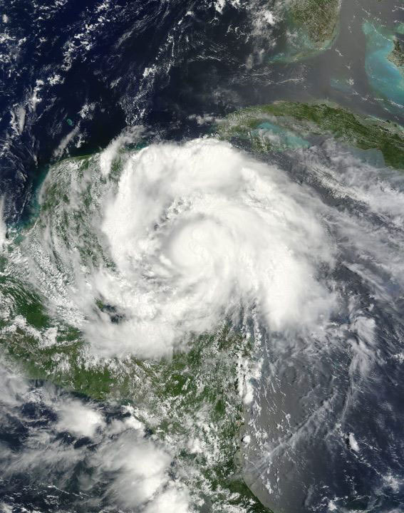
Hurricane Omar is one example of a cyclone that intensified after passing over these boundary layers, strengthening from a Category 2 to a Category 4 hurricane with winds of 135 mph (215 kph) in the course of about one day, Balaguru said.
The researchers took measurements from Argo floats, robotic sensors that measure temperature and salinity and other conditions throughout the world's oceans. The sensors happened to be in the Caribbean when Omar intensified. They also took measurements from another 587 tropical storms and cyclones between 1998 and 2007 to form their conclusions.
"What this study has shown quite nicely is that there are locations where freshwater layers regularly impede mixing colder water to the surface, which in turn allows hurricanes to emerge stronger from these regions than they might otherwise have done," said Texas A&M researcher Robert Korty, who wasn't involved in the study.
Reach Douglas Main at dmain@techmedianetwork.com. Follow him on Twitter @Douglas_Main. Follow OurAmazingPlanet on Twitter @OAPlanet. We're also on Facebook and Google+.
 Live Science Plus


