A commercial pilot has captured images of a massive, snow-strewn landslide that cascaded down a slope in remote southeastern Alaska last week, providing the first on-the-ground evidence of what geologists think might be the largest natural landslide since 2010.
Columbia University geologists detected the reverberations of what they thought was a landslide on Sunday, Feb. 16, from remote seismic instruments, but had not received on-the-ground confirmation until pilot Drake Olson decided to go searching for the evidence on Friday (Feb. 21). He searched using rough GPS data that the geologists had collected, a blogger for the American Geophysical Union reported today (Feb. 24).
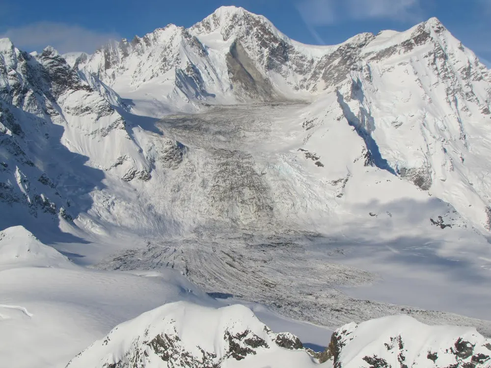
Olson struggled to see the ground through cloud cover at first, but says that the fallen rocks were easy to detect once they came into view.
Latest Videos From
"It stands out like a sore thumb," Olson told Live Science. "It's a big rubble field and a big gash on the side of the mountain, and everything else is pretty much white, so it's not hard to spot."
The scientists estimate that the slump contains roughly 68 million metric tons of rock, which is equivalent to roughly 40 million SUVs, geologist Colin Stark, a researcher at Columbia University's Lamont-Doherty Earth Observatory, told Live Science last week. [In Images: Massive Landslide Falls in Alaska]
The geologists estimate that the landslide started at roughly 9,800 feet (3,000 meters) above sea level on a nearly vertical cliff, and then ran for roughly 3 miles (4.8 kilometers), wrote AGU blogger David Petley, who is also a professor of hazard and risk at Durham University in the United Kingdom.
The landslide churned up a lot of ice and snow, and appears to be as much as 43 feet (13 meters) thick in some locations. But fresh snow has already begun to bury and hide the landslide, the scientists say.
The researchers have yet to release satellite images that will further help analyze the rocky scar in the snow, but tentatively say that this could be the largest natural landslide since 2010 — a year when a series of large events occurred within Pakistan and the Himalayas.
The geologists hope that their analyses will add to the growing body of knowledge on the physics of landslides and the dangers they pose in more-populated regions of the world, Stark told Live Science last week.
Follow Laura Poppick on Twitter. Follow us @livescience, Facebook & Google+. Original article on Live Science.