It's quick and easy to access Live Science Plus, simply enter your email below. We'll send you a confirmation and sign you up for our daily newsletter, keeping you up to date with the latest science news.
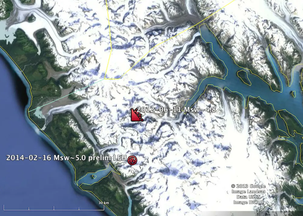
Geologists detected reverberations from a landslide in southeastern Alaska on Sunday, Feb. 16, but did not have on-the-ground confirmation of the event until commercial pilot Drake Olson provided these photos taken from his plane on Friday, Feb. 21.
The landslide is thought to be the largest ever since 2010, containing roughly 68 metric tons of rock, and flowing for nearly 3 miles (4.8 kilometers).
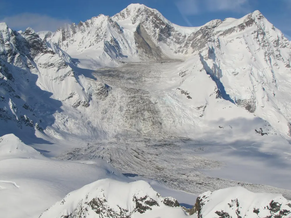
Olson landed his plane, and took images such as these to show the geologists the composition of the landslide, which consisted of a combination of stones, dust, snow, and ice.
Fresh snow has already begun to hide the evidence of the landslide. Here, a layer of dust deposited by the violent event has been buried under a layer of fresh snow.
Satellite image of landslide
(Image credit: NASA Earth Observatory)
Satellite imagery of the landslide, taken on Feb. 23.
Sign up for the Live Science daily newsletter now
Get the world’s most fascinating discoveries delivered straight to your inbox.
Laura Poppick is a contributing writer for Live Science, with a focus on earth and environmental news. Laura has a graduate certificate in science communication from the University of California, Santa Cruz, and a Bachelor of Science degree in geology from Bates College in Lewiston, Maine. Laura has a good eye for finding fossils in unlikely places, will pull over to examine sedimentary layers in highway roadcuts, and has gone swimming in the Arctic Ocean.

 Live Science Plus