


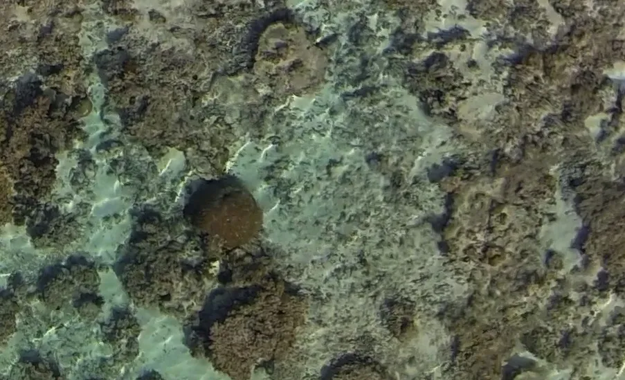
A flying drone the size of a shoebox has captured astonishingly detailed images of 300-year-old coral living beneath the waters off American Samoa in the South Pacific.
The new technology could allow scientists to map the world's coral reefs, enabling scientists to predict their health and the health of the ecosystems that the reefs anchor.
"These corals are time machines that were living before European culture discovered the Samoan Islands," Stephen Palumbi, a researcher at the Stanford Woods Institute, who helped conduct the drone study said in a statement. "What do they have to tell us about that long-ago time? What do they tell us about the likely future?" [Colorful Creations: Incredible Coral Photos]
Coral reefs sustain about a quarter of all marine life and are shelter for more than 4,000 species. The fish that live within coral reefs are an important food staple for about 500 million people around the world.
Yet despite their crucial role in the marine ecosystem, coral reefs are mostly unmapped. Hand-mapping or photographing reefs is incredibly tedious, time-consuming and potentially inaccurate, while satellite imagery gets muddled by waves. Radar can't penetrate the water's surface and sonar fails in shallow areas.
To get around these limitations, Palumbi and Stanford aeronautics graduate student Ved Chirayath developed a tiny, remote-controlled drone that can film coral reefs from up to 200 feet (61 meters) above the ocean.
But ripples on the water create distortion and blur that make the drone images difficult to interpret. So after the images were gathered, Chirayath used a technique called fluid lensing to digitally remove those distortions and sharpen the images.
Get the world’s most fascinating discoveries delivered straight to your inbox.
"The lensing takes a huge problem in looking through the surface of the water and turns it into an advantage," Palumbi said. "It not only removes the ripples, but uses their magnification to enhance the image," he added, referring to the fact that objects underwater tend to appear closer than they are because of how light bends when it moves from air to water.
The researchers then used a 360-degree camera to photograph the reefs from underwater.
Combining the images from both the drone and the underwater camera, the team produced gorgeous panoramic images of the reefs surrounding a marine protected area in American Samoa around Ofu Island.
The corals, some of which are 15 to 20 feet (4.5 to 6 m) wide, live in a reef called the "Village of Elders" that seems perfectly suited to these ancient corals.
As a follow-up, the team plans to combine data on water temperature and water flow with the images to see how climate change alters the reef ecosystem.
Follow Tia Ghose on Twitter and Google+. Follow LiveScience @livescience, Facebook & Google+. Original article on LiveScience.

Tia is the editor-in-chief (premium) and was formerly managing editor and senior writer for Live Science. Her work has appeared in Scientific American, Wired.com, Science News and other outlets. She holds a master's degree in bioengineering from the University of Washington, a graduate certificate in science writing from UC Santa Cruz and a bachelor's degree in mechanical engineering from the University of Texas at Austin. Tia was part of a team at the Milwaukee Journal Sentinel that published the Empty Cradles series on preterm births, which won multiple awards, including the 2012 Casey Medal for Meritorious Journalism.