Gallery of the Craziest Clouds

Face in the clouds
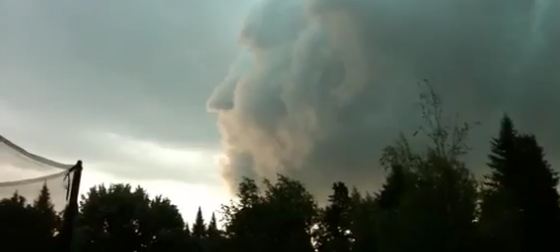
Last August in New Brunswick, Canada, YouTube user "denisfarmer" shot a video of what may be themost convincing "face in the clouds" ever. As a storm front moved across the sky, a man's profile seemedto emerge.
Totally tubular
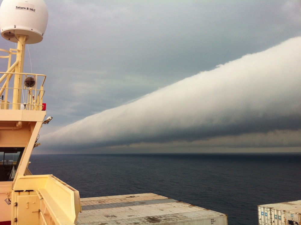
In February, a rare and beautiful "roll cloud" was photographed low in the sky above the AtlanticOcean near Brazil. Roll clouds are often born out of a storm's downdraft. Sinking cold air causes warm,moist air near the ocean's surface to rise, and when the air reaches higher altitudes, the moisture in itcondenses to form a cloud. Winds from the storm then roll the cloud into a tube.
Heavenly halo
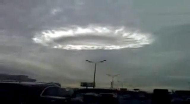
UFO believers took a strong interest in this strange cloud formation when it appeared over Moscow in2009. But meteorologists identified the ring of light as an optical effect caused by sunlight hitting whatis known as a hole punch cloud. These appear as a circular or oval hole in a thin layer of air containingsupercooled water droplets. When a section of the layer is disturbed, such as by wind or a jet planepassing through it, the droplets can freeze instantly or evaporate, leaving behind a hole.
Top hat in the sky

A cloud shaped like a top hat formed over Mount Fuji, Japan on June 21. Such formations, calledlenticular clouds, typically occur when moist air flows over a mountain and condenses.
Riding a volcano

Astronauts on board the International Space Station took this awesome photo of Sarychev volcano in Russia's Kuril Islands just at it started to erupt in 2009. The photo also captured some rather unusual atmospheric activity at the top of theash plume. According to NASA, the smooth white cloud atop the vigorously rising plume may be water condensation that resulted from rapid rising andcooling of the air mass above the ash column, and is probably a transient feature. As for the surroundingatmosphere, it has been shoved outward by the shock wave from the eruption.
Sky tsunamis
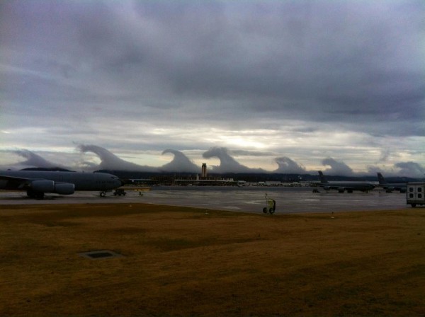
A series of huge breaking waves lined the horizon in Birmingham, Ala., last December, but they werein the sky, not the ocean. The incredible cloud formations were pristine examples of "Kelvin-Helmholtzwaves," which develop when a fast-moving layer of fluid slides on top of a slower, thicker layer, draggingits surface and causing crests of the thick layer to lurch forward.
Sky tsunamis
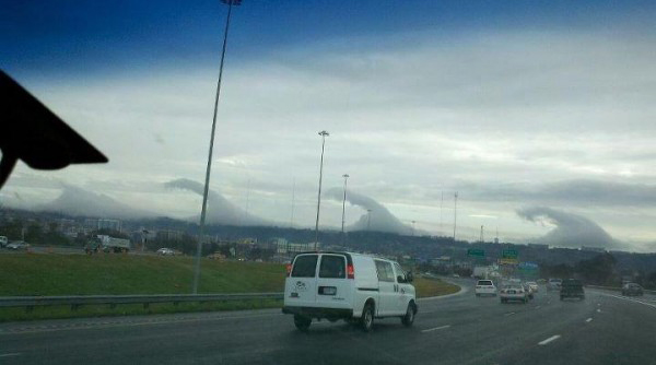
Another photo of tsunami-shape clouds that formed near Birminghal, Ala., in December.
Get the world’s most fascinating discoveries delivered straight to your inbox.
Sky tsunamis
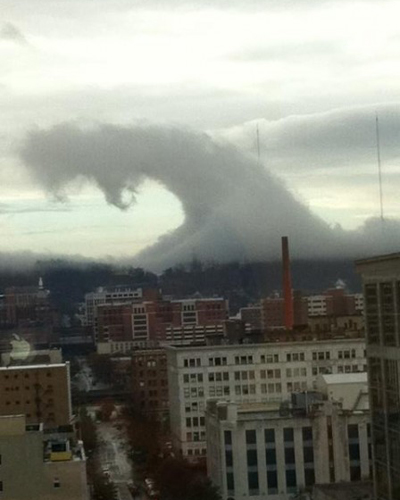
Another photo of tsunami-shape clouds that formed near Birminghal, Ala., in December.
Don't mess with Texas
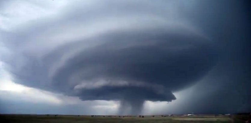
This ominous cloud formation is the most severe type of thunderstorm: a supercell. It developed in Mayin the Texas panhandle, and gave rise to at least one twister. "What you are seeing here is a well-developedrotating supercell thunderstorm, and the condensation pattern at cloud base forms a 'belt' or 'wall'appearance as air is lifted and sucked into the swirling storm," said Chris Walcek, a meteorologist at theAtmospheric Sciences Research Center at the State University of New York, Albany.
Cloud lumps
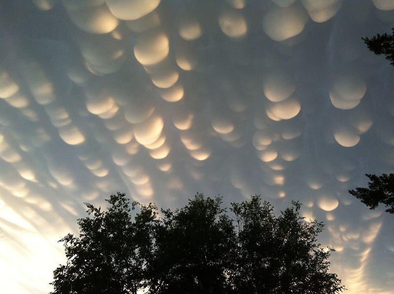
These "mammatus clouds" were photographed in the city of Regina, Saskatchewan, in June 2012, following a severe storm warning and tornado watch. Although their formation is not completely understood, these rare clouds usually develop at the base of a thunderstorm, and appear lumpy because of instabilities and temperature differences between sinking and rising air.

Natalie Wolchover was a staff writer for Live Science from 2010 to 2012 and is currently a senior physics writer and editor for Quanta Magazine. She holds a bachelor's degree in physics from Tufts University and has studied physics at the University of California, Berkeley. Along with the staff of Quanta, Wolchover won the 2022 Pulitzer Prize for explanatory writing for her work on the building of the James Webb Space Telescope. Her work has also appeared in the The Best American Science and Nature Writing and The Best Writing on Mathematics, Nature, The New Yorker and Popular Science. She was the 2016 winner of the Evert Clark/Seth Payne Award, an annual prize for young science journalists, as well as the winner of the 2017 Science Communication Award for the American Institute of Physics.

 Live Science Plus


