
 Live Science Plus


Image Gallery: Curious Clouds

Lenticular Clouds

This spectacular, multi-hued formation of so-called lenticular clouds was observed over Rocky Mountain National Park, near Estes Park, Colo. Professional photographer Richard H. Hahn snapped the magnificent view soon after sunset at 5:02 p.m. MST (7:02 EST) on Jan. 5.
Lenticular clouds form when waves of moist, fast-moving air are pushed upward by winds and ascend over high mountains. At the mountain's higher altitude, the moist air's water droplets cool and expand, and the water vapor condenses. When the air moves over the mountain top and descends to uniformly humid air conditions, lenticular clouds form.
These clouds are characterized by their smooth, symmetrical oval or round shapes, and because of this, are often referred to as "flying saucer" or "UFO" clouds.
"The significance of this particular atmospheric event was the dramatic shape and color of the cloud. It really did look like the 'mother ship' UFO," Hahn told LiveScience.com. "It was ominous and breathtaking."
Spooky UFO Clouds

Lenticular clouds, like the ones seen in Antarctica (shown here), are so smooth and round that they're sometimes mistaken for UFOs. Like some other cloud formations, including wave clouds, lenticular clouds form because of the vagaries of winds around mountain peaks.
Shelf Cloud

Approaching thunderstorm with lead gust front. Rain-cooled air from the storm moves out ahead of the storm. It ploughs under the warm moist air forming a flat "shelf cloud."

Cloud Over the Desert

A localized rainstorm over the Arizona desert in 2008.
Globular Mammatus

Globular mammatus clouds with radar in foreground. Often associated with thunderstorms and severe weather.
More mammatus

Globular mammatus clouds. These clouds are often associated with thunderstorms and severe weather.
Mother-of-Pearl Clouds
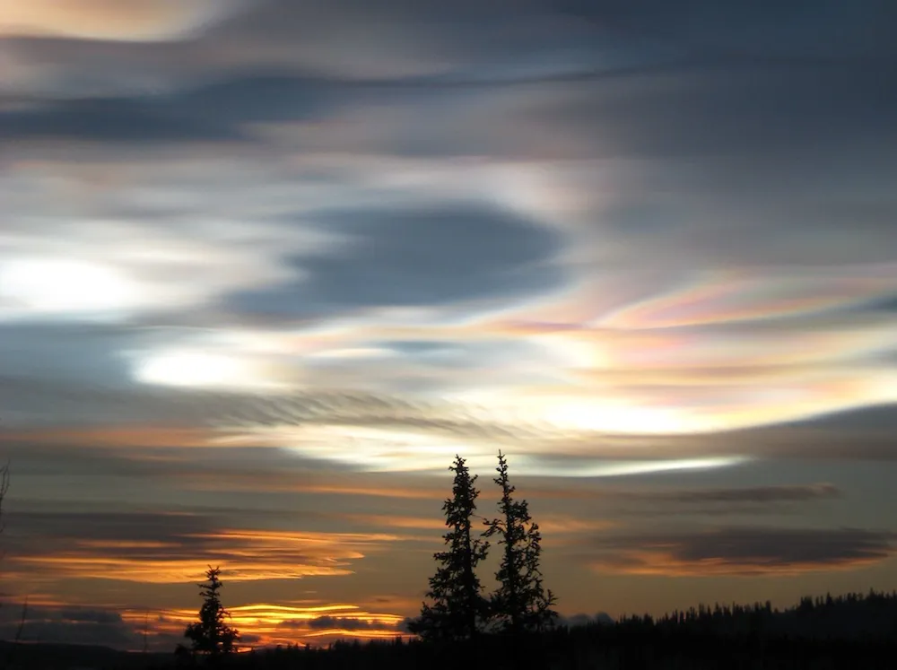
Clouds over Estrange, Sweden in January, 2011.
Get the world’s most fascinating discoveries delivered straight to your inbox.
Thickness in the Air

Thick wave clouds are captured over Mt. Pisgah.
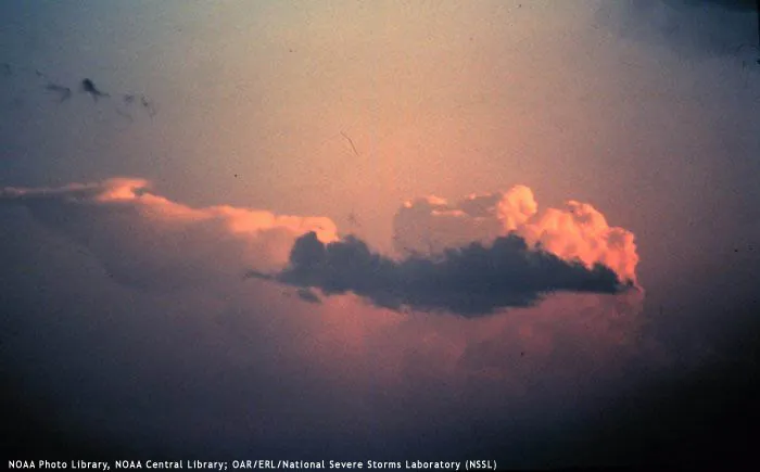
The Anvil

Towering cumulus. Mammatus clouds visible under the "anvil".
Thunderstorms Form
Cumulonimbus (Thunderstorm) is shown forming in the background. Smaller low level "scud" appearing in foreground.
Tornado Next?

Lowering wall cloud under main thunderstorm updraft. Tornadoes will generally form in and ground the wall cloud.
