


Stunning Weather Channel Video Shows Why Storm Surges Are So Dangerous
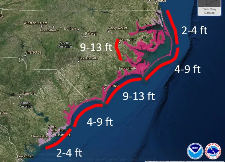
A National Hurricane Center graphic shows where significant storm surges are likely.
(Image credit: NOAA)
A hurricane can kill you in a lot of different ways. And even though meteorologists sort storms into categories by the strength of their winds, it's actually the storm surge that's most dangerous, as AccuWeather reported.
Hurricanes can push masses of water from the sea over land when they come ashore, raising local sea levels by as much as 20 feet (6 meters), according to the National Hurricane Center. But even much lower flood levels can be dangerous and reach surprisingly far inland, as The Weather Channel demonstrated in a stunning video released today. [Hurricane Florence: Photos of a Monster Storm]

TOPICS
