Hurricane Florence: Photos of a Monster Storm
Category 4
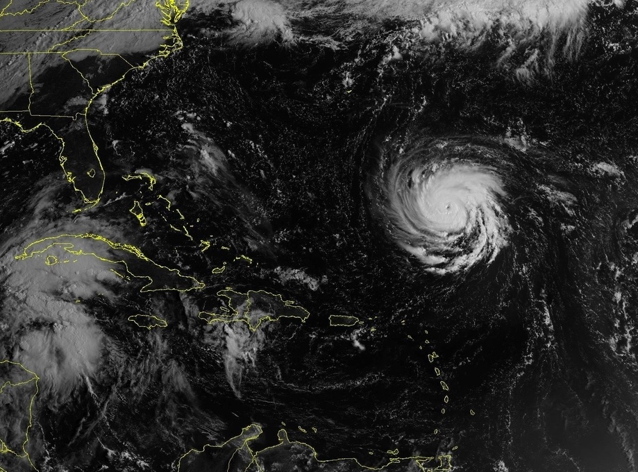
Hurricane Florence strengthened into a Category 4 storm, with maximum sustained winds reaching 140 mph (220 km/h) on Monday (Sept. 10). It continues to strengthen and is barreling toward the southeastern U.S. coast, where forecasters expect a life-threatening storm surge, major flooding and damaging winds later this week. Here's a look at the monstrous storm. [Stay up to date on Hurricane Florence news]
Still strengthening
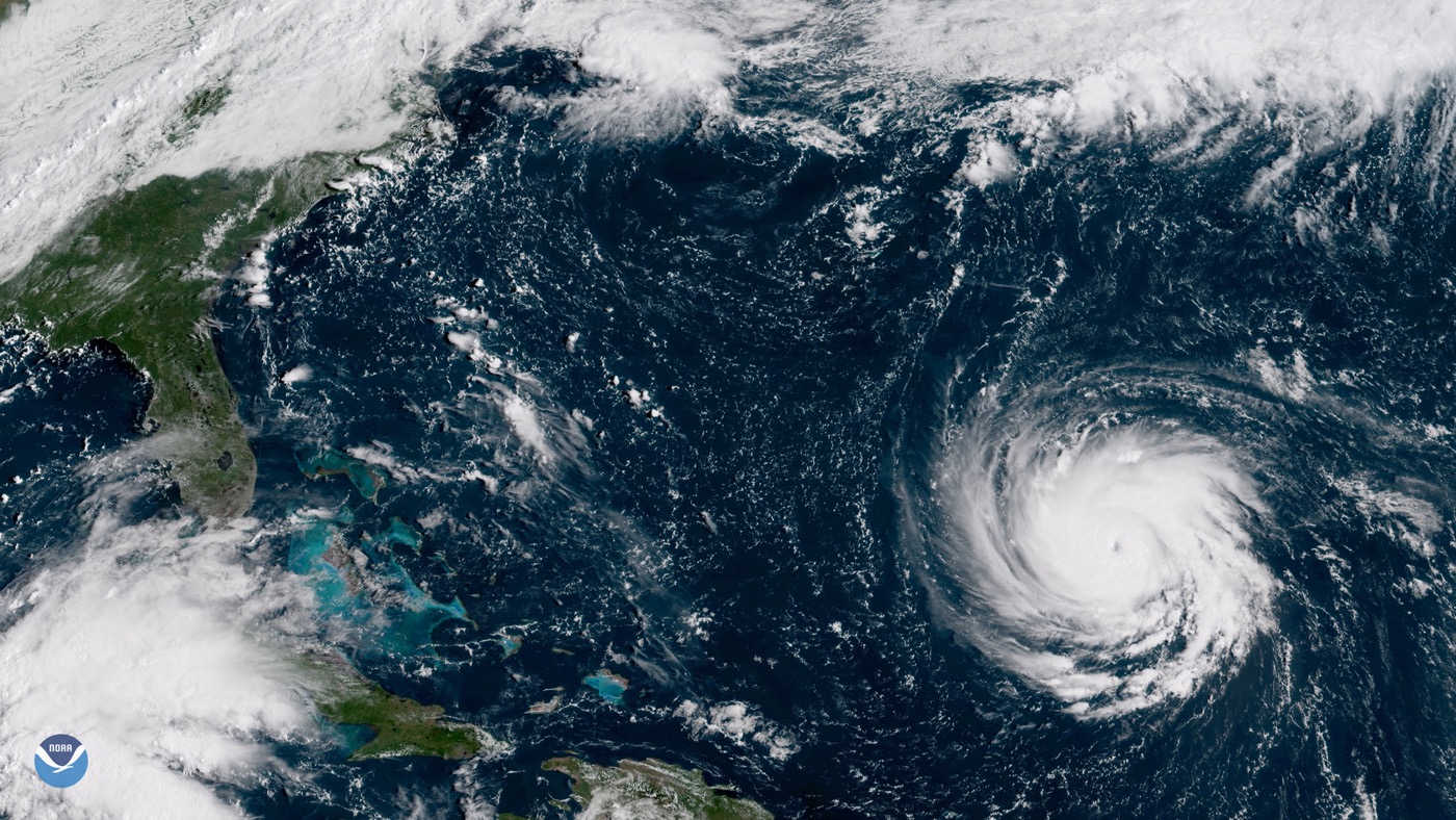
The GOES East satellite captured this image of Hurricane Florence at 10 a.m. ET Monday, showing the then-Category 3 storm in the western Atlantic, about 600 miles southeast of Bermuda. At that time, you can see the storm had developed a small, but well-defined eye and "a symmetrical appearance typical of major hurricanes that are rapidly intensifying," NOAA said.
Florence from space
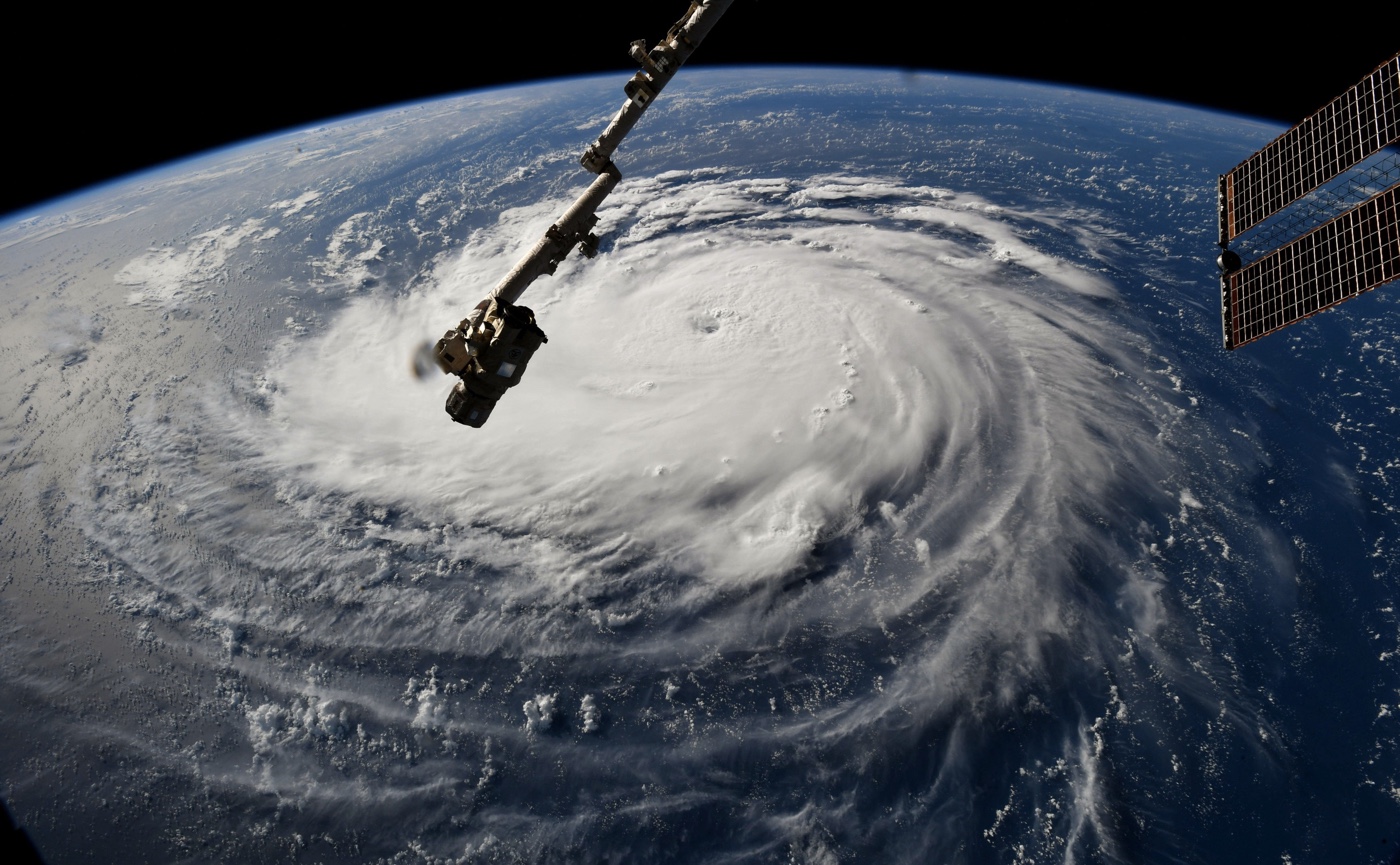
Astronaut Ricky Arnold got a glimpse of Florence from space, capturing this image while aboard the International Space Station on Sept. 10. Arnold tweeted, "Hurricane #Florence this morning as seen from @Space_Station. A few moments later, #Isaac & the outer bands of #Helene were also visible."
Article continues belowOn the move
Another dramatic view of Hurricane Florence, this one captured on Sept. 10 at 8:10 a.m. EDT as the storm was moving in the westerly direction across the Atlantic.
Astronaut's view
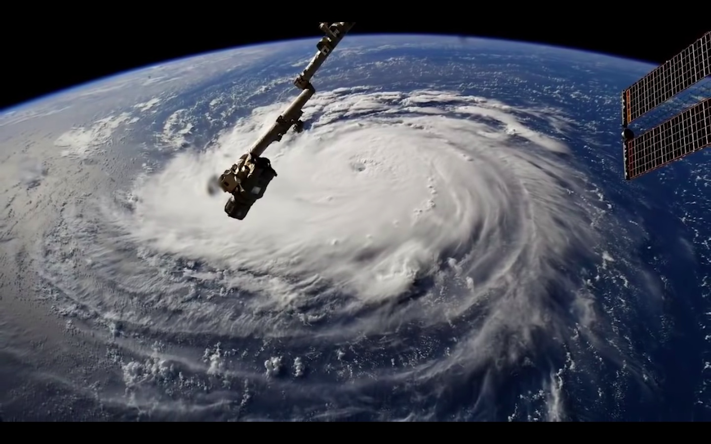
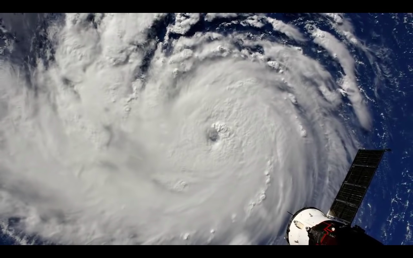
When this image was captured by cameras outside the International Space Station, the morning of Sept. 10, Hurricane Florence had maximum sustained winds reaching 115 mph. The ISS was flying about 255 miles above the storm when the video (video still shown here) was captured.
Giant cotton ball
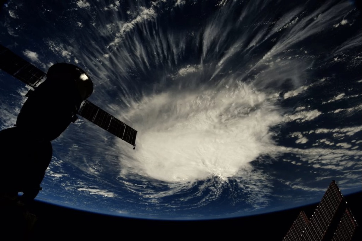
On Sept. 6, when astronaut Scott captured this image from the International Space Station, Hurricane Florence resembled a giant cotton ball. At the time, Florence was a Category 2 hurricane, located about 1,100 miles (1,770 kilometers) east-southeast of Bermuda.
Hurricane Hunter
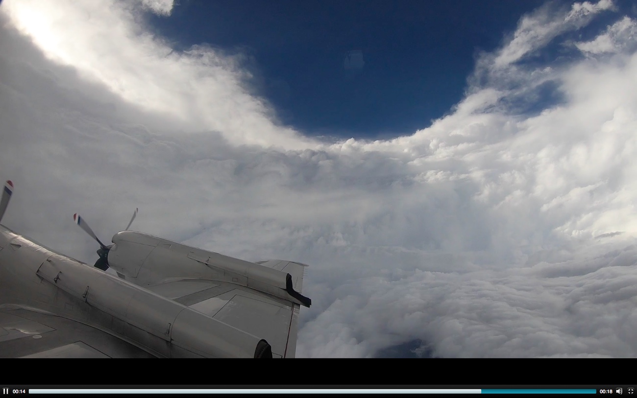
On Sept. 10, NOAA's Hurricane Hunter aircraft flew right through the violent wind and rain in Florence's outer bands to slice right through the eye of Hurricane Florence, revealing the vastness of the storm, as well as sunny skies beyond it. These aircraft are equipped with special equipment for collecting all kinds of weather data, including pressure, humidity, temperature, and wind direction and speed.
Get the world’s most fascinating discoveries delivered straight to your inbox.
Inside an eye
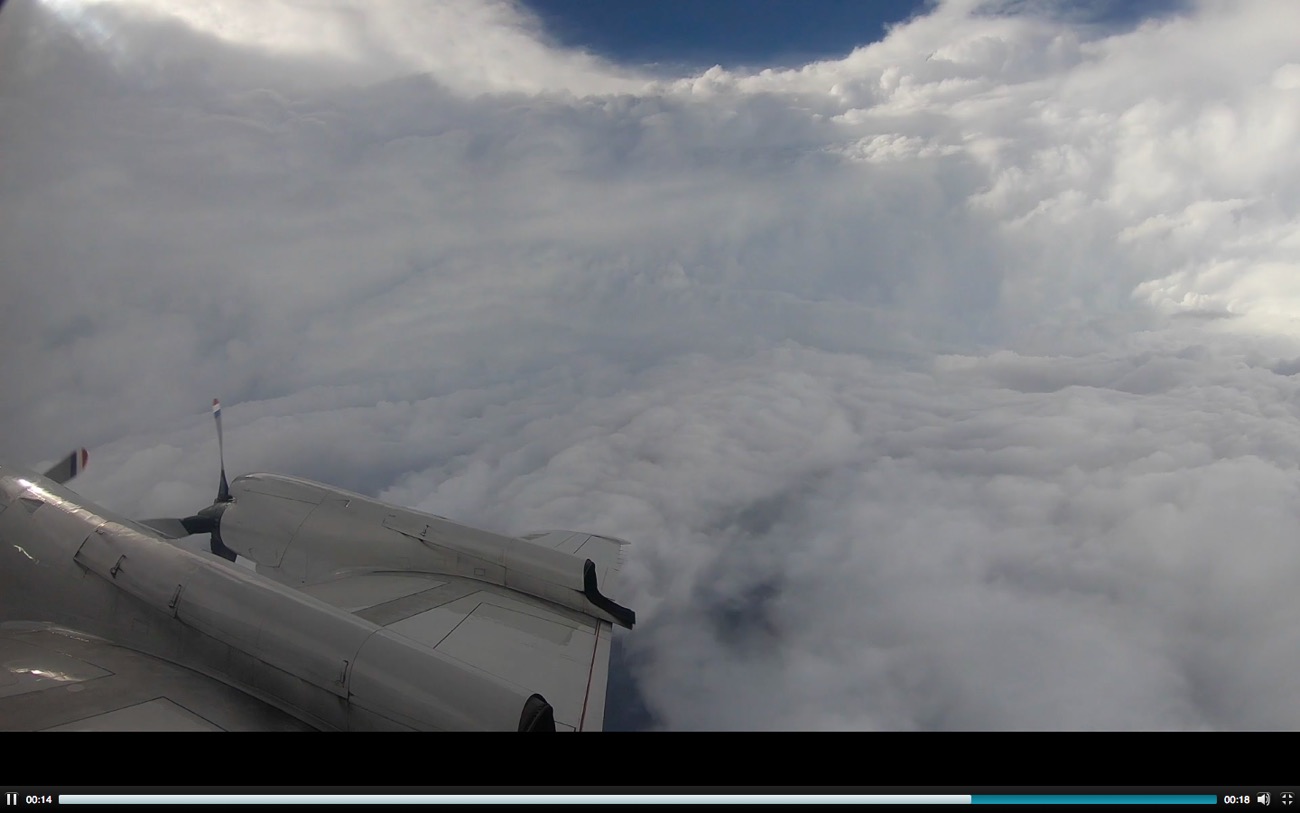
Another look at the Sept. 10 trip by NOAA's Hurricane Hunter through the powerful Hurricane Florence. Measurements taken during these flights provide a detailed look at a storm's structure and intensity, according to NOAA. The resulting measurements even help scientists calculate possible storm surge related to the hurricane.
Sobering view
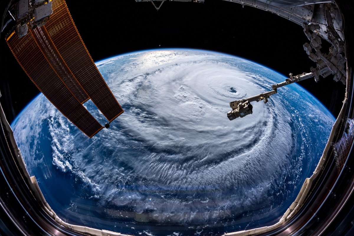
The Category 4 hurricane, Florence, can be seen while trucking toward the U.S. Southeast Coast on Sept. 12, 2018. The image was captured from an external camera aboard the International Space Station.
Wide angle
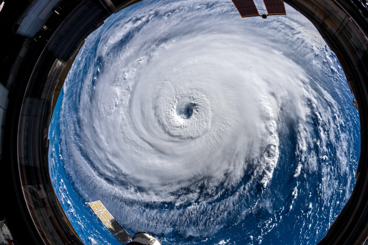
Hurricane Florence is so enormous, an astronaut aboard the International Space Station could only capture the entire storm with a super wide-angle lens, 250 miles (400 kilometers) directly above the eye. "Get prepared on the East Coast, this is a no-kidding nightmare coming for you," Alexander Gerst, an EU scientist on the International Space Station, tweeted.
Gaping eye
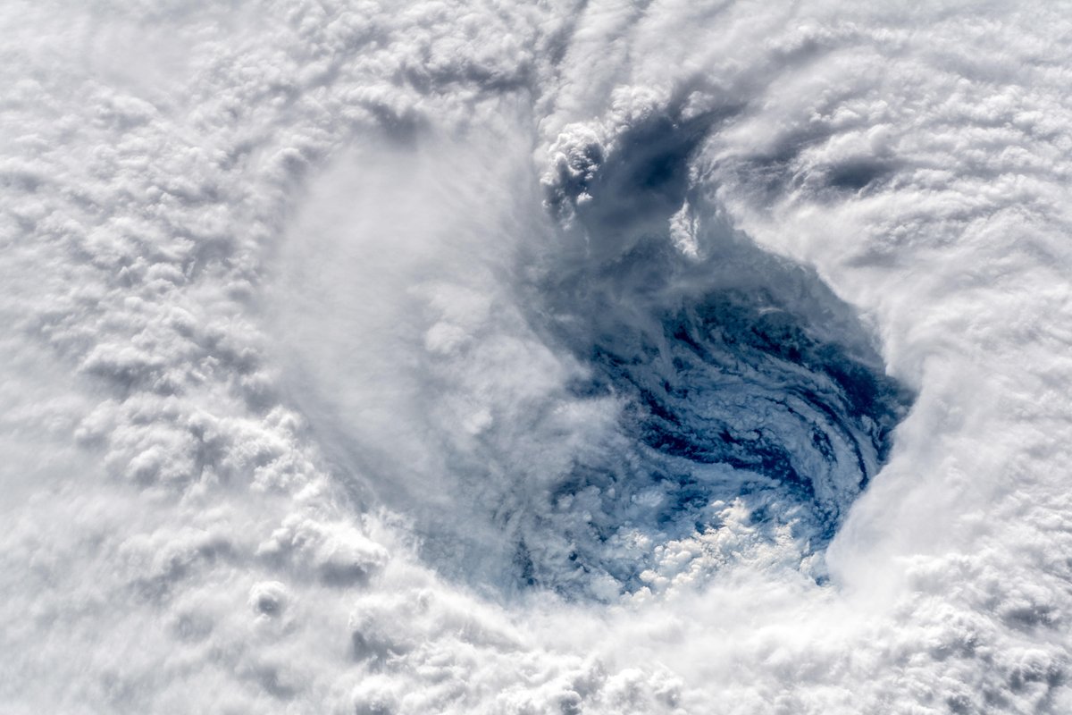
"Ever stared down the gaping eye of a Category 4 hurricane? It's chilling, even from space," Alexander Gerst, an EU scientist on the International Space Station, tweeted. Here, the eye of Florence is shown as it appeared on Sept. 12, 2018.
Jeanna Bryner is managing editor of Scientific American. Previously she was editor in chief of Live Science and, prior to that, an editor at Scholastic's Science World magazine. Bryner has an English degree from Salisbury University, a master's degree in biogeochemistry and environmental sciences from the University of Maryland and a graduate science journalism degree from New York University. She has worked as a biologist in Florida, where she monitored wetlands and did field surveys for endangered species, including the gorgeous Florida Scrub Jay. She also received an ocean sciences journalism fellowship from the Woods Hole Oceanographic Institution. She is a firm believer that science is for everyone and that just about everything can be viewed through the lens of science.