














Severe Tropical Cyclone Ita Menaces Northern Australia

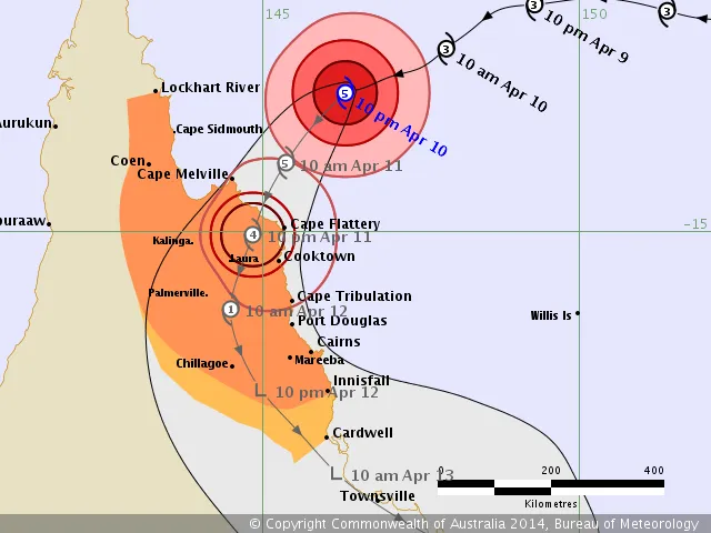
A severe tropical cyclone with winds equivalent to a Category 5 hurricane will hit the northeast coast of Australia tonight, forecasters predict. Tropical Storm Ita is expected to make landfall between Cape Melville and Cape Tribulation on the evening of April 11 local time, according to the Australian Bureau of Meteorology (BOM). Winds could reach 173 mph (280 km/h) when the storm lashes the coast, the BOM said in a statement. Category 5 hurricanes have winds greater than 157 mph (252 km/h).
Ita is the latest in a string of powerful late-season tropical storms in the Pacific in recent years. Studies have suggested that rising sea-surface temperatures may lengthen the tropical storm season. In Australia, the tropical cyclone season typically runs from November through April.
The Queensland coast is relatively unpopulated, with about 9,000 people directly in Ita's path, but government helicopters are flying to remote beaches to warn campers of the approaching storm, according to news reports. Flooding from storm tides and flash flooding from heavy rains will threaten coastal residents and towns through the weekend.
There is a strong chance that Ita's landfall will coincide with a 7 p.m. high tide, boosting storm surge flooding, the Guardian reported. Before spinning up into a severe tropical cyclone, Ita also triggered deadly flooding in the Solomon Islands.
Email Becky Oskin or follow her @beckyoskin. Follow us @livescience, Facebook & Google+.
Get the world’s most fascinating discoveries delivered straight to your inbox.
