It's quick and easy to access Live Science Plus, simply enter your email below. We'll send you a confirmation and sign you up for our daily newsletter, keeping you up to date with the latest science news.
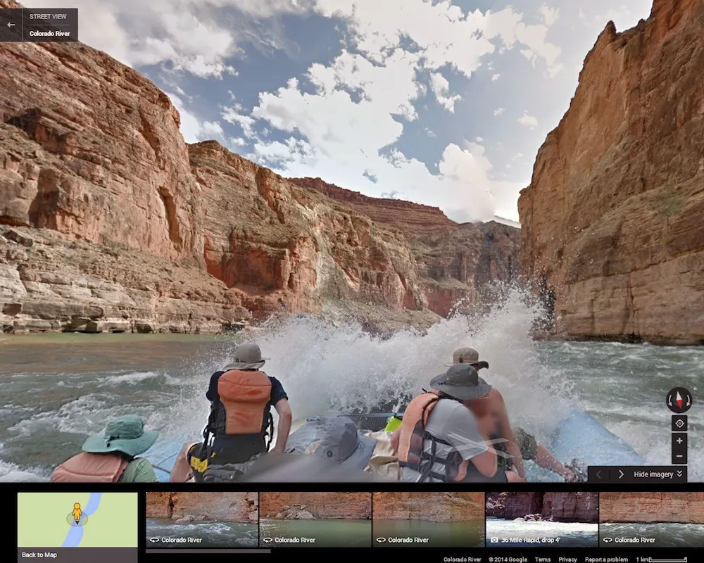
Anyone with an Internet connection can now raft through rivers traversing the Grand Canyon, without getting wet: Google Maps and the nonprofit group American Rivers have launched a "Street View" of the Colorado River.
Colorado River View, as it is called, takes users through 286 miles (460 kilometers) of river. There are also Street View-style photos of five popular side trails, including the Nankoweap Granaries, storerooms built into the side of the canyon by ancient Anasazi people.
The project was first pitched by Devin Dotson, the associate director of communications for American Rivers, after he attended a meeting with the Google Earth Outreach team, which works with nonprofits and other organizations. The team was looking for new ways to use Google Street View, Dotson told Live Science. He suggested rafting a river — specifically, the Colorado River. [See Images from Colorado River View]
"They had been wanting an excuse to do the Colorado River through the Grand Canyon, but couldn't figure out how and why," Dotson said. "So they said yes, let's do this."
Endangered river
American Rivers has named the Colorado as one of its Most Endangered Rivers of 2013. Water from the river supports 15 percent of U.S. agriculture and provides drinking water to 36 million people, said Chris Williams, the nonprofit's senior vice president for conservation. With so much demand, the waters of the Colorado River no longer flow into the Gulf of California.
"There are just too many straws in the drink," Williams told Live Science.
Sign up for the Live Science daily newsletter now
Get the world’s most fascinating discoveries delivered straight to your inbox.
There are efforts to restore this river ecosystem. The United States and Mexico have agreed to an experimental water release on March 23 that will send a pulse of life-giving liquid into the Colorado River Delta in Mexico. The goal is to restore the delta's wetlands habitat, allowing native trees to recolonize the arid region.
But the pulse is not a long-term fix. A growing population in the West means the Colorado River needs a more sustainable management plan, Williams said. Climate change, which is expected to dry out the already-arid West, will only exacerbate future water-management problems, Williams added.
Ride the rapids
The Grand Canyon and Colorado River as seen from the Nakoweap granary overlook.
(Image credit: credit Devin Dotson, American Rivers)
Raising awareness of the Colorado's grandeur and challenges was the goal of the partnership with Google, Dotson said. In August 2013, bearing two of Google's specialized Trekker cameras attached to rafts by a custom mount, Dotson and Williams joined others from American Rivers and Google Maps. Over eight days, the team, led by the outfitter Arizona River Runners, collected snapshots of the scenery every few seconds, which was later stitched together to provide the 360-degree navigable views familiar to any Street View user.
The first rapids were a bit nerve-racking, Dotson said. "You're realizing you have this very important piece of machinery strapped to your raft," he said. — But the Trekkers made it through just fine. One of the most magical moments of the trip occurred when the rafts traveled through a sudden squall. The clouds were spotty, letting a few luminous rays of sunlight through, and the views (and resulting Google images) were gorgeous, Williams said.
"It turned out to be some very beautiful imagery, because the desert in the rain is not something that many people get to experience," Dotson said.
The team also trekked up five side paths, including the Nankoweap granaries. They even snapped shots of bighorn sheep picking their way along the canyon walls. The photos are now incorporated into Google Maps. Alternatively, wannabe river explorers can start with 25 of the coolest shots and spots to explore.
Stephanie Pappas is a contributing writer for Live Science, covering topics ranging from geoscience to archaeology to the human brain and behavior. She was previously a senior writer for Live Science but is now a freelancer based in Denver, Colorado, and regularly contributes to Scientific American and The Monitor, the monthly magazine of the American Psychological Association. Stephanie received a bachelor's degree in psychology from the University of South Carolina and a graduate certificate in science communication from the University of California, Santa Cruz.

 Live Science Plus