It's quick and easy to access Live Science Plus, simply enter your email below. We'll send you a confirmation and sign you up for our daily newsletter, keeping you up to date with the latest science news.
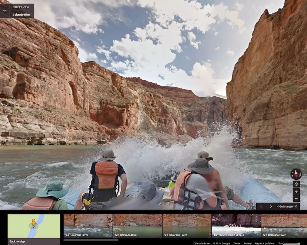
A screengrab from Google Maps' new Colorado River View, which allows users to navigate along 286 miles (460 kilometers) of the Colorado River, including the Grand Canyon.
Colorado River View
(Image credit: Google Maps)
The front half of the Google Maps raft seen on Google's new Colorado River View, which launched March 13. This shot was taken at 36 Mile rapid.
Vulcans Anvil
(Image credit: Google Maps)
Vulcan's Anvil, a volcanic remnant 50 feet (15 m) tall in the middle of the Colorado River.
Stephanie Pappas is a contributing writer for Live Science, covering topics ranging from geoscience to archaeology to the human brain and behavior. She was previously a senior writer for Live Science but is now a freelancer based in Denver, Colorado, and regularly contributes to Scientific American and The Monitor, the monthly magazine of the American Psychological Association. Stephanie received a bachelor's degree in psychology from the University of South Carolina and a graduate certificate in science communication from the University of California, Santa Cruz.

 Live Science Plus