


Mid-Atlantic Has a White St. Patrick's Day (Video)
Instead of wearing green for St. Patrick's Day, the Mid-Atlantic wore a coat of snow white. A late winter snowstorm, captured in a new NASA video, brought between 6 and 12 inches (15-30 centimeters) of snow to areas spanning from Baltimore, Md., to Richmond, Va.
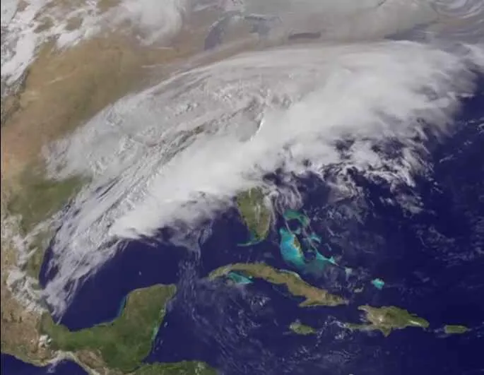
The National Ocean and Atmospheric Administration's GOES-East satellite captured the path of the storm, which swept in the evening of March 16 and continued through St. Patrick's Day, March 17. The NASA/NOAA GOES Project at NASA's Goddard Space Flight Center in Greenbelt, Md., compiled imagery taken March 15-17 to create the video.
More than 7 inches (18 cm) of snow fell in Washington, D.C., making it the third biggest snow so late in the season on record, according to The Washington Post's Capital Weather Gang blog. Reagan National Airport in Virginia (Washington, D.C.'s official weather station) got 7.2 inches (18.3 cm) of snow in this storm. The only times the city has gotten more snow so late in the year since records began in 1888 were March 28-29, 1942 and March 27-28, 1891. [The 10 Worst Blizzards in US History]
The National Weather Service issued a Winter Storm Warning for areas including Cecil County to Frederick County, Md., that was still in place as of 1 p.m. EDT March 17. The warning also spanned the Virginia counties of Clarke, Warren, Raphahannock, Madison and Albemarle. Counties south of Fredericksburg, Va., were under a Winter Weather Advisory.
The GOES-East satellite orbits the Earth at a fixed position, capturing visible and infrared imagery over the eastern United States and Atlantic Ocean.
To make the video, NASA/NOAA's GOES Project overlaid cloud data from GOES-East on a true-color image taken by the Moderate Resolution Imaging Spectroradiometer (MODIS) instrument aboard NASA's Aqua and Terra satellites.
Follow Tanya Lewis on Twitter and Google+. Follow us @livescience, Facebook & Google+. Original article on Live Science.
Get the world’s most fascinating discoveries delivered straight to your inbox.
