 Live Science Plus


Surprise: Louisiana Sinkhole Slid Sideways Before Collapsing
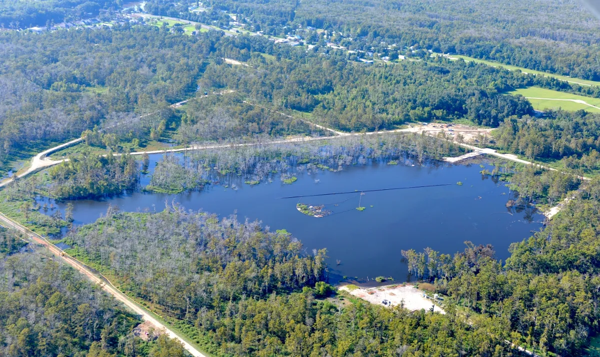
The Earth's surface slid sideways by as much as 10 inches (26 centimeters) before collapsing into a still-growing toxic sinkhole in Bayou Corne, La., a new study reports.
"This was unusual for us," said Cathleen Jones, a radar scientist at NASA's Jet Propulsion Laboratory in Pasadena, Calif. "Usually at a sinkhole, we expect to see vertical movement at the surface, some sort of subsidence," Jones said. "This horizontal motion is actually a new indicator people should be aware of."
Article continues belowThe subtle surface changes revealed in the new study, published in the Dec. 13 issue of the journal Geology, could improve models of how the sinkhole formed, Jones said. "I think this can tell you something about the path between the cavern collapse, which is about a mile deep, and the surface," she said. The sideways flow was like water slipping into a bathtub drain, Jones said. "The fact that the movement was toward a center point might tell you something about the geometry of the path that went down to the void," she said. The subtle flow forms a pattern like a two-leafed clover, consistent with a cavern sidewall collapse as suspected by the USGS, Jones and NASA colleague Ronald Blom report.

The pit also opened into a natural underground oil reservoir, releasing oil and toxic gases such as methane and hydrogen sulfide. Louisiana declared a state of emergency, evacuating 350 people from the nearby town of Bayou Corne after the sinkhole appeared on Aug. 3, 2012. A class-action lawsuit against mining companies Texas Brine and Occidental Chemical was filed in federal court in May 2013, as residents still cannot return to their homes. The sinkhole is still growing, gobbling up trees and threatening Highway 70 south of Baton Rouge. [Video: Bayou Corne Sinkhole Swallows Trees]
Serendipity
Jones and Blom caught the imminent collapse of the Bayou Corne sinkhole with an airborne radar system. Their discovery of the surface changes was a lucky break.
The sinkhole emerged in a part of the Mississippi Delta where NASA tracks sinking called subsidence, which could help improve levees. (The Earth's crust is sinking for a variety of reasons, including the massive weight of sediments delivered by the Mississippi River.) A plane equipped with a radar imaging system (called UAVSAR) regularly measures surface height in the Delta. The sensor sends microwave energy pulses from the sensor on the aircraft to the ground, and can detect small changes over time.
When Jones first learned of the sinkhole in April 2013, she suspected that NASA's radar data would have little to show, because the soggy ground in Louisiana's swamps interferes with radar imaging. Turns out she was wrong.

"The signal was so big it overwhelmed all that noise [from the soil moisture]," Jones said. "When I looked at the data, I thought, 'Wow, this is an enormous signature.' I couldn't believe it."
"The whole area was being pulled toward the sinkhole," Jones added.
Because the plane flew over Bayou Corne about once every year, the researchers can't say precisely when the Earth moved. But they do know that the surface shifted after June 23, 2011, and before July 2, 2012. There was no surface movement before 2011.
The good news for Bayou Corne is that this year's flight shows ground deformation around the sinkhole concentrates away from the town and Highway 70, Jones said. "We definitely don't see much movement along the road yet," she said.
Email Becky Oskin or follow her @beckyoskin. Follow us OurAmazingPlanet @OAPlanet, Facebook and Google+. Original article at Live Science's OurAmazingPlanet.

