In Brief

Tropical Cyclone Phailin Barrels Toward India

Tropical Cyclone Phailin forecast path
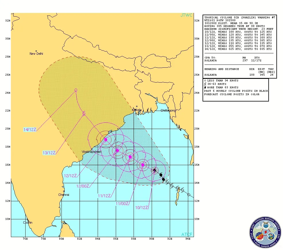
The projected path of Tropical Cyclone Phailin towards India as of 11:30 a.m. ET on Oct. 10, 2013. (Image credit: JTWC)

A potentially very dangerous tropical cyclone is churning its way toward northeastern India across the Bay of Bengal.

Tropical Cyclone Phailin is currently at a strength just equivalent to a Category 3 hurricane with sustained winds of about 115 mph (185 km/h), according to the Joint Typhoon Warning Center. Eric Holthaus, lead meteorologist for the news site Quartz, has said on Twitter that satellite estimates of the storm suggest it rapidly intensified, and could possibly actually be the equivalent of a Category 4 storm, with 140 mph (220 km/h) winds. Tropical cyclones and hurricanes are the same phenomenon (as are typhoons), but are called different names in different basins.

If the storm maintains this strength or intensifies further, it could wreak havoc on India's northeastern states with rough seas, storm surge and extreme rainfall. A 1999 super cyclone equivalent in strength to a Category 5 hurricane followed a similar path as Phailin is predicted to travel. That storm caused thousands of deaths, billions of dollars in damage and left more than a million homeless. It was the second cyclone to hit the area in as many weeks, the previous having been equivalent to a Category 4 storm.

Andrea Thompson
Live Science Contributor

Andrea Thompson is an associate editor at Scientific American, where she covers sustainability, energy and the environment. Prior to that, she was a senior writer covering climate science at Climate Central and a reporter and editor at Live Science, where she primarily covered Earth science and the environment. She holds a graduate degree in science health and environmental reporting from New York University, as well as a bachelor of science and and masters of science in atmospheric chemistry from the Georgia Institute of Technology.