Image Gallery: Moore, Okla., Tornado Damage - May 20, 2013
Get the world’s most fascinating discoveries delivered straight to your inbox.
You are now subscribed
Your newsletter sign-up was successful
Want to add more newsletters?
Join the club
Get full access to premium articles, exclusive features and a growing list of member rewards.
National Guard

Oklahoma National Guard Soldiers and Airmen respond to a devastating tornado that ripped through Moore, Okla., May 20, 2013.
Moore, OK, May 2013 Tornado
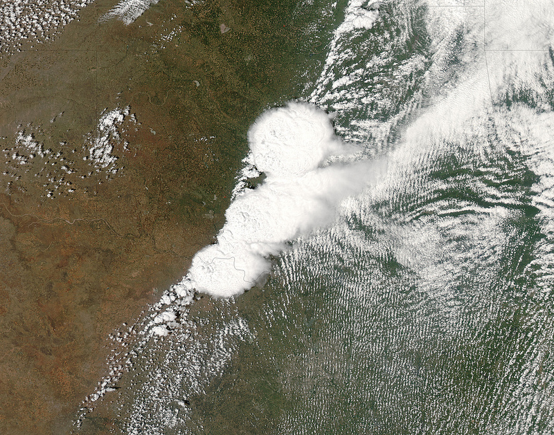
This is an image from NASA'S MODIS satellite of the storm system that generated the F-4 tornado in Moore, Oklahoma.
Moore, OK, May 2013 Tornado GOES image
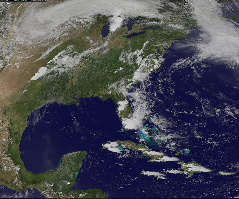
A line of thunderstorms that created the tornado is seen in the south central United States and resembles an exclamation mark. The tornado was generated near the bottom of that line of clouds.
Article continues belowSupercell
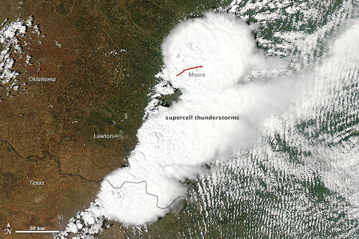
On May 20, 2013, a supercell thunderstorm in central Oklahoma spawned a destructive tornado that passed just south of Oklahoma City. The Moderate Resolution Imaging Spectroradiometer (MODIS) on NASA’s Aqua satellite acquired this image of the storm at 2:40 p.m. local time (19:40 UTC). The red line depicts the tornado’s track. The twister touched down west of Newcastle at 2:56 p.m. and moved northeast toward Moore, where it caused dozens of deaths and widespread destruction. The tornado had dissipated by 3:36 p.m., after traveling approximately 20 miles (32 kilometers).
Before and After

The Suomi National Polar-orbiting Partnership satellite or Suomi NPP satellite carries an instrument so sensitive to low light levels that it can detect lightning in the middle of the night. The Day/Night band on Suomi/NPP produces night-time visible imagery using illumination from natural (the moon, forest fires) and man-made sources (city lights, gas flares). The image on the LEFT shows city lights, cloud cover, and lightning during the early morning hours of May 20 prior to the storms over Moore, OK and the Oklahoma City area. The image on the RIGHT was taken during the early morning of May 21 and shows city lights in the Oklahoma City area, but reduced light output in Moore, Okla. as a result of the major tornado that occurred during the afternoon of May 20. Storms from earlier in the day had shifted eastward, still visible in the imagery.
Power Outages

When pre- and post-storm Suomi NPP imagery are combined in a 24-bit composite (May 20 and May 21, 2013), power outages in the Moore, Okla. area are evident in shades of yellow. Other areas appear yellow, such as Tulsa, Okla., but this is a result of changes in cloud cover between the two scenes.
Storm above Earth
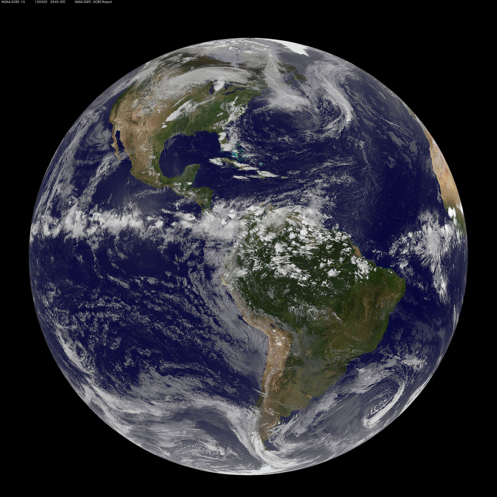
This full-disk image from NOAA's GOES-13 satellite at 3:45 p.m. EDT (20:45 UTC) shows the storm system in the south central United States on May 20, 2013, that generated the Moore, Okla., tornado. The Moore twister was a preliminary EF4 tornado (winds between 166 and 200 mph) that touched down around 2:52 p.m. CDT and dissipated around 3:36 p.m. CDT.
Get the world’s most fascinating discoveries delivered straight to your inbox.
Spin Speed
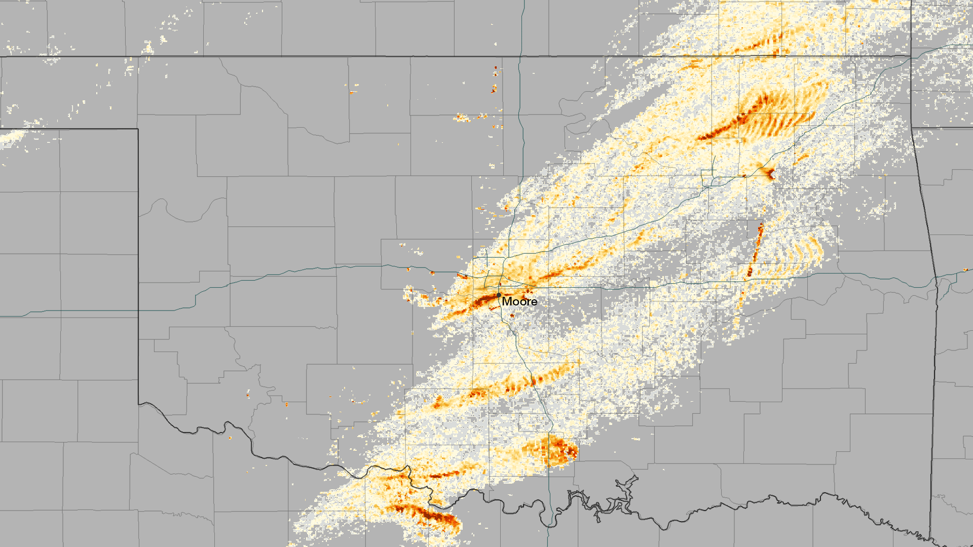
The rotation of tornadoes creates a distinctive signature in radar data, and can be used to estimate the track that the system takes over land. This image shows the rotational velocity of the systems that passed over Oklahoma on the afternoon of May 20, 2013. A single cohesive structure can be seen to cut across seven counties, with Moore directly in the middle.
Converging Air Masses
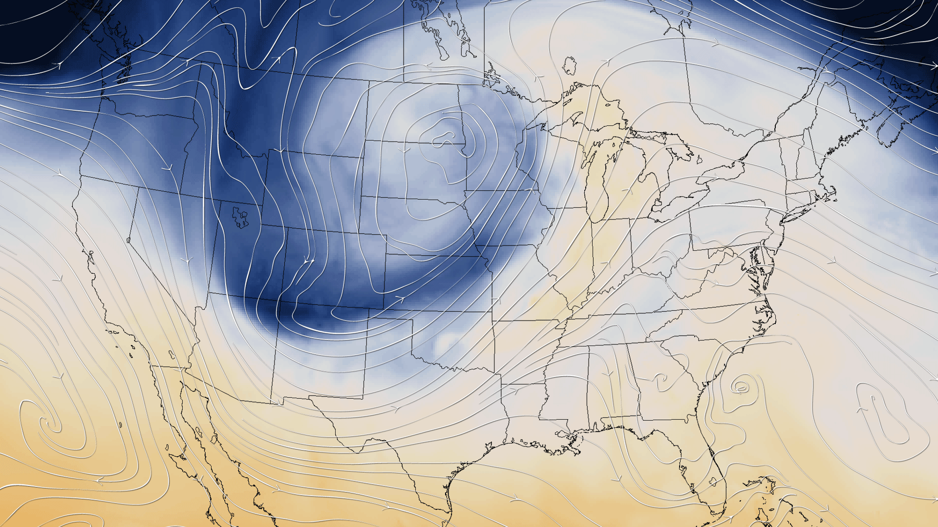
This image shows the air temperature at 40,000 Pascals (about 23,000 feet high in the atmosphere) using data outputs from the NOAA North America Model for 2100z on May 20, 2013, combined with an overlay of the winds at the same elevation. Tornadoes typically occur at the convergence of these two different air masses. A distinct boundary of "cold meeting warm" is visible in this temperature data, extending from Texas into Illinois.
Tornado Aftermath

Residents look through piles of debris in Moore, Okla., after an EF-5 tornado swept through the town on May 20, 2013.
 Live Science Plus


