Best Earth Images of the Month December 2012

Fiery reef
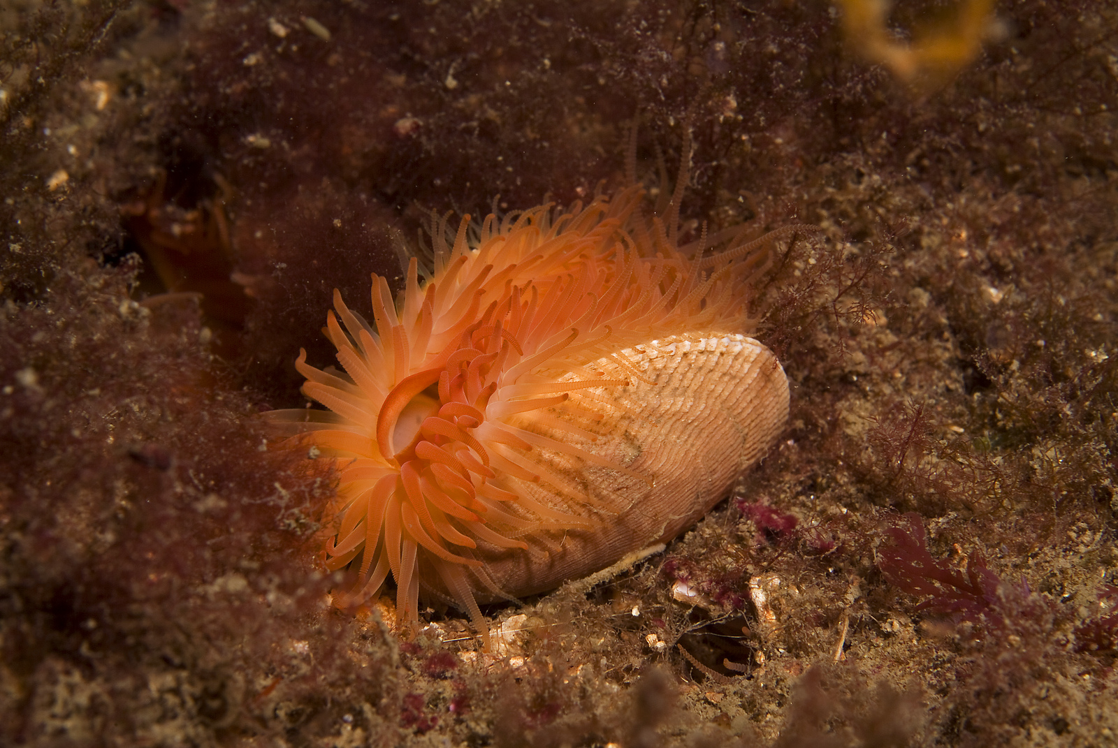
A huge, colorful shellfish reef discovered off Scotland's west coast could be the largest of its kind in the world, according to the Scottish government.
Packing at least 100 million bright-orange shells into 4.5 square miles (7.5 square kilometers), the living reef consists of flame shells, a rare saltwater clam found near Scotland. Neon-orange tentacles emerge from between the clam's paired shells, waving gently in the current.
[Full Story: Flaming-Orange Shellfish Reef Found in Scotland]
Comeback kids
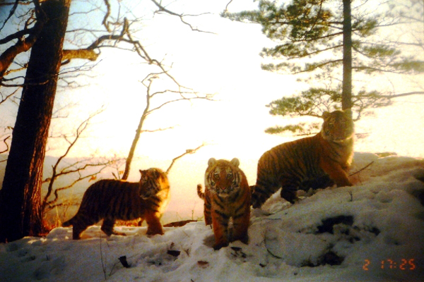
Camera trap images reveal tiger numbers rebounding across Asia, especially in southwestern India, where young tigers are leaving protected reserves due to population pressure, according to the Wildlife Conservation Society.
The WCS attributes the rise in different tiger groups to better law enforcement and protection of additional habitat. For example, a notorious poaching ring was busted in Thailand last year, and the gang leaders have been given prison sentences of up to five years the most severe punishments for wildlife poaching in Thailand's history, the conservation group said in a statement.
[Full Story: Tigers Making Comeback in Asia]
Unexpected beauty
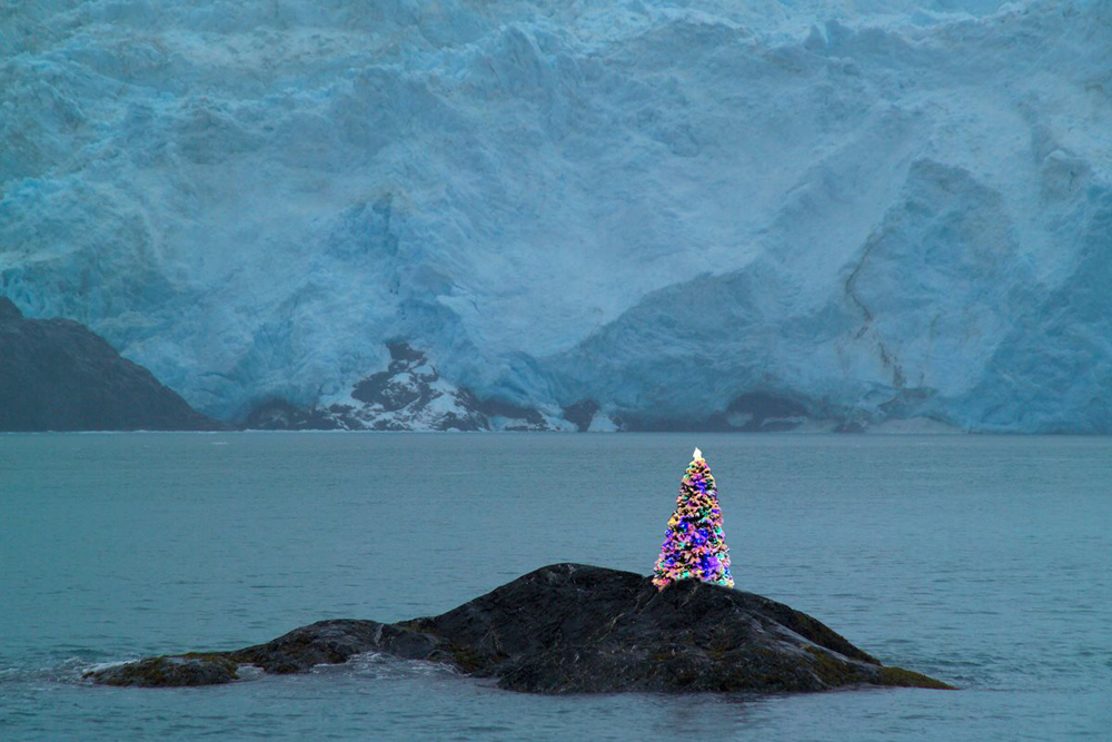
This year's coolest Christmas tree can be found in Kenai Fjords National Park, where mountains, ice and ocean meet deep in the Alaskan wilderness.
At the foot of a massive glacier stands a dazzling Christmas tree, carefully erected atop a rocky island. This bit of holiday spirit is found at the edge of the Kenai Peninsula, a national treasure where nearly 40 glaciers flow from the Harding Icefield, the crowning feature of Kenai Fjords National Park. Harding Icefield is the largest icefield completely contained within the United States.
[Full Story: The Coolest Christmas Tree You'll Ever See]
Feeding the fires
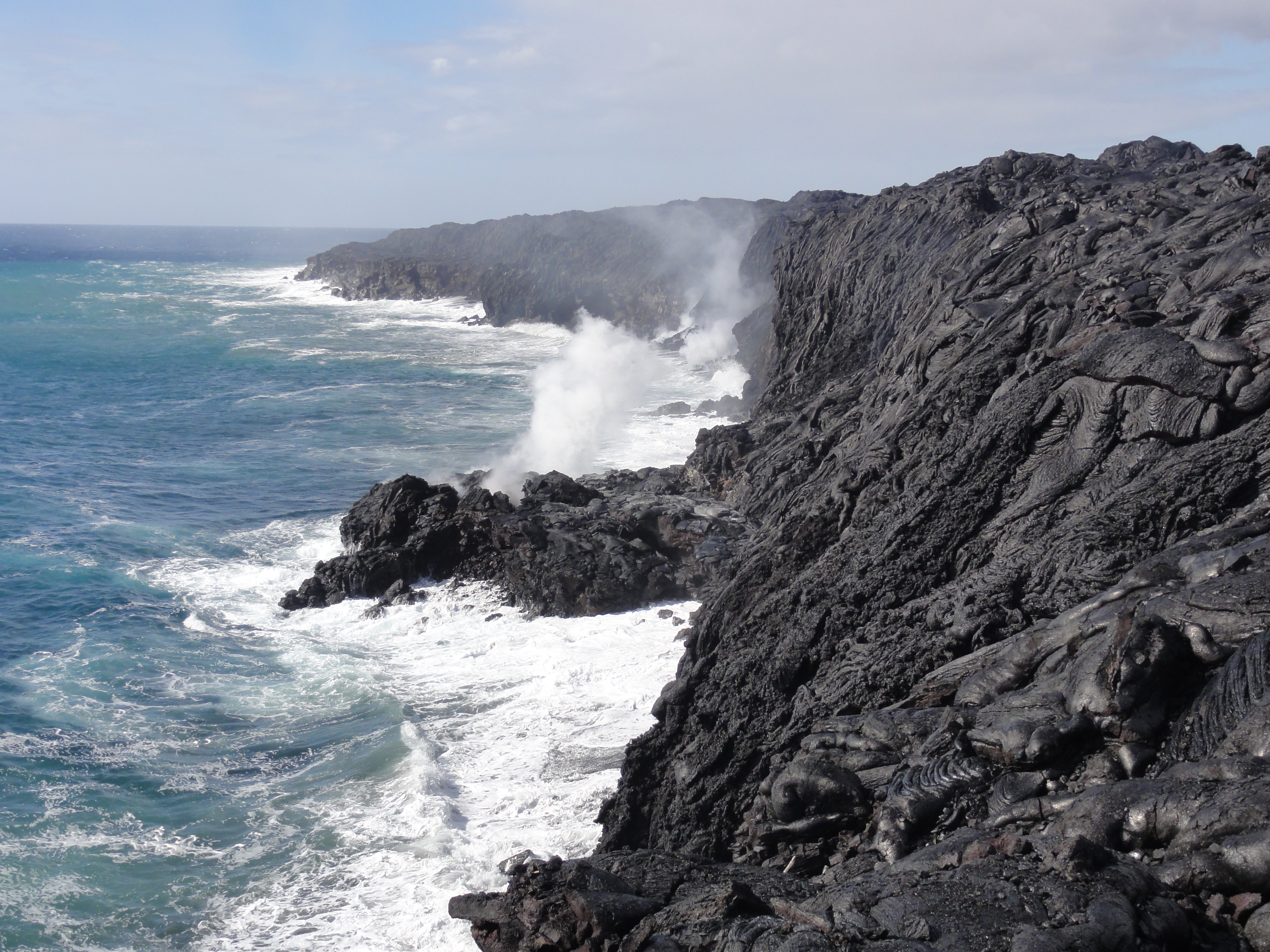
More than 30 small earthquakes, most too small to feel, shook the island of Hawaii in the past two weeks.
The tremors are signs of magma moving underground, feeding two ongoing eruptions at Kilauea volcano.
[Full Story: Shake and Pour: Hawaii Lava Spills into Ocean]
Beaches in the making
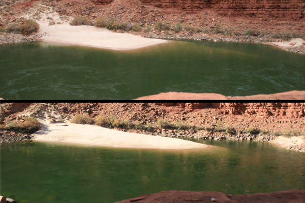
In late November, an artificial flood raced through the iconic Grand Canyon, temporarily transforming the clear blue water back to its historic copper color. The first of several planned floods, the Department of the Interior ordered the deluge, released in a gush from the Glen Canyon Dam starting Nov. 19, to rebuild habitat along the Colorado River.
[Full Story: Before and After Images: Grand Canyon Flood]
An Arctic treat
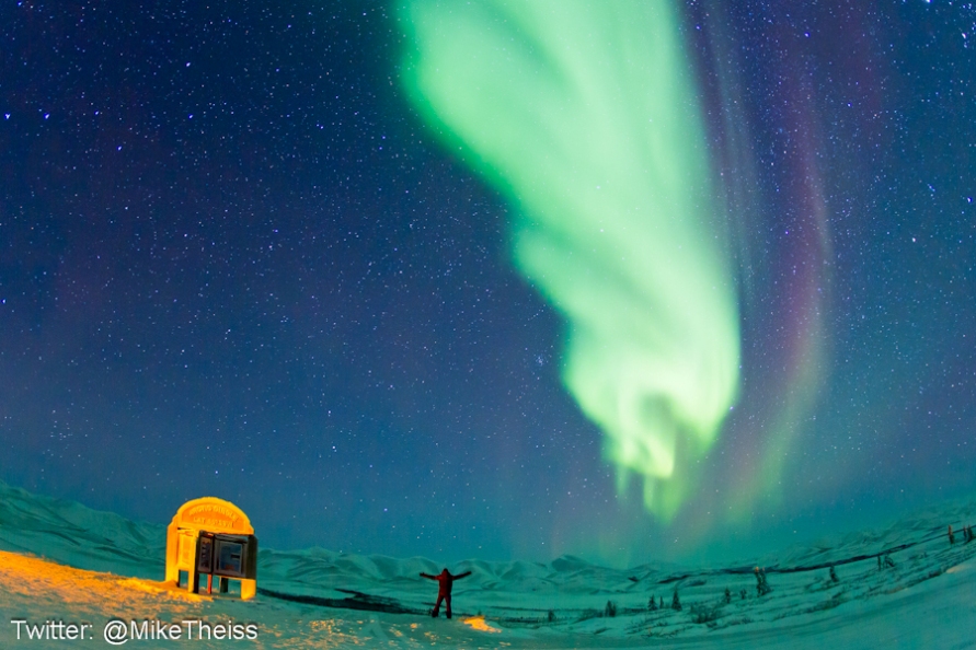
National Geographic photographer Mike Theiss has always wanted to see the northern lights. So when an assignment took him to Whitehorse, in Canada's Yukon Territory, he rented a car and drove more than 550 miles (885 kilometers) north to the Arctic Circle.
While it usually takes a major solar storm to send the northern lights dancing over the lower parts of Canada and the northern United States, auroras can sometimes be seen in the Arctic Circle even when not visible elsewhere. And sure enough, they made an appearance for Theiss.
[Full Story: Photographer on Arctic Trek Snags Stunning Northern Lights Photos]
Posing for posterity
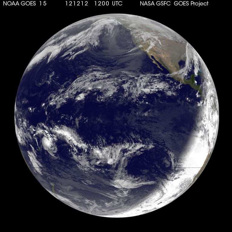
As you probably know, today is 12/12/12, the last time a date in this particular structure will have all three numbers the same until the year 2112.
On this auspicious date (or perfectly ordinary date, depending on how into numerology you are), the National Oceanic and Atmospheric Administration's (NOAA) GOES-15 snapped an image of Earth at 1200 UTC (7:00 a.m. ET).
[Full Story: Earth Has Its Picture Taken on 12/12/12]
Get the world’s most fascinating discoveries delivered straight to your inbox.
Our Black Marble
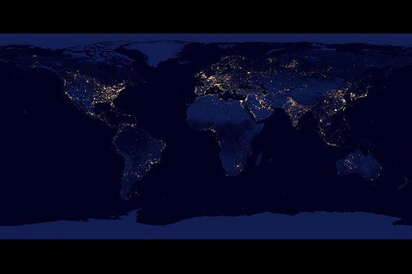
You may have seen Earth's lights from space but never quite like this.
Today (Dec. 5), NASA and the National Oceanographic and Atmospheric Administration (NOAA) released a slew of images showing what the planet looks like when the sun goes down. The amazing images were announced in a news conference at the American Geophysical Union's annual meeting in San Francisco and were taken by an instrument aboard the Suomi NPP satellite in recent months.
[Full Story: Black Marble: Stunning New Images of Earth at Night]
A touch of Hawaii
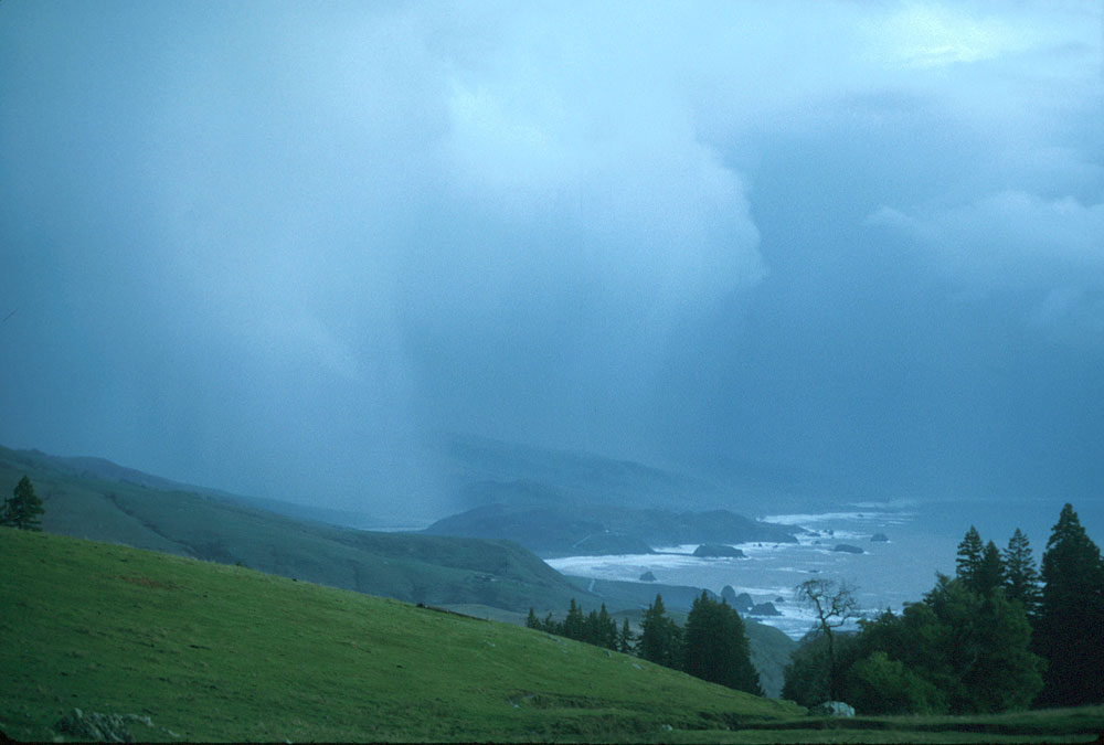
Nature generally doesn't time its storms so well. A "Pineapple Express" weather system so named because of its origins near the pineapple-rich Hawaiian Islands dumped large amounts of rain on San Francisco and Northern California this past weekend, just ahead of the announcement of a new system for forecasting and assessing exactly that type of storm.
These storms, aptly and more technically known as atmospheric rivers, bring huge amounts of moisture across the Pacific. They are narrow bands in the atmosphere that funnel moisture from the tropics into more northerly latitudes. Over the course of several days, or even longer, the moisture in the system is dropped on a wide area and can potentially cause flooding and reservoir overflow, as has happened in some West Coast communities with the current system. That system also brought strong, hurricane-force winds to some regions and dozens of inches of snow to others.
[Full Story: 'Pineapple Express': New Sensors to Monitor Torrential Storms]
Super Typhoon Bopha
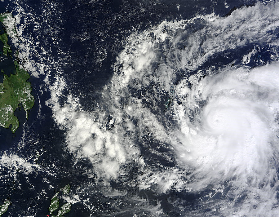
A massive typhoon, equivalent to a Category 5 hurricane, has formed in the western Pacific and is headed toward the Philippine island of Mindanao, which doesn't usually get hit by these types of storms and isn't well-prepared, according to reports.
Bopha is likely to be the strongest typhoon ever recorded in Mindanao, according to Jeff Masters at the weather blog Wunderground.
[Full Story: Super Typhoon Bopha to Hit the Philippines]


