It's quick and easy to access Live Science Plus, simply enter your email below. We'll send you a confirmation and sign you up for our daily newsletter, keeping you up to date with the latest science news.
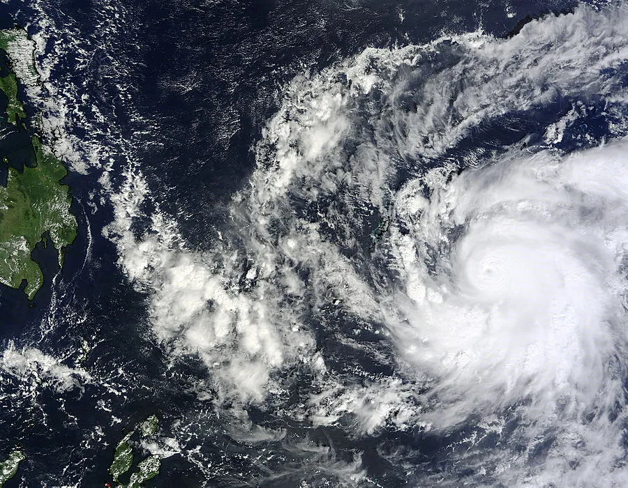
The MODIS instrument on NASA's Terra satellite captured this visible image of Super Typhoon Bopha approaching the Philippines on Dec. 2, 2012 at 0145 UTC (Dec. 1 at 7:45 p.m. EST).
A massive typhoon, equivalent to a Category 5 hurricane, has formed in the western Pacific and is headed toward the Philippine island of Mindanao, which doesn't usually get hit by these types of storms and isn't well-prepared, according to reports.
After steadily intensifying today (Dec. 3), Super Typhoon Bopha now has winds up to 160 mph (260 kph) and will make landfall early Tuesday, local time, according to the Joint Typhoon Warning Center (JTWC), run by the U.S. Navy and Air Force. The island has already started to feel the wrath of Bopha, encountering the first of its winds and rains; it could drop as much as 12 inches (30 centimeters) of rain in some areas, according to the BBC.
The island of Mindanao rarely gets hit by typhoons, Masters noted, since the island is too close to the equator; these storms are typically found to the north. Masters said the infrastructure of Mindanao is not prepared to handle heavy typhoon rains and Bopha looks to be a potentially a catastrophic storm.
The typhoon follows a similar track to last year's Tropical Storm Washi, which hit Mindanao on Dec. 16, 2011, with 60-mph (97 kph) winds and torrential rains. Washi triggered widespread flooding that killed more than 1,200 people. Washi was only a tropical storm, with winds less than half the speed of Bopha's gusts.
At 0347 UTC on Dec. 3, NASA's TRMM satellite flew above a dangerous typhoon Bopha. Joint Typhoon Warning Center (JTWC) to hit the island of Mindinao in the Philippines with winds of 135 kts (155 mph) later today. This 3-D image from TRMM's Precipitation Radar showed some strong convective thunderstorms on the eastern side of Bopha's eye were reaching heights of over 16 km (~9.94 miles)
For the science geek in everyone, Live Science offers a fascinating window into the natural and technological world, delivering comprehensive and compelling news and analysis on everything from dinosaur discoveries, archaeological finds and amazing animals to health, innovation and wearable technology. We aim to empower and inspire our readers with the tools needed to understand the world and appreciate its everyday awe.

 Live Science Plus