


Image: Typhoon Mawar Churns Over Philippine Sea
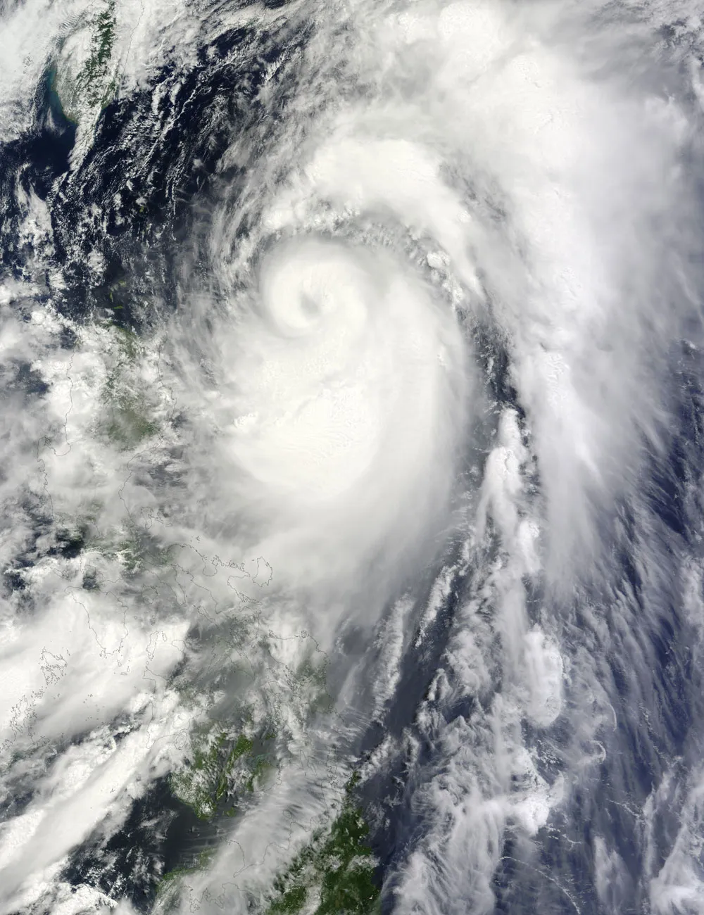
NASA's Terra satellite captured this image of Typhoon Mawar as it churned over the Philippine Sea yesterday (June 3), off the coast of Luzon, the largest island in the Philippines.
The Philippine Star reported that Typhoon Mawar (named Ambo in the Philippines) could still bring heavy rains. The Philippine Atmospheric, Geophysical and Astronomical Services Administration (PAGASA) had warned that the storm might drop 0.6 to 1.0 inches (15 to 25 millimeters) of rain every hour. Residents of low-lying and mountainous areas were warned to watch for flash floods and landslides; a landslide in Antipolo City had already injured three people.
As of June 4, the U.S. Navy's Joint Typhoon Warning Center (JTWC) projected a storm track for Mawar that had the storm turning toward the northeast and skirting Japan.
Mawar strengthened to a typhoon soon after forming over the western Pacific Ocean in early June. On June 3, the JTWC reported that Mawar was located roughly 435 nautical miles (805 kilometers) south-southwest of Kadena Air Base Okinawa. The storm had maximum sustained winds of 109 mph (175 kph) with gusts up to 132 mph (215 kph). Within 12 hours, wind speeds were forecast to increase to 121 mph (195 kph) with higher gusts.
Get the world’s most fascinating discoveries delivered straight to your inbox.
