
 Live Science Plus


Philippe Becomes 5th Hurricane of 2011 Season

published
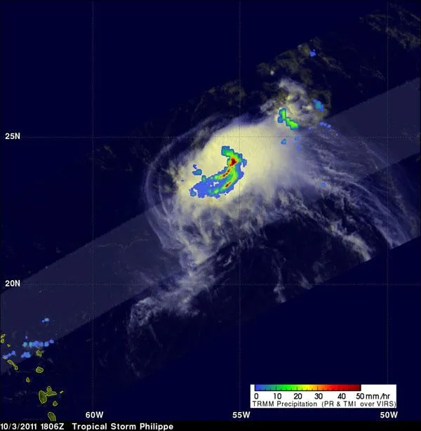
Philippe was still a tropical storm when the TRMM satellite passed above on October 3, 2011 at 1806 UTC (2:06 p.m. EDT) and took the data that made this image. The image shows the heaviest rainfall in Philippe (2 inches/50 mm per hour) in red, falling in its southeastern quadrant. Moderate to light rainfall appears in green and blue, falling at a rate between .78 to 1.57 inches (20 to 40 mm) per hour.
(Image credit: NASA/SSAI, Hal Pierce)
Tropical Storm Philippe formed in the far eastern Atlantic Ocean nearly two weeks ago; today, after days spent chugging across the ocean waters, Philippe has strengthened into the fifth hurricane of the 2011 season.
Hurricane Philippe is still swirling over the open ocean about 425 miles (680 kilometers) southeast of Bermuda, with winds of 80 mph (130 kph), making it a Category 1 storm on the Saffir-Simpson scale of hurricane strength.

