


Tropical Storm Ophelia Forms Over Atlantic
Editor's Note: As of 11:00 a.m. EDT, Ophelia's winds were up to 60 mph (95 kph).
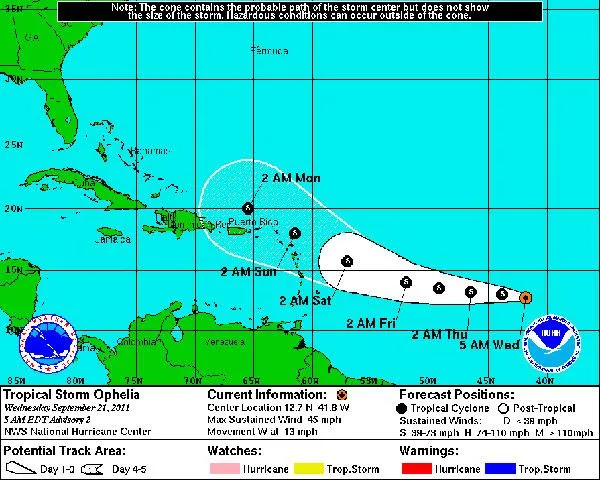
After a brief lull, the 2011 Atlantic hurricane season has revved up again as Tropical Storm Ophelia formed over the ocean basin late last night (Sept. 20).
Ophelia, the 15th named storm of the season, is moving westward over the tropical Atlantic with maximum winds of 45 mph (75 kph).
The storm is currently not a threat to land, though it's projected path could eventually take it past the Leeward Islands and Puerto Rico. [Storm Targets: Where the Hurricanes Hit ]
Ophelia could strengthen slightly in the next few days, according to National Hurricane Center forecasts, but is currently not expected to become a hurricane.
The 2011 season was predicted to be a doozy, with 14 to 19 named storms (which include tropical storms and hurricanes), seven to 10 hurricanes and three to five major hurricanes (Category 3 or higher). So far there have been 15 named storms, three hurricanes (Irene, Katia and Maria) and two major hurricanes (Irene and Katia).
The leftovers of Hurricane Katia blew through Britain Sept. 12, an unusual occurrence that brought the strongest winds the United Kingdom has seen in nearly 15 years. Hurricane Maria hit Newfoundland on Sept. 16.
Get the world’s most fascinating discoveries delivered straight to your inbox.
