


Irene Stirred Up Sediment in New York Harbor
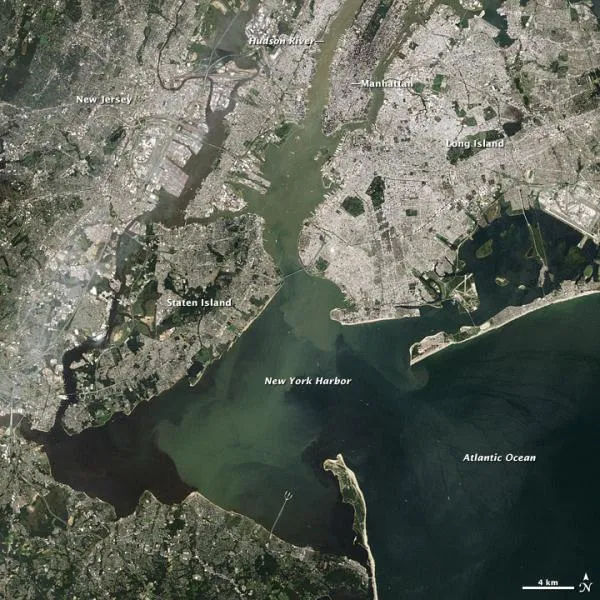
In the wake of Hurricane Irene's heavy rains , sediment filled many rivers along the U.S. East Coast. New York's Hudson River was no exception. In this true-color satellite image, pale green water flows past Manhattan and mixes with the darker water of New York Harbor.
This image was acquired on August 31, 2011, when Landsat 5 viewed the coast from the Carolinas to New York. Color correlates with the amount of sediment: lighter and browner water carries more silt than dark blue water. In addition to soil, flooding rivers can carry sewage, pesticides, and excess fertilizer. After Hurricane Floyd struck in 1999, scientists used similar satellite data to map flood waters in North Carolina.
- History of Destruction: 8 Great Hurricanes
- Irene's Rains Set Record River Levels in 10 States
- In Photos: Hurricane Irene
Get the world’s most fascinating discoveries delivered straight to your inbox.
