
 Live Science Plus


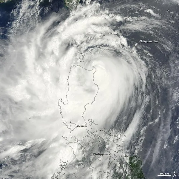
Typhoon Nanmadol Slams Southeast Asia

published
(Image credit: NASA/MODIS)
Although no longer a super typhoon on August 27, 2011, Nanmadol remained a powerful storm, classified as a Category 3 typhoon. The storm lingered over the northern Philippines, and stretched as far north as Taiwan. The Moderate Resolution Imaging Spectroradiometer (MODIS) on NASA's Terra satellite captured this natural-color image the same day.
After MODIS took this picture, Nanmadol continued traveling north, and caused substantial flooding in Taiwan, according to Voice of America. Packing winds of 100 kilometers (60 miles) per hour, the storm forced the closure of schools and businesses, and the evacuation of more than 6,000 island residents.

