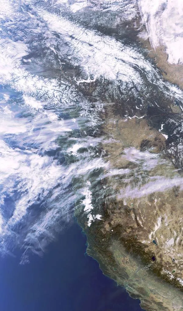
Western North America, featured in this image from the European Space Agency's Envisat satellite, is one of the most extensive mountainous regions on Earth.
The Coast Mountains (snow-capped, and visible in the image's top left) cover the Alaska Panhandle (not visible) in the United States and most of coastal British Columbia (top left) in Canada. Many glaciers have carved valleys in these mountains, resulting in the formation of numerous fjords with precipitous cliffs that can rise nearly 6,900 feet (2,100 meters) from the water along the Pacific coast.
The Rocky Mountains (snow-capped and at the center of the image), which include at least 100 separate ranges, stretch about 3,000 miles (4,800 kilometers) from northern Alberta and British Columbia southward to New Mexico.
Latest Videos From
The Vancouver Island Range, a chain of mountains that appear as a series of islands, including Vancouver Island is visible running parallel to the coast of British Columbia.
The Sierra Nevada mountain range is seen (it appears brown at the bottom right of the image) in California and Nevada. Lake Tahoe (the dark blue body of water located in the Sierra Nevada range) is located along the border between California and Nevada. Pyramid Lake (above Lake Tahoe), one of the largest lakes in the United States, is located in Nevada.
San Francisco Bay is visible near the bottom right in green. Sacramento Valley and the northern tip of the San Joaquin Valley are visible in green and tan to the east of the Sierra Nevada range.
The Coast Range (snow-capped, visible northwest of the Sierra Nevada) is a series of mountains along the Pacific coast, running from southern California through Oregon and into Washington. British Columbia's Coast Mountains are not a continuation of these ranges but of the Cascade Range .
The Envisat image was taken on Nov. 3, 2009.

 Live Science Plus